Monday, December 13, 2010

Day 150: Baseline


Apache Junction to Mesa. 20.9 miles/2881.8 total

Monday, December 13, 2010

8:55 a.m. Today I’m leaving from the Valero gas station at Tomahawk Road and U.S. 60 in Apache Junction. First I head south to Baseline Road, which parallels "the 60," as they say here, about a half mile south of the highway, and then west through Mesa and Gilbert to Dobson Road in Mesa, a distance of 20.9 miles.

It’s in the mid-60s now, expected to get into the low 80s. T-shirt weather again, which is nice for the middle of December.

In just a bit over half a mile I turn right onto Baseline Road, which runs straight as an arrow for the rest of the walk. Out here there isn’t much development yet, just a bit of light industry and lots of vacant desert areas just begging to be turned into condominiums and shopping centers. Off to the south is the area landfill, a man-made mesa of covered-over garbage.

The City of Phoenix is the fifth largest city in the U.S., with about 1.5 million people, and the metropolitan area has over 4.5 million. Apache Junction, where I’m walking now, has a mere 37,000 citizens, but is growing rapidly, like the rest of the suburbs. Apache Junction was named for the junction of the Apache Trail and U.S. 60, and doesn’t appear to be very old. Most of it sits at the foot of Superstition Mountain, the most familiar and largest of the Superstition chain.

After a couple of miles the sidewalks begin, intermittently at first, then more regularly. I see a variety of trees used for landscaping along the fronts of the new housing developments, between the six-foot cement walls and the road. One type, which has a green trunk and branches when it’s young, might be a kind of acacia, not native to the area but compatible with the climate. Others are mesquites, and still others are olive trees, also not native but having been introduced into the western U.S. some time ago.

I’m impressed everywhere I go in the urban parts of the southwest at the attention to landscaping. I’m partial to the stuff that looks compatible with and similar to the surroundings--cacti, small bushes, mesquite trees, and the like, planted in brown gravel as opposed to green lawns. Of course with landscaping there’s always the tendency to plant things that are prettier and more colorful than what might be out in the wild, so there's also a profusion of flowering bushes and trees--azalea, oleander, hibiscus, bougainvillea. Some of them fill the air with their perfume.

Besides the bushes and trees there are still lots of old reliable chollas, agaves, yuccas, and saguaros. There are also many palm trees throughout this area, which also are not native to the American southwest. Like the people themselves, though, they’ve been around long enough to belong. Down here you arrive, you find a place to live, you belong. Then you start acting like a native and treating the next people to come along like outsiders. It’s not that the southwest has no history--on the contrary, it has thousands of years of it--Indian, Spanish, Mexican, Anglo. It’s just that it’s always being taken over by new people, for new purposes.

At 3.8 miles I cross Meridian Road, leaving Pinal County and entering Maricopa County. I know this from the map, as there’s no sign to welcome me. I also think I’m in Mesa now. In places Gilbert begins just south of Baseline and in other places it’s Mesa on both sides.

Mesa has a bit of history. The Hohokam people settled this area two thousand years ago and at some point built a system of irrigation canals in order to grow extensive crops, including cotton, tobacco, corn, and agave. The remnants of some of these canals still remain. But the Hohokam seem to have been displaced before the Europeans came. Then in 1877 some Mormons, led by a guy named Daniel Webster Jones, came down from Utah to found a settlement in Arizona. There were two or three competing settlements, one of which was named Mesa City. Eventually it all got incorporated, starting with a one-square-mile town and expanding. Today Mesa is 133 square miles and has a whopping 460,000 people, making it the third largest city in Arizona after Phoenix and Tucson.

As for Maricopa County, it has about four million residents, over half of the state’s population, and is the fourth most populous county in the U.S. Its sheriff is the infamous Joe Arpaio, an Eye-Tie from Springfield, Massachusetts, who is famous for dressing the county's prisoners in pink boxer shorts and housing them in tents. He also has reinstituted chain gangs for both men and women. The good people of Maricopa County have been electing and re-electing him since 1992. Apparently they like his "law and order" stance, which I think is code for "keep the Mexicans in their place."

At this point Baseline Road becomes a boulevard with a median planted with trees and flowering bushes, and every now and then a saguaro cactus, standing like a mute green giant, stubby arms outstretched like a patient hitchhiker. I’m enjoying the trees, whatever they are, with their sinewy green bark, having been teased into convoluted shapes, trunks and branches turning at odd angles. They do the same thing to trees of similar size with dark deeply furrowed bark. I also see willow trees occasionally, and some California live oaks.

Saguaro cacti are protected in Arizona. It is illegal to cut them down without permission. They have a long life span--upwards of 150 years--and take as long as 75years to start growing their arms. Many saguaros are dug up in the desert and transplanted, but some of the ones I’m seeing alongside this road look as if they’ve been here all along. I pass one particularly large saguaro, perhaps twenty-five feet tall and two feet in diameter, with eight or nine arms. It might have been here when the Mormons came.

Behind walls the houses are roofed with terra cotta tiles and parts of their second stories are visible over the tops. Once in awhile I see some citrus trees growing in back yards, their fruit looking pretty ripe.

At 7.8 miles I reach the southern portion of Arizona 202, called the Santan Freeway here. In this area there is still some open farm land, and a few cattle graze on what’s left over from the harvest. Behind me there’s an excellent view of the Superstition Mountains.

Today is my 150th day of walking. That I suppose is an event of sorts. I’ve averaged 19.2 miles per day over the entire journey, including those weeks in the early fall of 2009 before I worked up to 20 or miles per day.

At 13.1 miles I cross Greenfield Road, near the Walmart where I’ve been staying and will stay again tonight in a section of the parking lot filled with motor homes. On the south side of Greenfield is a sign that says "Welcome to Gilbert," so I guess Baseline is the border between Mesa and Gilbert right here, at least. Gilbert is another large suburb, having grown from 5,700 in 1980 to over 220,000 today. It is considered more upscale than Mesa. Gilbert was a small railroad town in the early twentieth century, then in 1912 a number of Mormons came up to Gilbert from Mexico, where they had settled several decades earlier in order to avoid prosecution for polygamy. They were being chased out of Mexico as foreigners by revolutionaries like Pancho Villa.

Beautiful smells are coming my way from El Pollo Loco. I’m entering a long section of strip malls, restaurants, and grocery stores.

Not long after Gilbert Road, at 15.9 miles, I come to Queen of Heaven Mortuary and Cemetery, a large Catholic graveyard. They’re very much in the holiday spirit here at Queen of Heaven. Little artificial Christmas trees, green, white, and silver, all decked out with colorful balls, adorn the graves of the Mexican dead, sometimes with extra festive holiday grave blankets. Very jaunty and, if I may say so, silly. I sit down on the more sedate tombstone of Filomena Madaffari, an Italian woman who died in 2004 at the age of 89, and survey the holiday finery around me.

At 18.8 miles I reach Fiesta Drive, where there’s another Walmart, and I am now only two miles from my destination. It got up to nearly 80, I think, and was a very comfortable and balmy day.

It’s been a rollicking parade of business establishments today, with housing developments in between--Circle K gas stations, Fry’s grocery stores, Albertson’s grocery stores, Bashas' grocery stores, pizza places, strip malls, large malls.

As I close to within a mile of my destination today I feel compelled to say that I’ve been impressed by how few churches there are along Baseline. The worship of mammon, as opposed to God, has been the rule.

I pass Rhodes Junior High School, a large complex of buildings. Beyond that I see the sign for the empty Big Lots store, where the motor home is parked.

Sunday, December 12, 2010

Day 149: Superstition


Near Florence Junction to Apache Junction. 19.5 miles/2860.9 total

Friday, December 10, 2010

8:40 a.m. and I am departing from about Mile 216½ of U.S. 60 in Pinal County, heading for Apache Junction at the far eastern edge of the Phoenix suburbs, a distance of 19.5 miles.

It’s about 55 degrees. The temperature should get up to about 70 again today. There are some thin clouds overhead and a nice layer of smog in the west over Phoenix.

Although I start today in the country, by the time I’m finished I’ll be well within the ambit of the metropolitan area, just off the Superstition Freeway.

Today the saguaro cactuses look like tall skinny-headed supplicating Gumbies. At about three miles into the walk I come to Florence Junction, which isn’t much more than an exit off the highway. I predict that in twenty years it will look like Mesa does now, with a succession of shopping centers and planned communities, and that the suburbs will stretch most of the way to Superior.

There isn’t a whole lot to report today. I should hold forth a little about urban versus rural life. It seems to be a truism that people are seldom happy with the circumstances in which they find themselves. Folks raised in the city often wish to live in the country and vice versa. The former condition, which I’ll call the Oliver Wendell Douglas syndrome, arises often in people who have been raised with all the benefits that urban living has to offer, then reject those benefits because of what they perceive to be its drawbacks. However, in even greater numbers people put down the plow and move into the city. Most compromise and choose to live in the much-denigrated suburbs, although they are the happiest of all places for people who recognize the advantages of the city but don’t want to be right in the middle of it all day long.

For some illuminating thoughts on the advantages of city living, I recommend John Snow’s book The Ghost Map, about the London cholera epidemic of the 1850s. Despite the toll this disease took in the city, Snow is at pains to explain that urban living is generally more healthy, productive, and fulfilling than country life is, and that the human tendency to wish to gather in cities is indeed a salutary one. Cities, not the country, are where most advances in science, medicine, education, and the arts are made, and where humans have the best chance of fulfilling their potential beyond mere reproduction. Furthermore, notwithstanding the pollution and consumption of resources that characterize cities, says Snow (with statistics to back him up), on a per capita basis city dwellers use less energy and leave smaller carbon footprints than do their suburban and country cousins. This is because of mass transit, less need to travel for the necessities of life, and economies of scale in connection with the provision of water, energy, and other natural resources. That there is more pollution in cities is mainly because so many more people live there. Cities must have some basic allure, because as of 2008 more than half the world’s population lived in cites, and the number is rising, despite the fact that the birth rate is lower among urban dwellers.

Of course the news media, always eager to notch up the public’s paranoia, ceaselessly advertises the dangers of city living. And that helps fuel our paradoxical longing for a simpler place and time when we all supposedly lived in harmony with nature. We want to get back to the Garden of Eden. But of course we can never go there, only to the place where Adam and Eve went when they were thrown out of the Garden, condemned to till the soil and live by the sweat of their brows and bear children in pain, and all that.

The real country life most people dream of is not that of the ceaseless toiler, but rather of the country squire, well leveraged with servants and slaves, wandering through his estates and giving orders and sitting on the front porch drinking mint juleps. Which brings us back, in the interest of reality, to the suburbs, the acceptable middle ground on the outskirts of the cities themselves, into which I’ll be venturing today.

At about 8 miles I begin to see some signs of development. On the north side of U.S. 60 is a stone sign welcoming newcomers to Entrada del Oro. Behind the gate is mostly desert, but desert that aspires to be something more. Here then is the outer fringe of the eastern cities of the Valley of the Sun.

At 11.5 miles I reach two signs, on the south side of the road, for entrances to a Renaissance Festival, which is held on weekends from February 12 to April 3. It was between these two signs, back from the road about fifty feet, that I spent last night. The sound of the traffic was there but I was hidden from passing motorists by some mesquite bushes and it was dark and conducive to sleeping.

At 12.6 miles I reach Peralta Road. The Superstition Mountains are just to the north of the road, the frontmost line of them looking from here like a sleeping hound dog, its long nose pointing westward. There’s a monument at this intersection claiming this as Jefferson Davis Highway No. 70, erected in 1943 by the United Daughters of the Confederacy, Arizona. I do what I always do when I see the name of a slavemongering cur like this, drawing forth from within me the largest lugie I can summon in such dry weather, and expectorating it onto the hated name of the president of the C.S.A.

Just past this intersection I see my first planned housing development of the day, a collection of terra cotta roofed one-story houses in various earth tones--brown, grey, beige. Down the side roads the bougainvillea blooms bright red in the sun. Then I come to King Ranch Road, where there's a Best Western hotel, a Walgreen's, a strip mall, banks, a fire station, and some gas stations. This is a place called Gold Canyon, the easternmost fully turned out suburb, a fast-growing place whose population was 6,000 in 2000. And of course no desert community would be complete without golf, that most bourgeois of pastimes, the last refuge of the doddering. Old people are plentiful here, complaining deafly, driving dangerously, golfing poorly. They congregate down here in the desert heat, in training for hell.

I pass a billboard advertising the Superstition Funeral Home. I don’t know about you, but that name strikes me as more than a bit odd for a funeral home. It's not one that evokes the gravitas and tasteful formality we have come to expect from mortuary establishments. Of course I know this is the Superstition Highway and that those are the Superstition Mountains, but still.

Then again, maybe they’re working an angle. “Friends, remember the Superstition Funeral Home, where we cater to all your superstitious needs and those of your loved one. Would you like us to put coins on grandma’s eyes to pay the boatman who ferries her across the River Styx? No problem. Do you believe in the resurrection of the body? We’ll dress grandpa in our exclusive spiffy all-synthetic outfit that’s guaranteed not to decompose before Judgment Day, so he can pop out of the grave in style. Worried that Uncle Clyde might come back as one of the Undead to suck your blood? Leave it to us--we’ll drive a wooden stake through his heart while you watch. At the Superstition Funeral Home our motto is ‘If You Believe It, We Believe It.’”

At 15.6 miles, as I cross Superstition Mountain Drive, things become more built up, but only on the north side of the road. Nothing to speak of on the south side yet. Up there in the Superstition Mountains is where the legend of the Lost Dutchman’s Gold Mine originated. The Dutchman in question, Jacob Waltz (actually a German) is supposed to have found a fabulous gold mine in the mountains, which thousands of people have looked for in vain since the 1890s. As for your humble narrator, the only treasure this Dutchman (Dutch and German in equal measure and other things besides) is going to find is what I picked up on the road in New Mexico.

At a little past 17 miles the divided highway officially becomes the limited access Superstition Freeway. I’m up on the expressway now, in the vastness of the urban expanse. Up ahead I see, beckoning to me, a star on a sign at the Tomahawk Road Exit.

So my journey for today comes to an end at the Valero gas station that houses a Carl’s Jr. hamburger place and the Bill’s Ghost and Spirits Store and a car wash. The motor home sits on a little side road next to the building.

Thursday, December 9, 2010

Day 148: Superior To What?


Top-of-the-World to somewhere in Pinal County. 20.2 miles/2841.4 total

Thurdsay, December 9, 2010

9:28 a.m. I’m leaving from a spot about a mile east of Top-of-the-World on U.S. 60, heading through there and down to the small mining city of Superior. Then I’ll continue on 60 for another ten miles or so, a total distance of 20.2 miles.

It’s another clear day, pretty warm, in the high 50s. It’ll probably get into the 70s when I’m in the lower elevations.

In less than a mile I leave Gila County and enter Pinal County and also the tiny community of Top-of-the-World, which the internet says has a population of 330. It’s at an elevation of 4,600 feet, about halfway between Globe and Superior. There’s not a lot to the place, other than a couple of trailer and RV parks, some scattered ranch houses, and some signs on the highway that allude, somewhat cryptically, to highway expansion plans. The folks up here evidently want the highway to pass them by and leave them alone. Fine by me.

I check to see if the Top-of-the-World Trading Post is open, a place that looks like a combination grocery and junk store, or maybe just a really junky grocery store, but it’s locked up.

This place was once going to be the site of an army encampment called Camp Pinal in the 1870s, but that plan was abandoned after a few months. Top-of-the-World was a dance hall started in the 1920s up here. The name stuck, although apparently it’s also been known as Pinal Ranch.

After less than a mile Top-of-the-World is behind me as I walk downhill. Parts of the first half of today’s walk are going to be a bit treacherous. There are narrow spots where there’s no shoulder and some blind curves. If I make it to Superior the road should become ample again. I pass Apple Valley Road and the Spirit of Truth Baptist Church.

The road winds through some cavernous and spectacular rock formations. All around me on the hills are these brown rounded boulders and outcroppings that look like faces and figures on the green hillsides. Down in the valleys between the bottom of the mountains and the road sycamores grow, and also aspens, their leaves resplendently yellow in the mid-morning sun.

I’m going through an area called Devil’s Canyon, apparently so named by the soldiers who once traveled the area. I get a ride offer. This was a person who went down and found a place to turn around on this narrow road, drove back up to me, and then when I declined the offer, had to find another place to turn around so he could go back the way he was going. This happens often, and speaks to the desire of people to go out of their way to help. I can’t say enough about the kindness of those I encounter. Ride offers in Arizona are running at two a day on average, which is respectable. And that doesn’t count inquiries from the Highway Patrol, of which I’ve had several in Arizona.

Just as I saw cotton module trucks back in the Safford area, here I see a steady progression of ore trucks, with V-shaped open-topped trailers.

I really wish I had better words to describe the grandeur of this rocky scenery I’m walking through. Even my photographs don’t do it justice. To my left is a gorge perhaps fifty feet deep out of which grow aspens and cottonwoods. To the right is a sheer wall of rock at least a hundred feet high, at the top of which are fingers and faces and other forms of sandy brown rock. The seedy little village by that name notwithstanding, I can see how someone who spent a lot of time up here could feel he was on top of the world.

I get another ride offer, this time from an old guy who used to work at the copper mines south of here. We enjoy a chat in one of the many large pullouts for cars and trucks along this road. It takes him a while to grasp the logistics of my walk, and once he does he laughs at what he evidently thinks is the convoluted frivolity of it.

I go through the Queen Creek Tunnel, about a half mile long, and at 8.7 miles I begin crossing the Queen Creek Bridge, the saguaros on the opposite side looking like crosses stuck in the hillside.

At about 9.5 miles I enter Superior. There’s an exit off the highway for the “business district” in the center of town. I drove through there this morning before the walk, and I have to tell you that it’s a trick. There is no business district to speak of over there. There are a few blocks that resemble the aftermath of urban warfare. The real business district of Superior, whether the nostalgia hounds want to admit it or not, is right here on U.S. 60. So I’m staying on the highway, because here’s where the Circle K gas station and a number of other places are. I like a quaint old downtown as much as the next person, but Superior’s is too quaint by half. Off the opposite side of the highway from downtown a collection of shanty-like houses dots the hills, their tin roofs glinting in the sun.

Superior’s population in 2006 was about 3,100. Off in the distance I can see a copper mining operation and a few stripped hills and some heaps of coal-black tailings. But Superior's real claim to fame, as the Wikipedia article tells it, is the fact that several movies have been set or filmed here, including U Turn, How the West Was Won, The Prophecy, and one from 2005 called Alien Invasion Arizona, which went straight to video.

There’s a dollar store and a Dairy Queen and a sign advertising helicopter tours. A kind of western oak tree I think is called the canyon live oak grows between the sidewalks and the road. Superior has at least two gas stations and a rest stop and a few restaurants. One is called the Buck Board City Café, next to which is a place calling itself The World’s Smallest Museum. It is indeed small—about five feet wide and ten or fifteen feet long. It has glass cases on either side of an aisle down the middle and features a collection of memorabilia such as presidential campaign buttons. Its roof is shingled, as it were, with empty beer cans with the paint removed. Michelob and Busch, mostly.

With that I begin to pull out of Superior and head into the country again. Things flatten out a bit and the mountains get pushed back from the road. On the scrubby hillsides saguaros grow in profusion, looking like crazy skinny hands with varying numbers of digits jutting from the ground.

At 13.3 miles I come to a historical marker. Picket Post Mountain is in front of me. It was a landmark and lookout point during the Indian wars. Colonel William Boyce Thompson, a mining magnate, was the founder of the Southwest Arboretum at the foot of the mountain, the largest arboretum in Arizona.

At about 14 miles U.S. 60 widens into a divided highway. I believe this is the beginning of the Superstition Freeway, running along the southern edge of the Superstition Mountains. On through the rolling foothills I walk until I crest a final hill and am looking out at a vast valley, containing the beginnings, at least, of greater Phoenix.

At 18.2 miles I go through Gonzales Pass. Then I see the sign saying I’m leaving the Tonto National Forest, where I’ve been for all of today’s walk.

I come upon a dead fox by the side of the road, the first one of those I’ve seen for several states. The roadkill in Arizona so far has been meager, mostly domestic dogs and skunks.

Just beyond a sign that says I’m 4 miles from Florence Junction and 52 miles from Phoenix, I see the motor home, parked off the road behind some mesquite bushes.

Wednesday, December 8, 2010

Day 147: An Orderly Lynching


Cutter to near Top-of-the-World. 19.3 miles/2821.2 total

Wednesday, December 8, 2010

8:57 a.m. This morning I set out from the western edge of the San Carlos Apache Reservation, heading west on U.S. 70 until it merges with U.S. 60, through Globe and a string of mining towns and uphill to just east of a town called Top-of-the-World, a distance of 19.3 miles.

It’s a nearly cloudless day, the temperature in the high 50s, probably getting up into the high 60s.

Today’s walk will be one of contrasts. Here at the beginning I’m in the desert and distant mountains of the reservation but very soon will be moving in to a series of small cities with strip mines and bustling commerce. Then for the last third of the walk I’ll be going uphill into the mountains, looking at some scenery and rock formations that are different from anything I’ve seen hitherto.

Because of the earthly delights I will encounter on the way I have deliberately made this walk a little shorter than usual, anticipating that I’ll have to enter a few antique shops and maybe a museum or two. I’m also traveling light because of the easy access to drinks and snacks.

Very shortly after I begin I leave the reservation and enter the outskirts of Globe. It started as a mining town and is the seat of Gila County. I believe the reason they named it Globe is that when they started mining silver here they found a huge nugget of ore shaped like a globe. Silver only lasted for four years, and then copper took over and has been mined here ever since. In fact, the Freeport-McMoRan Gold and Copper company, also present in the Safford area, is one of the big copper mining outfits here.

About two miles into the walk, at the entrance to High Desert Middle School, sidewalks begin. A green and white sign says I’m entering Globe, elevation 3,544 feet, founded 1876.

About a mile into the city, as I continue my descent into the river valley, I stop to get a cappuccino. I stop to pick up a penny (and the Greek behind me disappears), and I see from my notebook that I’ve only found 15 cents in Arizona so far. I guess after the spectacular haul I got on the last day in New Mexico I’m due for a let down, but this is a pretty small take, even for a state that's mostly desert. Before the New Mexico treasure my largest single day for money was in Louisiana, on the Route 10 bridge from Slidell across the eastern end of Lake Ponchartrain, when I picked up about six or seven dollars. That’s a phenomenon I still can’t explain, unless the folks who drive across that bridge use it as a sort of wishing well, in which case I hope all their wishes come true.

Just before the El Rey Motel, which has an old neon sign with flaking paint advertising that it is “refrigerated,” thus consigning it to a different generation of hostelries, there’s a large painting of Geronimo, his sad serious defiant mouth set, and his eyes fiery, staring with reproach at the passing motorists.

U.S. 70 has merged with U.S. 60 and will end shortly. I’ll remain on 60. I pass the Toastmaster Café, a wonderful defunct pink stuccoed building with glass bricks on each side of the door. Then I pass the Rock Shop, a little place I visited yesterday. It’s filled with polished stones, rocks, and jewelry, much of it local, including the peridot of the San Carlos area. A great place except, as happens all too frequently, the guy who owned it was listening to a hideous right-wing radio show. The shit that was spewing out was so obnoxious that I just tried to tune it out. The show was coming from, of all places, Hillsdale College, in Michigan, a traditionally Baptist school that has turned into a serious bastion of fundamentalist ultraconservatism. When I was going to Alma College, Hillsdale was in our athletic conference, the MIAA, and in fact pretty much dominated it, at least for football. Now I think their only varsity sport is Obama baiting.

I wonder if anywhere in this country there’s a little shop owned by a guy who’s as far to the left as these geezers are to the right. But then, what radio show would he be listening to? There is no such thing as left wing talk radio, unless you can pick something out of Havana. Still, it would be fun to come in and hear the guys on the radio ranting about wresting control of the means of production and eliminating private property and lining all the parasitic capitalists and their running dogs against the wall, and all that. That would be refreshing.

After stopping at an antique store I make my way to Broad Street, to walk through downtown Globe. It’s an exceptionally lively place, with the majority of buildings occupied, in spite of being a couple of blocks off the highway. There’s even a first-run movie theater with four screens right downtown. That’s pretty rare.

At the La Luz del Dia bakery and coffee shop I turn south to visit another antique mall that boasts it’s in the tallest three-story building in the world. That’s a pretty serious claim, and I doubt it. I then wend my way back to Broad street to follow it back out to 60. On the way I pass a marble slab with an inscription. It says that near here was the Hanging Tree, a sycamore where L.B. Grime and C.D. Hawley were lynched in 1882 for the holdup murder of two men. It says the culprits had a “fair hearing” before someone on Tuesday evening, and at 2 a.m. Wednesday morning they were taken out and hanged. “Saloons were closed and it was an orderly lynching.” And--get this--the monument is dedicated to the law enforcement officers of Gila County. “Protect and serve.” Behind it stands a young sycamore, perhaps twenty years old, which might be a descendant of the Hanging Tree.

That’s a pretty interesting commentary on local law enforcement. I don't know about you, but I get a little nervous in a place that brags, in the name of the law no less, about an "orderly lynching."

There are any number of little antique places around here and I have to be selective or I could really eat up some time. Dusk comes promptly at 5:00 p.m.

At 5.7 miles I’m back out on the highway, walking past large aspens, their leaves still greenish-yellow in the late autumn, and mostly still on the trees. Hills rise steeply on both sides a few hundred yards from the road.

To the north, as the road follows a dry stream bed, there is a large man-made mountain of stone that looks like coal. This is tailings, which is what’s left after the copper ore has been processed and treated and the copper removed from it. Probably filled with interesting chemicals that leach into the water. Despite that, a few tumbleweeds have managed to take hold in it.

I stop at the Gila County Historical Museum for about 20 minutes. The elderly hostess is bursting with information and eager to tell it all. Finally I must break away, leaving a Dutch couple from Vermont to get the balance of her tour. Like most of these museums, it is filled with “old” things from the early days of the town, but since the town isn’t all that old by eastern standards, much of the stuff looks like what was in my house or that of my grandparents when I was growing up. Still, interesting.

I did learn that the mountain of tailings is from the underground mine that used to be operated here by the Dominion Copper Company. Now all the mining is open pit, which is a less emotionally charged term for strip mining. My feeling is, what are a few less mountains when you’ve got so damn many? Just trim them down neatly and try to do it all in one area. Unless of course you think it’s better to send men underground like in the good old days. Speaking of that, the building in which the Gila County museum is housed used to be a mine rescue station for when they had fires and other disasters.

I pass a restaurant called Hog Heaven and the smell of the barbecue is divine. In the distance the open pit mining presents an interesting picture. The terraces and layers make some of the hills look like ziggurats. And they seem to be different colors—some beige, some white, some greenish from the copper, some rich brown.

At 9.4 miles I pass the Walmart where I’ve been staying for the past two nights and will be staying tonight again, under a light so bright that I wake up in the middle of the night sometimes thinking it’s morning. Don’t get me wrong. I like staying at Walmart. But darkness is more conducive to sleep.

I pass into Claypool, then in less than a mile into Miami. I pass the Divine Grace Presbyterian Church, then go two blocks north to the main drag. Miami has a funky cache, and Sullivan Street is one antique place after another. Finally I have to quit going into them to keep up my walking pace. I should have come here yesterday. There’s a nice arty feel to Miami that Globe didn’t seem to have, and there are a couple of nice looking restaurant/bars, too. If anyone is visiting this area and likes antiques, I recommend Sullivan Street in Miami. Looks like it could become a gay haven if it isn’t already. Who knows? Maybe there’s a whole gay copper miner-Brokeback Mountain thing going on here, with guys in tight blue jeans and hard hats and cowboy hats, like in the Village People. Very butch, these Arizona dudes. I can see it now--late night on Sullivan Street, with the music pounding. Suddenly a high lispy male voice: “Hey girls, let’s have a lynching!”

There’s a plaque in a park in the center of town that tells a little of its history. Prospectors first came here in the 1860s, but it wasn’t until the early 1900s that the big copper mining companies really got set up. Cleve Van Dyke came in 1908 from southwestern Arizona and did something or other. The place was finally incorporated in 1918. Its population has fallen off, I suppose because mining has become less labor intensive. Miami calls itself “The Copper Center of the World.” I'm guessing that's a little bit of municipal hubris, but what the hell.

Now I’m a couple of miles outside Miami and the road is going uphill precipitously, through some interesting and beautiful rock formations. The hills are covered with big beige boulders that are quite rounded, and almost look like the artificial rocks they have at climbing walls and in hokey theater sets. Life imitating art.

At about 15.5 miles I arrive at a cemetery, a memorial garden, here in the quiet mountains. I sit on a bench in front of the grave of Richard O. Martinez, 1939 -1971, and relax. Two men are digging a grave near the entrance. This is a pretty nice place to be buried—a lot more serene than down near the busy highway.

At 17.5 miles I cross Pinto Creek. The road cuts right through the rocks now and creases the hillsides and takes sharp blind turns, making my walking a bit dangerous because there’s no shoulder to speak of. The bridge over Pinto Creek was given an award—the American Institute of Steel Construction “Most Beautiful Steel Bridge, Class II” award, in 1949. I can’t see the bridge because I’m on it, so I’ll have to look later. The dry creek bed lies perhaps a hundred feet down. After I get to the other side I look back to see the structure of the bridge. Not bad. Off to the north are several more strip mines.

The road continues to wind upward as my walk for today comes to an end, where the motor home is parked in a little turnout.

Tuesday, December 7, 2010

High Roller


Tuesday, December 7, 2010

Took today off to rest and do errands, staying at the Walmart in Claypool. Early this afternoon I drove back to the Apache Gold Casino to try my luck, and came away half an hour later $5.95 to the good. Saw far too many Apaches gambling alongside their white brethren. I took my winnings to Globe, where I blew them in a riotous afternoon at the Wash-N-Fluff laundromat. Also went to an RV dump station and filled up on propane. Wild and crazy day.

Globe is a city of about 7,000, easternmost in a chain of contiguous communities along U.S. 60, including Midland City, Claypool, and Miami. It's as close to urban sprawl as you're going to get here in Gila County, these other places just about doubling Globe's population and creating a market for the all-important Walmart. Globe and its neighbors are mining towns dating from the 1870s. First there was silver, but it soon ran out, and then they discovered copper. Today there's still a copper smelter around here somewhere. Some of the mountains along the highway have been neatly sheared off and terraced as they continue to take ore out of them, and new mountains of ore and slag have been created. Globe has a colorful old west past, including the usual fighting between the Apaches and the townsfolk, gunfights, lynchings, and trials of desperadoes. I'm sure I'll discover more as I walk through these places tomorrow.

I promised to post some maps of my progress, so here are two--one for the trip since I started back and the other for the entire trip.

Day 146: Apache Revenge


Peridot to Cutter. 20.7 miles/2801.9 total

Monday, December 6, 2010

8:50 a.m. I’m walking downhill from near the intersection of U.S. 70 and Indian Route 6, at Mile 276, heading west through the Peridot-San Carlos area to a point about two miles past the Apache Gold Casino in Cutter, a distance of 20.7 miles.

It’s a little warmer this morning than it was yesterday, probably in the mid-50s, with a scattering of high clouds, but mostly clear. Once again I expect it to get into the low 70s.

About a mile into the walk I get a ride offer from a nice white guy and his wife. He wonders, as folks usually do, if my car has broken down. This happens especially early in the day when people see my car and then me a short distance later. He gets out of his car to talk to me, and as he’s going back he says, “Careful walking on this reservation. They’ve got gangs and stuff.”

Whether that's true or not, I realize how the media victimize us all with the use of catch phrases and sound bites, pandering to our fearful imaginations like scoutmasters telling ghost stories around the campfire. Newspapers are very lucky if they get things half right, and TV stations--well forget about it. I tell him, “Thanks anyway, but these are some of the nicest people I’ve ever met.” I did see a few pairs of young guys yesterday, walking or hitchhiking, but gangs? On a piece of land three times the size of Rhode Island with a population of less than 10,000, how much gang activity could we be talking about? And if there really are gangs, they’re more likely to be messing with each other than with some old white dude who looks like he’s trying to find a place to go fishing.

To be sure, I’m not blind to the devastation of the place. I see the hundreds of broken bottles and empty cans at many of the pulloffs, probably better than the motorists do, and I’m sure that on Friday and Saturday nights when the weather’s warm there’s plenty of carousing going on, and that things must get ugly now and then. But at the moment it’s 9:00 a.m. on a Monday. I’ve walked 20 miles on this reservation so far and I just spent a very quiet, starry night on the roadside. I wonder how many miles this guy has walked here?

This morning I get a flurry of ride offers. I get checked on by a San Carlos Ranger and I tell him my deal, and where my car is parked and where the motor home is parked and that I’m walking between them. He looks a little bemused, as people often do. But it’s a good thing, because now the local law knows my vehicles aren’t abandoned and maybe they’ll keep an eye on them. He tells me to have a good walk.

At the bottom of the hill I come to a project of fifty or more pretty decent-looking houses, all sand colored and small. Some are detached one or two bedroom places, some are trios of condo-type dwellings. There are a few of the obligatory wrecked cars and a little bit of garbage, but the neighborhood looks more prosperous by far than Bylas did, though it would be overstating it to say that it’s middle class.

I enter Peridot, a community of about 1,200 named for the mineral peridot, which is found in nine different forms in basalt deposits nearby. The town has a different name in the Apache language, which I won’t try to reproduce here because of all the diacritical marks.

The other town nearby is San Carlos, about two miles to the north, which is the seat of government of the reservation. It has a population of 3,700 or so. According to the internet its median family income of $13,400 makes it one of the poorest Indian communities in the U.S. I don’t know what effect the casino has had on that poverty, but I hope it has alleviated it somewhat.

At Moonbase Road I come to a Texaco station, and head in for some refreshment. Outside a man stops me and says, “Didn’t I see you walking earlier? And yesterday, too?” I tell him yes, and fill him in on my project. He wonders if I need a warm place to stay tonight but I thank him and tell him I have the motor home. He asks if I’m walking for a reason, and this time I say I’m going to write a book about how friendly and kind people are all over the country. He smiles. He tells me he’s lived on the reservation all his life and that people have this idea that Apaches are wild and violent, but they’re not. I tell him that I’ve found the people on the reservation to be uniformly decent and friendly. We shake hands and he says his name is Joe. He tells me to put him in my book, and I promise I will. Then he holds up his beautiful little girl, about two or three, and says, “Her name is Kimberly.”

I go in to the station and a woman who has overheard my conversation with Joe says, “Didn’t I see you sitting on a guardrail yesterday?” I say yes indeed. Guardrails, of course, are my favorite places to sit and rest. Then the cashier starts asking me about the walk. I guess I’m a bit of curiosity.

One thing I notice in the Texaco station, which I’ve seen in a couple of other places on the reservation, is a framed picture of Geronimo—a photo of him on one knee facing the camera and holding a rifle. It was probably taken after his capture in 1886. It’s a rather iconic picture, even though by the time it was taken he was being treated a little like a tamed beast. I suppose here on the reservation the picture of Geronimo is a bit like portraits of Washington or Lincoln would be. He wasn’t a chief, though; he was a very fierce warrior and a powerful man, supposedly being able to walk without leaving tracks and impervious to bullets and possessing other supernatural gifts. He was hit with bullets and buckshot a number of times, but always survived. And he spent the last 23 years of his life as a prisoner of war, not as an American. For those reasons and many more he is revered. Also, he seems the embodiment of the Apache ethnic type—wide round face, high cheek bones, wide mouth, aquiline nose, dark brown skin, black hair.

Here in Peridot I cross the San Carlos River and leave Graham County and enter Gila County.

I stop in at the Apache Cultural Center in Peridot. It’s a small museum dedicated to the history of the Apaches. The director of the museum is a pleasant and cultured Apache man named Herb Stevens, who gives me his card, which says he possesses a Master of Fine Arts degree. The exhibits in the museum put together the picture of the history of the tribe and help me to better understand some things I have been mulling over already.

What I’ve been preaching since shortly after I left my front door on this walk fourteen months ago is the sameness of people everywhere. This despite the fact that well-meaning friends have warned me at every turn to be careful as I walk into each new state, because the people are “not like us.”

The perceived differences between Native Americans and the European conquerors of this continent, and particularly the biases in favor of and against the two groups, begin to evaporate the more one looks at the facts. I absolutely reject the idea that the Indians are qualitatively different from us in their beliefs and lifestyle, as well as the pervasive myth that they occupy some moral high ground with respect to us in terms of their relationship to nature and the land they occupy. Ultimately, both we and they have been motivated and shaped by the same forces, and our histories are not that different, except insofar as the accidents of geography make them so.

Our ancestors and theirs were nomads and warriors. They came, they saw, they conquered. The forebears of the Apaches had the advantage of occupying a mostly empty continent, so they probably were able to avoid other groups for long periods of time. Our immediate predecessors—groups like the Celts, then the Huns, the Goths, the Visigoths, and the Vikings—came into places that were already occupied. But at some point the “indigenous” peoples they displaced—the ancient Britons, the Etruscans, the Basques, and others—had come into an empty land also.

The Apache tongue is in the Athabaskan family of languages, related to those of the Navajos, some Indians of the California coast, the Alaskan natives, and people in Asian Siberia. So what happened is that the people who came down across what is now the Bering Strait eventually spread out and got a little different from one another.

Like all people who have been in one place for many hundreds of years, the Apaches began to believe at some point that they had been on this land forever—that God had placed them there. The Europeans had a long written history to disabuse them of this silly notion, but at some point in history there were surely people in Europe who believed this and maybe there still are in a few out-of-the-way places. Even today the attitude of most national groups, be they Irish, Spanish, French, German, Swiss or whatever, is that they have some God-given right to possess their little pieces of the rock. So again, not much difference between the Apaches and us.

The museum explains how Apaches believe themselves to be the guardians of the land on which their ancestors have died. Tell me how that’s one iota different from the way the English feel? Or the Portuguese? This is merely part of the natural conservatism that comes from living in one place for a long time.

The museum even says, with a straight face, that the Apaches weren’t as warlike as people accuse them of being, because they only made war when food and resources were scarce (in other words, when they needed to), or in order to get revenge for injustices they thought had been done to them by others (in other words, when they were angry or felt insecure). Am I missing something, or aren’t those the same reasons that people make war everywhere on earth? It might also have helped that the Apaches were pretty good at making war—they usually won. Nothing incites people to repeat an action more than knowing they’ll be successful at it. Look at the United States. Wars regularly every twenty or thirty years throughout our history. Why? Because we usually win. Let us get our asses kicked a few times in a row and we’ll start thinking like the Belgians.

So what did finally push the Europeans over into the North American continent, to in turn push the Indians aside and replace them as the owners of this land? What, for that matter, made the Vikings sweep down into western Europe a thousand years ago, or the Angles, Saxons, and Jutes invade the British Isles five hundred years before that?

What makes people do these things is not something essentially different in their natures than that of the indigenous peoples they conquer or displace. It’s usually just overcrowding and a desire for more room and resources. The Indians hadn’t reached that point yet, though they eventually would have. Our ancestors had. The ancestors of the Apaches must have been prompted to move for some urgent reason—famine, warfare, changes in climate. They didn’t just wake up one day and say, “Let’s migrate.” If things are good, people tend to be complacent and pretty happy where they are. If things aren’t so good, they get restless, irritable, and discontented--and feisty, too.

Whether our conservatism causes us to think other people aren’t as good as we are, or our liberalism causes us to think other people are better than we are, both ideas amount to the same thing, namely, the erroneous notion that people are fundamentally different from one another.

I pass the post office and the brand new San Carlos High School, looking very well financed, probably with casino money. Across the street is a place called Apache Burger, a triumph of cultural assimilation.

After traveling uphill for about four miles from Peridot, I begin to descend into another valley. Across the expanse of lowland I see a few houses and other buildings, their roofs glinting silver in the mid-afternoon light.

At 16.7 miles I come to another intersection of U.S. 70 and Indian Route 6. I’m just a mile or so east of the Apache Gold Casino and Resort. I am at the point on the map called Cutter, and beginning to reach the western end of the reservation. Off to the south and southwest are the Mescal and Pinal Mountains.

I’m approaching the Apache Gold Casino now. It’s surrounded with palm trees. This is indeed a goldmine for the Apaches, as casinos are for Indians everywhere. In fact, it’s better than a gold mine, because nothing is being taken out of the land. Instead people from off the reservation bring their gold here and deposit it. People pay money to drive out here in order to go inside and give the Apaches a guaranteed profit of perhaps ten to twenty cents of every dollar spent inside. All the hosts must do is maintain the casino and serve free drinks. The rest takes care of itself. A nice antidote to centuries of privation and spoliation at the hands of the invaders. Now the invaders, particularly the eldest of them, dependent on Social Security and pensions, go to the Apaches and lay treasure at their feet in hopes of winning, against all odds. This amounts to voluntary direct taxation for the benefit of the Indians, an idea which, if you were to put it that way to these white senior citizens, would seem abhorrent.

Ordinarily I would go inside and bet my five dollars, as has been my custom. But since I have only 78 cents in my pocket at the moment I will forgo the exercise. Maybe I’ll come out here tomorrow on my day off. Now I need to get through the walk before dark.

After the casino things get lonely again pretty quickly, and the next 2.5 miles go by uneventfully. At the intersection where the motor home is parked Smokey the Bear on a sign says the forest fire danger today is moderate.

Sunday, December 5, 2010

Day 145: The Commonweal


Bylas to Peridot. 20.4 miles/2781.2 total

Sunday, December 5, 2010

8:55 a.m. This morning my car is parked in the lot next to the Mt. Turnbull Apache Market in the center of Bylas. I head northwest on U.S. 70 through the San Carlos Apache Reservation to the intersection of 70 and Indian Route 8 near Peridot, a distance of 20.4 miles.

It’s chilly now as it always is in the early mornings, perhaps in the high 40s, but it will get into the low 70s by the middle of the afternoon, just like yesterday. There are wispy high clouds all over the sky.

Bylas stretches out for a couple of miles in either direction from the center of town. It’s a long string of small houses perhaps two blocks deep. Most of them are very dilapidated, and the few that aren't suffer from their proximity to the rest.

I pass trailers jacked up and torn apart, hovels that look uninhabited and uninhabitable but probably aren’t, defunct vehicles, dogs, cats, lots of dust, and endless amounts of my favorite thing—litter. A plethora of broken bottles, empty cans, containers of one kind or another, rolled up rugs, pieces of plastic, tires on rims and rimless.

Many places show evidence of minor home improvement projects begun and abandoned. Sheets of rotting plywood half cover doors and windows. Rickety outbuildings fall apart or stand uncovered. Chickens peck in the grassless dirt. Occasionally horses look balefully at me as if to disavow any part in the squalor.

Everywhere in the weedy back yards are the modest good intentions of the residents in the form of raked and swept together piles of trash and garbage, burned or burning, reduced to the fireproof skeletal basics—brown rusty cans, sooty glass bottles. The pungent smell of burning plastic and rubber pervades the Sunday morning air.

It is an interesting phenomenon of extreme poverty that the immediate evidence of it is not the absence of items of property, as one might expect, but rather the intrusive presence of such objects everywhere. Conversely, a characteristic of an affluent neighborhood is its neatness and lack of litter, together with an attempt to make the surroundings as much like nature and as little like somewhere humans live as possible. Hence broad parklike lawns, many trees, abundant gardens. The house is often hidden from sight, and the vehicles are put away discreetly.

With the poor everything they’ve accumulated is strewn around out in the open for all to see. Their lives are all about these things—the essential trappings of human existence—not about nature or an imitation of what was on earth before we came into it.

Of course we can shake our heads sadly at litter-strewn vacant lots and backyards, filled with trash and dirty weeds, but at some point we must confront the question of why we equate such conspicuous signs of human life with the undesirable aspects of our nature and with dereliction of duty and the lowest element of our species, while counting ourselves happy and decent when we can recreate, however modestly, a tamer and tidier version of nature in our own backyards. The affluent strive to bring order out of the chaos of nature and their own human natures, while the poorest wallow in the evidence of man’s triumphant toolmaking talents.

Why are we afraid of our own garbage? The wealthy hide theirs; the poor dwell in theirs. Which group is more comfortable with human nature?

Be that as it may, the great thing about walking through a place like this is that you don’t feel at all bad about littering (not that I ever do). In fact, when you toss aside another wrapper or Styrofoam cup to mingle with all the other detritus, you feel that you’re contributing to the commonweal of the place. If there’s a law against littering here, it’s as obscure and meaningless to the locals as the Rule Against Perpetuities is to a first-year law student.

I stop a young woman to ask her if she knows what kind of trees these big evergreens are that I’ve been puzzling over, but she doesn’t. She’s no doubt taken them for granted her whole life. I didn’t know or care anything about trees until I was in my forties, so I understand. I'm confident that somebody will tell me eventually.

I follow the trail of garbage until little is left but scrubby sagebrush and dirty mesquites, and finally the houses end for good. And by that I mean for the rest of the day.

At 8.3 miles interrupt my reveries long enough to report to you that nothing has changed since I left Bylas, about two miles into the walk. I’ve said this before any perhaps I will again, but I have to report that beyond the town limits this is the most desolate stretch I've walked. There is evidence of man’s incursions, to be sure—the road itself, a few power lines, litter-strewn pulloffs, barbed wire fences—but beyond about a fifty-foot swath on either side of the highway there is nothing that I can see in all directions but the Gila Mountains and to the south maybe the Santa Teresa Mountains and in front the Pinal Mountains. Perhaps with all this relatively pure nature to go around there’s no incentive for the town dwellers to try to make their places look anything but purely utilitarian. You want nature? Get out of town.

A nice young Apache couple stop and offer me two bottles of water for my walk. I accept one, since I already have some in my vest. But this extra one affords me the chance to drink it down without feeling the need to save it. The man asks me if I’m walking for a cause, like the veterans, and I tell him no, that I’m the rebel without a cause. Only after they leave does it occur to me to tell him that I’m walking so I can write a book about how, among other things, kind and generous people like him have made this walk an unexpected pleasure, in spite of what the media would have us all believe.

I’m beginning to see saguaro cactuses growing wild for the first time as I get up into the hills of San Carlos. They beckon me with their stubby arms like green spiky Michelin men. There are some prickly pears and chollas scattered about, too.

Every now and then, as I crest a hill, the rocks and mountains morph in shape and color to something different from what I have been walking through. Just now the cliffs are white and chalky, and ahead of me a couple of mesas are chocolate brown in the midday sun.

On top of a bluff about seventy feet above the road someone has dressed up a saguaro or large barrel cactus with a hat and a shirt and a belt, and it looks like a rotund cowboy with a ZZ Top beard.

At 17 miles two eerily clean-cut young white men stop to ask me if I need a ride. I explain the deal to them, and the driver, a very religious-looking type, wishes me well. I think it is with supreme self-restraint that he does not witness to me about the wonderful saving power of his lord Jesus Christ. You can just about see it on his face. He does tell me he and his companion are on their way to San Carlos "for a service.”

At 20 miles I reach the junction of U.S. 70 and Indian Route 8, which is the first road of any kind to diverge from the highway all day. Just up at the top of the hill from this intersection the motor home awaits.

Saturday, December 4, 2010

Day 144: Geronimo


Pima to Bylas. 21.2 miles/2760.8 total

Saturday, December 4, 2010

9:13 a.m. My car is parked in front of a cotton field in Pima, next to the Glenbar Gin, as I head west on U.S. 70 through the communities of Glenbar and Ft. Thomas and onto the San Carlos Apache Reservation to Bylas, a distance of 21.2 miles.

It’s a clearer day than yesterday, although there are still lots of high streaky clouds. The temperature now hovers in the high 50s, and it should get up into the low 70s. The dust of the recently picked and plowed cotton fields fills my nose and coats my teeth.

I’m going through Glenbar, which is just a small collection of houses, nothing much. I’m out of the urban sprawl of Safford-Thatcher-Pima, such as it was, and into the agricultural hinterland, heading very slowly uphill into the Gila Mountains.

At about 4.5 miles I pass by Eden, which according to the map lies about a quarter of a mile north of 70. To my left is a reddish piece of low hill called Red Knoll. Unlike Glenbar, Eden has its own Wikipedia article, though not much else. It has a population of about 150, and once contained a place called Eden Mansion, until it burned down in 2008. The mansion had a 70 by 270 foot swimming pool, the largest in Graham County (that's a hell of a large swimming pool), and was said to have hosted the Rolling Stones.

If anyone wonders just how I fill my seven to eight hour days of walking when I’m not talking into the recorder or taking photos or jotting things down in my little notebook, it generally goes like this. Those activities don’t take all that long, and in the intervals I have a great deal of time when I’m free to occupy myself, as long as I keep putting one foot in front of the other. Anyone who has spent all day walking knows that the enemies of the process are fatigue and boredom, which can exacerbate the tiniest pain and draw out the seconds and minutes into a seeming eternity. Of course I have the iPod to keep me busy sometimes, listening to tunes or recorded books, but that's something I usually save for the afternoon hours when I know I’ll feel most tired and I need voices in my brain to drive out the ones already there that are asking me, “Why are you doing this, for God’s sake?”

The most powerful weapon in my arsenal of diversions is the knowledge, built up over time, that I will get through every day, no matter how shitty I may feel at the moment. It's best not to think too far into the future, but not to be too short sighted either. Sometimes I imagine that I’m finished with the whole project, out in Los Angeles, basking in the sun on a beach somewhere. But that’s really not productive or conducive to getting on with the day’s work. Too remote, and still in the realm of the undiscovered, where it belongs right now. It’s better to stay, if not in the moment, then at least in the day. My ideal middle distance, mentally, is about one to two hours. I’ll think, "Where will I be in two or three miles?" or maybe "When will it be time to eat my lunch?" and focus on those things.

When I remember to do so, I like to shut up the voices in my head, external and internal, and look around me. Maybe at a hawk sitting on a telephone pole, a piece of dead meat on the roadside, a huge tumbleweed about to get loose, and of course on the ever present mountains and desert. In cities there are diversions galore, and I never get bored, but out here in the country it's often necessary to play little games, because the passage of time and distance can become so attenuated.

Somehow, miraculously, I get up wanting to walk each morning that I plan to walk. How and why that happens isn’t clear to me, but it continues to happen.

At 10.4 miles I enter Fort Thomas, at just about the halfway point of today’s walk. It’s a community of about 450, with a high school and an elementary school that serve the outlying areas, including Bylas on the Apache reservation. The original fort was built in 1864 and named for a Civil War general, George W. Thomas. It eventually consisted of 27 buildings, and was known as the worst fort in the army because of the persistence of malaria. After Geronimo was captured in 1886 the government turned the fort over to the Department of the Interior. The town itself was established in 1876.

There’s a Mormon church, and a store called Keen’s Fort Thomas Store, just past the new-looking high school. I stop in there for a bit of refreshment, then it’s on past the post office and the Fort Thomas Café, advertising karaoke on Fridays and Saturdays.

Next comes a historic marker and a monument to Fort Thomas’s most prominent native son—Melvin Jones, founder of the Lions Clubs International. He was born here in 1879, the son of a cavalry captain, and lived here for eight years. In 1917 he started the Lions Clubs, up in Chicago, where he had become a businessman. He died in 1961. All this is written at the foot of a three-sided spire featuring bas-relief busts of Melvin Jones on two sides. Next to it is a small building that says it’s a Lions Club Memorial. But it’s closed, so I go around to the side and urinate on the wall as my way of signing the guest register, and meaning no disrespect to the Lions.

Here’s to Melvin Jones and the Lions Clubs, doing a good job with the glasses and hearing aids and other things all over the world. Their motto is “We serve,” and Melvin Jones’s personal credo was “You can’t get very far until you start doing something for somebody else.” Hear hear. And see see.

I’m beginning to encounter a type of bushy evergreen tree I can’t identify. From a distance it is pale green, growing very large and rounded, and looks deciduous. But when I get close I see it has fronds of twenty or thirty very thin limp spikes, not sharp on the ends. It looks like it might be a kind of juniper, but I’m not sure. Lots of aspens and cottonwoods appear along the roadside here as well.

I pass through Emery, another tiny settlement. I see a sign for Emery Cemetery, but I look all around and see no graves. If it’s there it’s a good distance back from the road, and I can’t really afford the time to explore. It’s been too long since I’ve sat in a cemetery, though.

Now here’s something I rarely see in Arizona or New Mexico--a flowing body of water. It appears to be coming down from the mountains. I imagine it’s been dug out and routed to be of maximum use to the cotton farmers around here.

At 14 miles I reach another historic marker, this one for Geronimo. It says that here was where the original Camp (later Fort) Thomas was located, established to keep “the rebellious medicine man” and his Chiricahua Apache people on their farmland along the Gila River. Geronimo, by the way, was not what they called him at home. His Chiricahua name was Goyahkla, meaning “one who yawns.” He is supposed to have acquired the name Geronimo when he was fighting some Mexicans so ferociously that they began praying to Saint Jerome (Jeronimo, in Spanish), and the name stuck.

The village of Geronimo, just after the marker, presents an interesting picture. It’s not really a village so much as a tiny latter-day ghost town, although there may be actual dwelling places somewhere off the road. It used to be a station on the railroad, with a post office, but that closed in the 1890s. What’s here now is the skeleton of a turreted old-fashioned filling station and a neighboring building of the same style. Huge tumbleweeds grow in front and a mélange of plywood boards try to cover the doors and windows, as if someone would be interested in getting inside. A couple of superannuated house trailers, 1940s or 50s vintage, sit over on the other side of Geronimo Lane, a dirt side road.

From Geronimo I begin a descent into a valley that marks the beginning of the San Carlos Apache Reservation. A sign says their casino is 45 miles ahead, so I still have two full days until I reach that. It must be at the far western end of the reservation.

At 17.2 miles an arrowhead-shaped sign welcomes me to Bylas, and at 19.2 miles I crest another hill and start to walk into the village itself, spread thinly along a couple of miles of US 70. I’m listening to the iPod now, to a mixture of ZZ Top and Ricky Nelson, brought about by a strange quirk. When I loaded the two CDs onto iTunes, they got combined as one album under the rubric “greatest hits, various artists.” So every other tune is a ZZ Top greatest hit and the alternating ones are those of Ricky Nelson. I grant you it’s an odd juxtaposition, but it sort of works, because of the crisp contrast between the two. I go from the west-coast curled lip style of Ricky to the righteous R&R of the Top. I play air guitar, Billy Gibbons and Dusty Hill style, as I walk down the mountain, to the bemused stares of oncoming motorists.

Easing down the highway in a new Cadillac
I had a fine fox in front, I had three more in the back.
They’re sporting short dresses, wearing spike-heeled shoes
They’re smokin’ Lucky Strikes and wearin’ nylons too.
‘Cause we’re bad, we’re nationwide.


The houses around here are mostly squalid and grim-looking trailers and small one-story buildings, not much more than shanties, evincing great poverty despite the existence of the casino. I daresay the income from that enterprise doesn’t go far enough to turn each member of the tribe into a member of the middle class. Actually I have no idea how they divvy it up. Perhaps it has resulted in an annual stipend of some kind. Then again, where’s the incentive for these folks to look and behave in any way like members of white society?

I reach the end of my day’s walk at the general store and gas station that anchors Bylas. I’m parked in front of the Bylas Rest Area, just past the post office.

Friday, December 3, 2010

Day 143: The Morons


Artesia to Pima. 20.6 miles/2739.6 total

Friday, December 3, 2010

9:20 a.m. I lock the car up in front of a little street called Stauffer Lane in the vicinity of Artesia. I’m still out in the country south of the urban areas, but in the midst of a dozen or so small prefabricated and dilapidated buildings with multiple vehicles parked in and around them. I’m heading through Safford and Thatcher and up to Pima, a distance of 20.6 miles.

It’s much warmer than it was the last time I walked. It’s about 60, the sky is covered with high clouds, and I think it’ll get into the low 70s.

Off to my left are the Pinaleño Mountains and to my right is the back side of the Peloncillo Range. In front of me, to the north, are the Gila Mountains.

Somewhere up there in the Pinaleños is Mount Graham, the 10,720 foot peak after which the county is named. It's the location of the Mount Graham International Observatory, which maintains three telescopes. One is called the Heinrich Hertz Submillimeter Telescope. Another is the Vatican Advanced Technology Telescope. Why the Vatican needs an observatory in Arizona is beyond me, but they’re into astronomy big time. Maybe making up for not believing Galileo all those years. Perhaps they’re scanning the heavens looking for God. Or checking to make sure he’s not looking back at them. Also up there on the mountain is something called the Large Binocular Telescope.

I would like to thank everyone who responded to my plea for comments. You were there all along, it seems. I did it at the risk of sounding a bit desperate, but I want you to know that I write this as much for the readers as for myself. I was beginning to wonder if interest had slacked off due to my long hiatus, or if I had lost people because I’m running out of ways to describe the desert and the mountains and the blue skies, having pretty much reached the limits of my rhetorical skills in that regard.

I made a point of saying some things that were provocative enough to prompt people to comment, and that seems to have worked. I wish to say that I am not insensitive to the plight of the downtrodden. I'm just not into cultural flaggelation. True, my generation was raised on the assumption that we as a country and a civilization are guilty of many things—colonialism, economic imperialism, ruthless exploitation of everyone and everything. It’s a wonder we can look ourselves in the mirror. But most heinous of all seems to be how we have supposedly let technology get out of control. As we came of age the nuclear era was scaring the shit out of everybody, then the ecology movement came along and the zero population growth idea was launched, and there followed many smaller but still worrisome ideas, culminating in the global warming predictions of today. In the face of all these scary and pretty much intractable mega-problems, self-reproach, in the opinion of many, is the only proper response.

I just don’t know why we should be so filled with shame for being what we are as a species. We move, we reproduce, we progress. That’s what we do. Let’s face it, we’re a lot better off today than we were a century ago. Bigger, stronger, more resistant to diseases and even to the poisons we create as byproducts of our success. Why are we so afraid of being ourselves? If a Malthusian adjustment has to occur from time to time, so be it. There’s probably not a damn thing we can do about it. And what gets us will probably be something absolutely no one could have predicted. In the meantime, Party On, Wayne.

At about 6 miles I pass the Graham County Fairgrounds and begin to get into the ambit of the city. I pass Family Dollar and the first gas station since Bowie. Then comes the sign that says, “City of Safford. A great place to live, work, and visit. Welcome.” Just once I’d like to see the Chamber of Commerce types come up with a little twist on that whole rah-rah welcome thing. How about “City of Safford. A great place to get up, eat, and die.” Or “City of Safford. A great place to stop and take a leak.”

The first big church I pass is the Church of Jesus Christ of Latter Day Saints, more commonly known as the Mormons. But I like to call them by their technically correct name, the Morons. This is a religion invented by a guy named Joseph Smith, who in 1827 claimed to have been given the translation of certain golden plates by the angel Moroni, out of a language called “reformed Egyptian.” The result was the Book of Mormon, a volume that reads like something you would expect to see if Moses and L. Ron Hubbard got together and smoked a couple of bowls. From that book emanated a religion filled with beliefs so bizarre they make the otherwise weird underpinnings of orthodox Christianity look positively logical in comparison.

Paradoxically, and notwithstanding the evident insanity of their founder, today's Mormons are on the whole a sober, hard-working, seemingly sane bunch, as adept at turning a buck as they can be and about as representative of the stereotypical ideals of bland Americanism as anyone, despite their funny secret underwear. Go figure.

Of course, there is the polygamy thing. For a nutbar, Joseph Smith was a pretty crafty bastard. This guy dragged the little woman through upstate New York and Ohio and down to Nauvoo, Illinois over a thirteen-year period and into middle age, then suddenly got a revelation that Jesus had commanded him to take an additional wife. A fifteen-year-old girl, no less. But hey, why not? For some reason, Mrs. Smith never did warm to this idea. Poor sport, I guess. Undeterred, Joseph kept adding wives.

Back to Safford. It was founded by three guys from Gila Bend named Joshua Bailey, Hiram Kennedy, and Edward Tuttle, in 1874. I don’t know if they were Mormons, but the Mormons soon followed with their industry and tidiness and of course their funny secret underwear. The city was named for a Territorial Governor of Arizona, Anson P.K. Safford. Its population today stands at about 10,000, but it seems bigger.

At 7 miles I come to the first traffic light I’ve seen probably since Lordsburg, New Mexico. On up US 191 I go, called 1st Street here, and when I get to Main Street I turn left and head west into the center of the city. It’s all decorated for Christmas, which is a little hard for me to wrap my brain around amid the palms and cactuses and in the 70 degree weather, but there it is. All the wreaths and snowmen you could ask for.

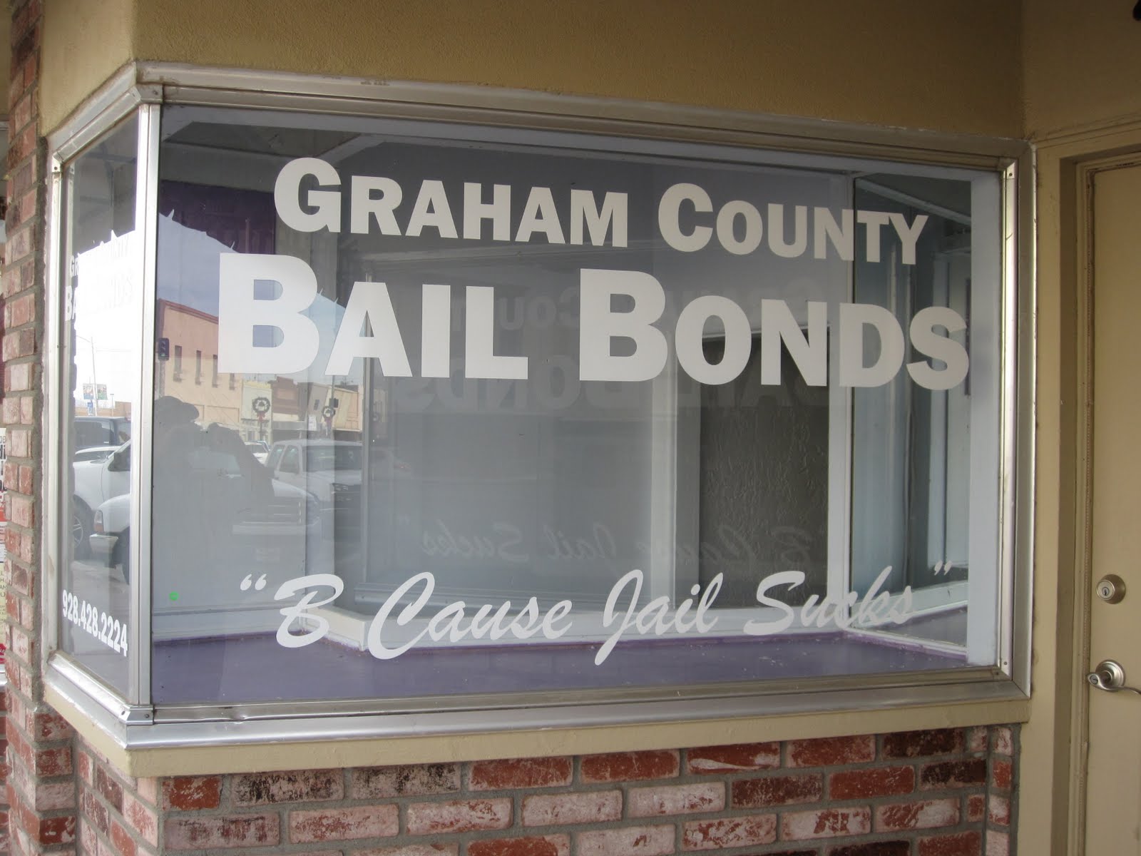
Main Street has the usual line of moldy old store fronts and facades you see in just about every little city in America, fighting vainly to compete with the more popular and prosperous and real business district on the nearby well-traveled highway. Why do they bother? About half the stores are occupied and the others are for rent. Little marginal boutiques, a carpet and tile place, a drapery place, a nail salon, a lawyer’s office, a bail bondsman, none of which look like they’re booming.

I pass Safford City Hall and come up to the Graham County Courthouse, built in 1916. I went inside it yesterday, and there's nothing to report. Outside it’s handsome enough, though it does have two rather stupid-looking Santa Claus heads with what look like mops for beards hanging over the main entrance, hardly evoking the majesty of the law.

At courthouse square I head north a block and turn west on U.S. 70. Burger King, McDonald’s, a Best Western hotel, a couple of Chinese buffets. Off to the north are mountains and cotton fields. Also up there somewhere is the Freeport-McMoRan Copper and Gold mine, the largest new mining operation in the country, according to one source. Other big contributors to the Safford economy include a state prison and a federal prison.

At 10.4 miles I pass the Walmart where I’ve been staying, and next to that is a Walgreen’s and a Home Depot. There’s even a movie theater across the street with five screens.

Just past Safeway the City of Thatcher begins. This place, a city of just under 5,000, was founded by Mormons in 1881, and was named for one of the apostles of the church. The businesses gradually thin out, and cotton fields line US 70 on both sides. To my left I see Mount Graham rising above a Ford dealership.

The cotton fields have been recently picked and modules dot the fields. Trucks are busy transporting them back toward Safford. I saw a gin on 191 just south of 70, and I’m sure there are a few more around here.

In the middle of the prosperous-looking Thatcher downtown is the new campus of Eastern Arizona College, a community college originally started by the Mormons and called the St. Joseph Stake Academy, then later donated to the state. Across from that is the equally new and prosperous-looking Thatcher Town Hall, next to which is a monument and bust of one of the fathers of Thatcher, Christopher Layton, 1821-1898. He was the first president of the St. Joseph Stake of the LDS church. He named and platted the town; donated the lot for the first schoolhouse; donated the land for the college; built the first business in town, Layton-Allred, a dry goods store; organized an irrigation canal; started the first post office; and started a stage line. He did it all. And still had time for his ten wives, all of whose names are listed on the plaque, and his 65 children. A vigorous and busy guy was old Christopher. I guess the prospect of getting laid by any one of ten different women on a given night would keep a man in fighting trim. And the beauty part, as they say, is that it’s okay with God.

Out on the west side of Thatcher there’s even more cotton. I see two different sizes of modules—what I’ll call the “standard” size, maybe 30 feet long, and some that are about two-thirds that length, all with fitted tarps over the tops.

At 14.8 miles I come to a brand new Mormon temple, just finished this year. Very spiffy, with a gold-plated statue of the angel Moroni on top. This is the Gila Valley Arizona Temple. It lies in the community of Central, between Thatcher and Pima. After the temple I’m pretty much out in the country with the cotton fields.

At 16.8 miles I enter Pima, population around 2,000. This place also was settled by the Mormons, but the name suggests that it is, or was, Indian land. Pima has a much dumpier look to it than tidy little Thatcher. At Main Street I look north at the one-block downtown, which doesn’t amount to much. Whatever else is going on around it, Pima is a rundown little city.

The prevailing architecture, if you can call it that, is the one-story square cinder block house, sometimes painted and sometimes stuccoed. But even more prevalent are trailers, placed haphazardly on lots and allowed to become permanent. Little fences around them enclose yards whose lawn ornaments consist of non-running vehicles of one sort or another, some with hoods up and some without hoods, and all with flat tires. Once in a great while a Craftsman-style gabled house from the 1920s or 30s stands apart from the rest, looking as if it might have been handsome once. These were probably ordered from the Sears catalogue.

It’s getting close to 4:30 as I leave the west end of Pima. The sky is still covered with a thin layer of high clouds, leaving the mountains visible in the distance above the thousands of acres of cotton across the irrigated Gila Valley. The motor home sits in the wide space between the road and some unused railroad tracks.

Wednesday, December 1, 2010

Day 142: The Land


Graham County Line to Artesia. 20.7 miles/2719 total

Wednesday, December 1, 2010

IS ANYBODY OUT THERE BESIDES BILLIE BOB? I’VE BEEN GETTING VERY FEW COMMENTS LATELY, AND HALF OF THEM ARE MINE. IF YOU’RE READING, DROP ME A LINE. THANKS.

9:15 a.m. The car is on the side of a hill on U.S. 191, near the Graham County line. I’m heading north to Artesia, 20.7 miles. It’s going to be a straight walk today, with no interruptions for gas stations or towns. Just the road and the desert and the mountains.

It’s a clear day, cool now, in the 40s. It’ll probably get up to about 60 later. For a change I’ll be walking north all day instead of west. The sun will be over my right shoulder in the morning and my left in the afternoon.

My companions this morning, such as they are, are the road construction guys who are working on making this part of 191 a four-lane road. Their main occupation seems to be rearranging the molecules of a fifty-foot hill of rock so as to put the road through it. This involves chipping away at the hill, and converting huge rocks into all grades of stone—rip rap, trap rock, gravel, and sand. Huge piles of different sizes of rocks line the side of the construction site. Busy yellow machines with Brobdingnagian tires move back and forth like creatures from a Star Wars movie. I can’t help thinking that George Lucas got his ideas from watching stuff like this when he was a little kid. That and reading and watching too much really bad and trashy sci-fi.

At 1.1 miles I enter Graham County, leaving Cochise County. Off to the left I come upon a large field of cholla cactuses, their yellow clusters of fruit hanging down off their branches like little chandeliers.

Departing from its habit of naming counties after subjugated Indians and tribes, the Territory of Arizona named Graham County for Mt. Graham, a 10,720 foot peak in the Pinaleño Mountains, northwest of where I’m walking now. Mt. Graham was in turn named for Col. James Duncan Graham. He was a surveyor and topographical engineer in the U.S. Army; born 1799, died 1865. And not just any knockabout topographical engineer. He was about as active in that capacity as anyone could have been, helping to establish boundaries between the U.S. and Canada, the U.S. and Mexico, the U.S. and the Republic of Texas, and settling a dispute about the Mason-Dixon Line, about which he published a voluminous report.

Just got stopped by the Arizona Highway Patrol. Again, a friendly guy asking after my welfare, and telling me to have a good walk.

I walk along today through the countryside with the mountains on all sides of me, now becoming so commonplace that I don’t even marvel at them any more. The foothills of the Pinaleño Mountains are off to the left. It gets me thinking about the attitude various groups of people have had toward the land. We’re told the Native Americans revered the land but didn’t feel they possessed it, just that it was their ancestral home, full of spirits and good magic and all that stuff. We’re also told, about ourselves as Europeans, that we came and viewed land more as a commodity to be owned, tamed, and exploited. Okay, fine. But because of the myth of the Noble Savage, perpetrated by Rousseau and others and certainly abetted by the Native Americans themselves, we’re also given to believe that the former attitude, that of the Indians, is somehow better and wiser and more spiritual and more highly to be prized than our attitude, which is considered crass and tantamount to the love of money writ large.

But there are other ways to view the differences between the so-called indigenous people and us as relative newcomers. First, the Indians, like everybody else except maybe some Africans, moved in from somewhere else. Over a long period of time they came to regard their position here as almost perpetual, since it went back to time out of mind. Some tribes even thought of themselves as autochthonous--as having arisen from the very earth they lived on. Then when the Europeans came, first the Spanish and later the English speaking people, they brought this idea that land was to be used for specific purposes and that others were to be kept off of it. Here, we are told, is where the Indians saw things differently. But in fact they saw things the same, only they had in mind that they and their gods were the husbands of the land, not us. There were so few of them, comparatively speaking, that they had perhaps been able to avoid major conflicts over this issue.

In any event, the Native Americans are perceived, and indeed see themselves, as being tied to these ancient homelands in a physical, spiritual, and emotional way. On the other hand, our intrepid European ancestors, not saddled with such restrictions, were happy to leave their ancestral lands and come over here and move into whatever kind of setup they could get—eastern and southern swamps and fields, Midwestern prairies, western mountains. Now I ask you, which person is more fit to occupy the land? The one whose spirit pines away and shrivels up when removed from one greasy little spot, or the one who says, "Okay, show me where to sleep and how to get water, and I’ll make the best of any place you put me"? Everyone possesses both these instincts in some measure and proportion, of course. But we, the ones who came to this continent from the other side of the ocean, had liberated ourselves from the sentimental and superstitious ties to place and time. We were dispossessed already—peasants, younger brothers who wouldn’t inherit, dodgy members of the demimonde. We were portable by nature. We even had a portable god, who didn’t live in the mountains or rivers, but went with us everywhere we went. Ancestors? Who needs ‘em, they’re dead, and a fat lot of good they did us anyway.

Ultimately this was our strength. We were more adaptable. It didn’t hurt that we were technologically way ahead of these people who hadn’t had really felt the need of our inventions until we got here. Originally they, like we, had been nomads and adventurers. But lack of serious conflict had made them stagnant, or at least slowed them down. They were evolving, but more slowly than we. Hence, they weren’t as adaptable as we were. Too bad for them.

So I ask again, who is nobler, more spiritual, and wiser in the long run, the winners or the losers? Why do we glorify the losers? We see them as purer somehow for their very vulnerability. Look at the Irish. An island full of people who have been beaten down time and again by the English, and will never be their match in anything but the ability to get drunk and recite poetry. Yes, of course, give them the island. Give the Palestinians their homeland, yes. But don’t say they occupy the moral high ground because they’ve been unable to hold on to what was once theirs. The conquerors are the ones who move and evolve fastest—to conquer and evolve some more and become stronger, and to strengthen the species thereby. Yet the losers make us pine for something we can't get back, some supposed innocence and leisure and purity. They make us want to return to the Garden. What they really represent to us, rightly or not, is our own childhoods, lost forever and replaced with the sense of purpose that comes with maturity.

It’s warmed up nicely this afternoon, probably into the low 60s. I have taken my sweatshirt off and have its sleeves tied around my waist, Eurotrash style. The Adopt-a-Highway sign over Mile 104 says, “In memory of Louie R. Tartaglia.” Sounds like a name that belongs in Rhode Island or New Jersey rather than out here in the arid mountains of Arizona. Maybe Louie got sent here by the witness protection program. Badda bing.

At 13 miles I arrive at the junction with Arizona 266. This is the first intersection I’ve come to all day. The road has gone from two lanes to four and back to two, but here at least there’s a shoulder wide enough so I can stay well clear of Refuseniks.

At about 15 miles I crest a hill and begin a long descent into a valley containing scattered settlements and evidence of human habitation. I’m looking at Artesia and beyond that Safford, and the Gila River Valley. I can find little information about Artesia other than that it's on the map.

At about 19 miles I begin passing some houses and more trees as the road flattens out a bit here in the valley. Just short of Mile 112 sits the motor home, against a high dirt embankment, across from Stauffer Lane.