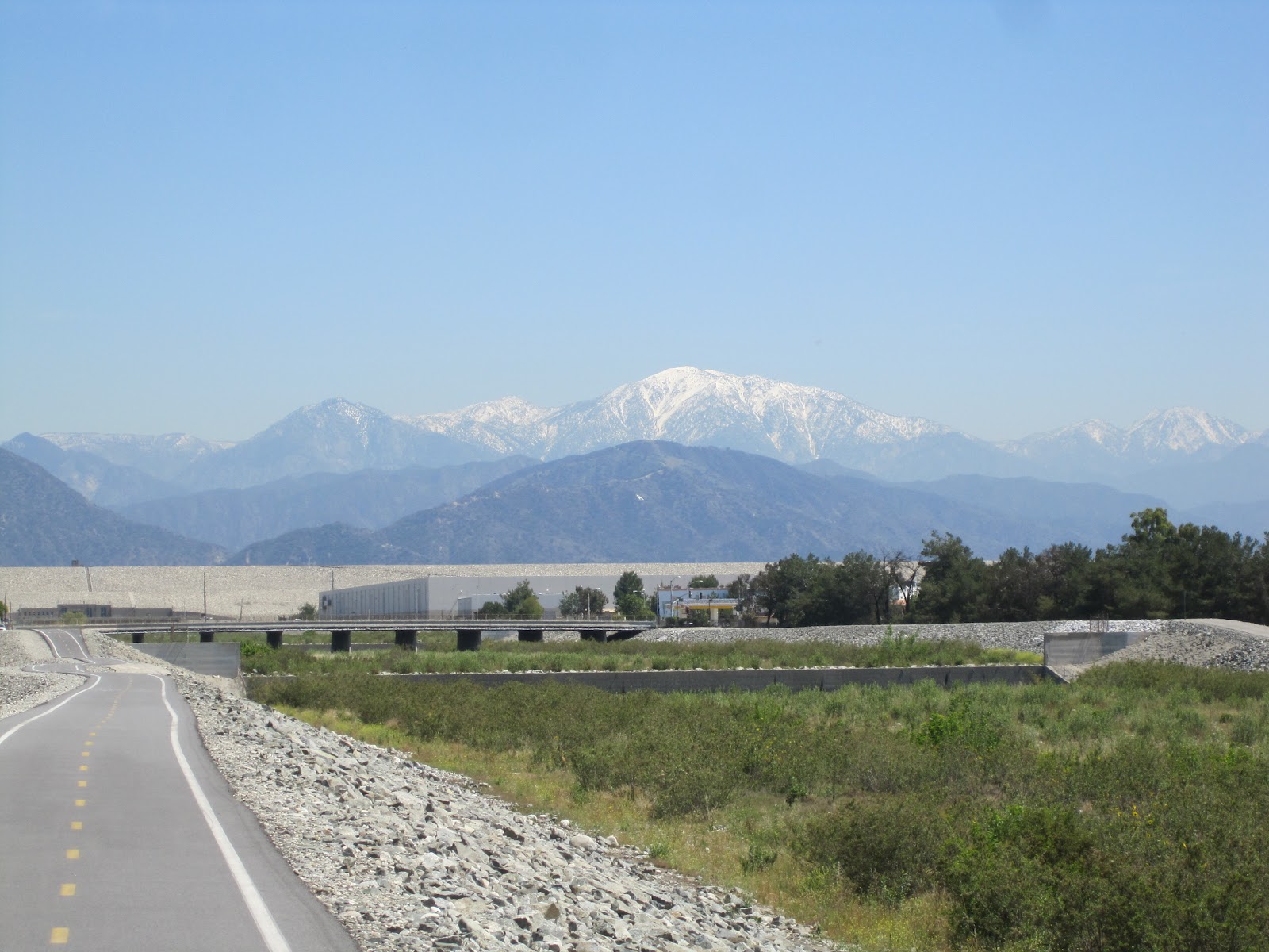
Friday, April 27, 2012

Mt. Wilson At Last


Southern California

Saturday, April 21, 2012

9:50 a.m.  Starting up the Mt. Wilson Trail from Sierra Madre, telling myself that I’m going to walk it all this time.  It’s going to be a hot day down here in the valley, maybe 90, and I’m looking forward to getting up into the shadier realms and higher elevations where the heat will be more tolerable.

It’s clear and cloudless above, but hazy with smog down below.  I’m carrying in my walking vest my usual full complement of paraphernalia, evenly distributed at least, including three 16 ounce bottles of water, which I expect to refill when I come to one of the three streams the trail crosses on the way up.  I haven’t yet heard anything negative about the water quality up here, but still I’m a bit nervous about it. 

I’m amazed, as I was on the two previous occasions, at how quickly the initial feeling of energy and exhilaration leaves and the lung burning begins and fatigue sets in.  Fortunately this is just part of the process of gathering one’s second wind.  It’s very hot already on the south-facing sunny parts of this lower half of the climb.  The bandanna I carefully left out to take with me this time to mop my brow and neck is still on the back seat of the car, but I did at least remember to slather sunscreeen all over my exposed skin.

Sweat pours in sheets down my face and forehead and down the center of my back.  Even the spaces between my fingers are wet where sweat trickles down my arms.  Only my legs, in khaki shorts, haven’t started to perspire yet. 

I take few pictures of humans when I’m on these walks, and as those of you who follow the blog know, few shots of people in general.  Don’t quite know why that is, except that I’m a little reluctant to photograph people without their permission, and I don’t feel like stopping to ask them.  Nevertheless it's the humans on whom I focus my attention.  Folks with dogs, suffering hot people like me, half trotting down in my direction, all muttering the same one-word greeting (or perhaps it's merely a statement) to each other: “Morning.”  Japanese, Koreans, Chinese, Latinos, Anglos, couples and families, pairs of young girls and middle aged women, men and boys, huffing and puffing older men:  “Morning.”  Very seldom do we fail to greet one another as we pass, as if to do so would violate an uncodified rule of civilized human interaction. "Morning."  I guess it's also to show each other we haven’t lost our minds or our speech.  "Morning."  Or maybe it’s like when the employees in the gym come up to oldsters like me when they see us laboring on the machines and ask a question, to make sure we can answer back and they don’t have to go get the defibrillator.

Yes, morning.  Despite the sweltering heat, I'm reminded of the sweet words of the hymn by the English writer Eleanor Farjeon, written in the 1930s.  “Morning has broken like the first morning, blackbird has spoken like the first bird.  Praise for the singing, praise for the morning, praise for them springing fresh from the Word.....Mine is the sunlight, mine is the morning, born of the one light Eden saw play.  Praise with elation, praise every morning, God's re-creation of the new day.”

I come to the spot that was the jack o’lantern man’s seat on the first walk, but barely acknowledge or slow down for it as I make a switchback turn and let the sun hit the left side of my face for a change.  Above the dirty mist covering the San Gabriel Valley the tip of a mountain rises like a low island on a grayish white sea.  Perhaps it will grow, or disappear altogether, as I climb.  Could it be a mirage?  I know the confluence of the mist and clouds and heat can play tricks on the eye.  More will be revealed, I think.

I am armed today with a plastic-coated guide to the wildflowers of Southern California, filled with color photos of blossoms.  I stop to try to identify something with small yellow petals, which may be golden yarrow.  But none of the blooms I see seem to be the exact ones pictured, and I give up for now to concentrate on walking.  I do see (and pick and smell) lots of what appears to be wild rosemary growing in small clumps along the path.  Occasionally I catch a whiff of it through the air.

I make it the 1.5 miles to First Water in 45 minutes and pause to drink a bottle of the water I’ve brought with me.  I appreciate the patches of shade beginning to appear here and there on the path.  Somewhere between here and Orchard Camp there’s a stream where I intend to drink another bottle of my store-bought water and fill both empties.  I’m losing a great deal of fluid and without a doubt will need to take in a half gallon to feel decently hydrated.  Since I started with a quart and a half, that means I’ll have to have at least one bottle of the river water in besides.  I know at the top of the mountain I’ll be able to replenish again.

In another hour, at 11:38 a.m., I reach Orchard Camp and stop and eat a sandwich and drink some more water.  Then I begin the 1.9 mile leg up to Manzanita Ridge, by far the most difficult piece of the trek.  It has all the steepness of the piece from the street to First Water, only I’m missing the energy I had at the beginning.  Stops of a minute or so just to stand still become more frequent. 

I make it to Manzanita Ridge at 12:42 p.m., just a little over an hour from Orchard Camp.  Much better time than I made last trip.  Up here there’s a large clearing with a wide view of the mountains and valley and the summit.  In the center is a modern wooden bench.  I stand over on the shady side of it and drink another pint of water while chatting with two middle-aged women, one of whom, a pediatrician (her friend tells me), lies prostrate under a tree looking a little like a beached seal.  I ask one of them if she’s heard anything negative about the drinkability of the water from the streams on the way up and she says no—that she assumes it’s pretty clean, probably much more so than when people used to ride horses up here a hundred years ago.  I say good, because I’m drinking it now.  She takes the bottle from me and holds it up to the light, as if that will tell her anything.  It’s as clean looking as anything you’d get in the store.  “If there are any insects in it, I won’t mind,” I say.  Just some more protein.  It’s the microscopic bugs I’m concerned with.  “Well, I guess I’ll know in a few hours one way or the other,” I say.

These women have come up the same path as me, they say, but they’re done in, and have decided not to do the 2.75 miles more up to the top.  If I see their friend Anna, an Asian woman wearing a black top, would I please tell her they’re okay but won’t be going any farther?  Of course I agree, then after a few more minutes of chat (much more enjoyable than my conversation with Janos the Eastern European last time), I continue onward and upward.

At 1:15 I attain the old Toll Road and begin the last 1.75 miles up.  The forest of towers and antennas at the top is in full view.  To describe the vistas I see at this point would require me to use trite words like “magnificent” and “breathtaking,” so I just take photos instead.  It’s like an Asian painting, with the mountains above the clouds. While the layer of smog covers the populated floor of the valleys of greater Los Angeles, above it hilltops peek like enchanted floating isles.  I can just barely make out, amid the haze, the cluster of cylinders and skyscrapers that is the downtown business district of LA, and nothing else of the city, or of the sea to the southwest beyond.  What a view this must be on a breezy clear day.  Well, that’ll be for another time.  I encounter Anna, the friend of the two women at Manzanita Ridge, coming the other way, and give her the news that her friends are okay but won't be going the rest of the way up.  She has surmised as much, and is going down to meet them.  

Soon I see some parked cars, and I realize I’m not too far from the top, which is attainable by road from the other side, via La Canada-Fruitridge.  It turns out that at this point there’s another rocky steep trail that cuts off the Toll Road.  A group of Japanese people coming down tell me this trail is the way to go and I get on it, but a guy I met and talked to at the beginning of the Toll Road is still down there on the relatively wider and more gradual remnants of the roadway, strewn with boulders but still inviting if you’ve been mostly walking on a three-foot-wide ledge all day.  I can see him several dozen feet down the hillside, paralleling my rougher route.  I decide that he’s taking the easier, softer way and that I’ll definitely not take the piece of trail I'm on now on the way back down.  Still, I’m glad I’ve tried it out.  

At 1:50 I attain the summit.  I’m on the edge of a large gravel parking lot which at the moment is filled with two dozen motorcyclists who have made the vehicle trip from La Canada and are looking down the mountain.  I take a little unkind satisfaction in the realization that, like Harley riders everywhere, these folks are far too fat and out of shape and/or dissipated to have walked up.  Noble knights of the road.

Around me are a plethora of antennas and the domes of several telescopes.  In the immediate distance is a pavilion, in the center of which is a refreshment stand.  Nearby are some bathrooms where I refill all three of my water bottles for the walk down.  It’s in the 80s even up here, but I’ve stopped sweating with exertion and know I probably won’t need all the water.  Still, I’ll take it.

I venture down a road in the direction of the Mt. Wilson Observatory itself, but realize that it’s still at least a half mile distant.  I stop at a small astronomy museum—just a large room, really, where there’s some information about George Ellery Hale, the man who built the first telescope up here in the 1890s.  Later work was done up here by John D. Hooker and Edwin Hubble, among others.  The little museum also contains some great photos of outer space take from various equipment.  I decide to save the trip to the observatory for a time when I can drive up.  Besides, I have an aversion to things celestial that goes back to bad experiences I had with a couple of astronomy classes in college--my own fault, but still distasteful to contemplate.    

I decide, with advice from my leg muscles, that walking any more in the opposite direction from the top of the trail back down the mountain isn’t a good idea, so after the museum I turn around and head the quarter mile back to the refreshment stand.  Though I have plenty of water in my vest and even a couple of snacks left, it doesn’t seem right not to partake in what this store of comestibles has to offer, especially since I believe they're only open on weekends and might not be available next time I come up.  An iced coffee looks good, and to go with it I get some vanilla ice cream, in one of those little cardboard cups with the flat tabbed lids like we used to get from Mr. Greer the druggist on the last day of vacation Bible school when I was a kid.  After drinking a bit of the coffee I put the entirety of the ice cream into it, to melt slowly amid the ice and the caffeine.

It’s 2:30 as I officially start my descent from Mt. Wilson.  It took me exactly four hours to make it up, and I’m hoping I can get down a in bit more than three and back home by 6:00 p.m.  This time, however, I don’t seek out the trail, instead walking past the forest of antennas and finding the old Toll Road from which I diverged.  This will take me back to the regular trail in a little less than two miles.  You’d think, amid all this vast transmitting capacity, that cell phones would work up here, but that’s not the case.  I’ve been without a signal since just a bit past First Water.

Soon after starting down the dusty one-lane road I encounter a nice young couple I’d passed an hour or two ago on my way up.  They’re standing on a promontory overlooking the misty city, still working their way up to the top.  It’s their first time to the summit, too, and the girl, especially, is really fatigued, and they’ve obviously been stopping frequently.  “We're almost there, aren't we?” she beseeches.  I assure her that they are indeed almost there.  They ask me to take their picture with her fancy and rather heavy Nikon camera, and I oblige, asking them to return the favor with my small and trusty Canon.  We talk a bit more and then I’m on my way.

Strolling down this old autoway is by far the easiest part of the descent, and soon enough I’m back on the rocky trail and into the woods, almost trotting at times, as I make my way back to Manzanita Ridge, which I reach at 3:25.  When I get there it’s deserted, and I don’t tarry.  What a difference it makes when you’re not huffing and puffing.

To keep me company on the steep remainder of the descent I have my earphones in now and am listening on the iPod to The Island at the Center of the World, by Russell Shorto, a 2004 narrative of the history of the Dutch New Amsterdam colony, based on some recently-translated 17th century Dutch records found in the New York State archives.  I’m pretty sure a word or two will be said about some of my ancestors, both Dutch and English, who were there during that period.  In any case it’s an interesting and detailed account of an aspect of American colonial history that’s usually summed up with the oversimplified story of Peter Minuit buying Manhattan for $24 worth of trinkets, then followed by a fast forward over the next half century to when the British took over and renamed the place New York.

At 4:10 I get to Orchard Camp, about halfway down.  Making pretty good time.  The sweat now isn’t so much from exertion as it is from the afternoon heat shimmering up onto the increasingly less shady trail. 

At about 5:00 I pass First Water with just over 1.5 miles to go.  The only wear and tear I’m feeling is the beginnings of blisters on the bottoms of both my heels, evidently from the slippage of having to put on the brakes with almost every step.  Interestingly, I didn’t get this the last two times.  I stop to tighten my shoelaces, but I fear the damage is done. 

At 5:45 p.m. I’m back to the car.  Mission accomplished.  I'll next try the trail up Mt. Wilson that begins at a place called Chantry Flats in Arcadia, of approximately equal distance and difficulty, they say.  Then it's on to others of what are called the Six Pack of Southern California mountain hikes, up to increasingly higher elevations.  But for now, some rest for the feet.


Monday, April 23, 2012

The San Gabriel


Southern California

Tuesday, April 17, 2012

11:00 a.m.  I am setting forth on my bicycle from the Thiennes Road entrance to the San Gabriel River Bikeway, in South El Monte at the 23.75 mile point, heading north to the Irwindale/Azusa terminus of the bike path and then back south again.

It is a warm day, in the 70s right now.  This is a very nicely maintained bike path, asphalt, about the width of a one-lane auto road, with two lanes for bicycles.  Repaving and repairing seem to be going on at frequent intervals, with county maintenance trucks plying the bikeway.  At the moment it runs along the west side of the San Gabriel River bed, which today (and most of the time) is dry enough that mature trees grow in the basin between the two sides of the river.  Obviously in the event of flood a great deal of water can be accommodated. 

At one time no doubt this was a much wetter and wider river, created by runoff from the San Gabriel Mountains several miles to the north.  Today, due to damming and other techniques, much of the water is diverted for the use of the local residents of the towns nearby.  Where I am now those towns are El Monte, Irwindale, Duarte, Monrovia, Azusa, and a few others. 

I think this is the first time I’ve blogged specifically about a bike ride, although I’ve ridden here a dozen times or more.  At this point it runs along the back ends of modest to poor residential neighborhoods, many of which have small stables for single horses or ponies, built of plywood and other scrap materials, as well as some coops for the raising of poultry.  The fowl seem in particular to be colorful and ornately-feathered roosters, used no doubt in this area for friendly and humane cockfighting matches.  There just doesn’t seem to be sufficient reason for so many roosters to be strutting around with no hens in evidence.

Out in the middle of the mostly-dry river basin there does run a small rivulet of six or eight feet wide, swelling in some places to a full river almost filling the bed.  Here wild fowl of all types dive and bob—ducks, geese, herons, and cranes.  They swim amid the trash that floats atop the water—styrofoam, plastic, debris of all kinds—surviving, indeed thriving, in a way that would be unsettling to a nature purist.  But that’s the one of the beauties of this river: it exists within sight of pristine snow-capped mountains in the north, while running fitfully through the midst of garbage and graffiti and urban grit.

In small permanent copses on the river's edge I can see makeshift tents and shelters where indigent people live in their worlds of stuffed black garbage bags, empty beverage containers, and the shopping carts they use to collect and transport these things.  A disheveled bearded man pedals slowly past me, metal cart affixed to his rear axle.  Out collecting what others don’t want, either to sell or use or eat or burn. 

The bike path runs along a sort of levee twenty feet or so above the river bed and there’s another levee on the other side, about 150 feet across the way.  Sometimes there are bike paths on both sides and sometimes the path crosses, via a street or occasionally a pedestrian bridge, from the west side of the river to the east and back.  Down on the outside of the levees, behind the back yard fences of the houses lining the way, there is frequently a dirt path, along which people—men mostly—ride their horses.  Most of the equines are sorrel-colored and appear to be well-groomed and fed.  The riders—caballeros—sometimes decorate their horses with silver-ornamented saddles and bridles and themselves dress in spangly vaquero-style costumes, occasionally topped with sombreros but more often with western hats.  Most ride wearing simpler clothing, but all ride with evident pride and care and skill.  Where they get the money and time to care for these horses is anyone’s guess, but they do.  These are no white-fenced Kentucky horse-country operations.

Up on the bikeway, carefully marked every quarter of a mile to show the mileage, I encounter a wide variety of fellow travelers: other casual recreational bikers like me, kids and young men and women strolling and gathering for a furtive smoke or a kiss, people simply walking or jogging, and of course the many “serious” bicyclists who zoom past me in either direction, the ones I call Spandex Warriors.  Often these latter are dressed as if they were about to enter the Tour de France, complete with colorful and endorsement-laden jerseys, expensive bikes, and all the latest paraphernalia from head to toe, their gleaming helmets making them look like busy and fast moving wasps, firm in the belief that all this will make them better and faster and more serious riders, though I suspect that very few of them are more than clubby enthusiasts.  They ride, indeed, with a gravitas that suggests they might like to ban children from the activity altogether, for not taking it seriously enough.  They ride with a conformistic fanaticism that reminds me of serious amateur golfers, with their Ping hats and pink shirts and chinos and whatever is the latest and most trendy and pricey equipment their hobby has to offer.

Meanwhile I plod along as I have since childhood, a tortoise to these hares, simply pedaling from beginning to end pretty much without stopping, on legs and a body that are sturdy and time-tested, if not flashy and sleek.  But lest you think I am gainsaying these bicycle enthusiasts, I hasten to assure you I am not.  I look upon them as a man on the freeway in a Hyundai might look at the guy in the Ferrari who zooms past him, marveling at the many ways people choose to approach the basic task of getting from one place to another on wheels.

High up in the underpasses that dip beneath the many cross streets, in the little cubbies just below the steel of the roadways, are other signs of human habitation—cans, bottles, tarps, piles of grimy clothes, the smell of urine.   I am aware that I’m traveling not just alongside, but through, the homes of men. 

The rundown casitas of El Monte give way to the gravel pits, steel cranes, power line towers, and warehouses of Irwindale as I make my way north to Arrow Highway, the only street where the bike path users must stop and cross traffic.  Irwindale, so devoid of residents but so filled with the things that make livable the lives of the millions who live nearby—a huge Miller brewing plant, for instance.  Then gradually as I approach the Santa Fe Dam, the San Gabriel Mountains themselves come to dominate the horizon.

Having crossed the road, I begin what is the only even moderately strenuous uphill climb on the bikeway, to the top of the Santa Fe Dam, a half mile or so of incline that make me downshift to the smaller front sprocket of my premodern Panasonic ten-speed.  For the most part the bikeway is easy to ride on, running gently downhill from the mountains south to the Pacific Ocean in Seal Beach.  Even when going north and upriver the ascent is so gradual as to barely be noticeable.  In fact, it’s often easier to go north because of the winds that blow from the sea out of the south and west.

From atop the dam I can look to the left and see the majestic mountains and then to the right at the rooftops of the factories and industrial buildings of Irwindale.  I’m not sure which I like better—perhaps both in equal measure.  The brewery, which appears so vast from the 210, looks tiny against the green backdrop of the foothills.  All along the road at the bottom of the fifty or more-foot slope from the dam, a hundred feet of usable space between the trap rock and the road is used as a series of plant nurseries, growing small trees and shrubs in buckets, mostly.

Having attained the Irwindale parking lot and entrance to the bikeway, at the 35.25 mile mark, I turn around and head south and am now within a mile of where I began today’s journey.  Once again I pass behind Mountain View High School, home of the Vikings, where here in the early afternoon the gym classes play soccer out on the fields.  I’m pushing against a strong breeze from the southwest.

South of El Monte, at about the 22 mile mark, the river has widened and moves faster.  This is the area known as the Whittier Narrows, where there’s a large flood control dam across the riverbed, and is perhaps the most picturesque part of the ride.  Across the way I look up into the hills to the east, where I catch glimpses of Rose Hills Cemetery in Whittier, the largest cemetery in the United States.

I continue south past the Pico Rivera Golf Course and soon after, at San Gabriel Parkway, cross the street on a little bike and pedestrian path to the east side of the river.  Over on the east side, just over the fence and past the ditch and dirt path is another long line of scrap-wood made, impossibly small, horse stables, their usually single inhabitants sticking their heads out from the open, chest-high barriers.  Latinos ride and train the horses in the bit of otherwise unused dirt between the river and the back yards.  Perhaps some of them are being trained to give rides to children or to hire out for gentle weekend walks through the precious bits of open space hereabouts.

In this small space also there are bits of junk and discarded tires, and graffiti sprawled across little otherwise-silver shacks used by the railroad, which also runs nearby.  Suddenly I’m cheek-by-jowl with the 605 freeway and down in Bellflower or Norwalk or Lakewood or Cerritos.  The river has widened to take up all its allotted space, though it's still shallow.  Then more nurseries, some covered in domes of plastic, graffiti decorating the sides.

At the 14 mile marker the river loses its natural plant-based bed and becomes a concrete basin.  Running down the center is a ten-foot-wide indentation, a rushing torrent of water, on either side of which is a flat expanse of concrete about the width of a two-lane highway.  It’s one of those perfect places for drag racing you always used to see in teenager movies set in the greater Los Angeles area during the 50s and 60s, as the smooth pavement runs for miles alongside the bit of river in the center.

Just past the point where the river becomes concrete comes a sickly-sweet smell of rotting garbage reminiscent of a big-city Chinatown in summer.  It’s the D.A.R.T.—Downy Area Recycling and Transfer Plant, over on the west side.  On my side of the river are narrow acres given over to the raising of annual flowers and vegetables—marigolds, pansies, leaf lettuce and the like—tended by bent-over Mexicans and Asians.  If the fetid air can impart any fertilizing nutrients to this enterprise, then the flowers should do very well.  In any event, the workers get to smell this miasma all day long as they hoe and water.

All along the sloping sides down to the concrete riverbed is evidence of graffiti, but it has been uniformly painted over with rollers by the authorities.  The result is not one bit of identifiable tagging, but instead a steady, miles-long patchwork of white, beige and light blue rectangles.  This is the triumphant graffiti of the powers that be, saying unequivocally that they, not the local kids and gangbangers, own the river bed.  Tagging of the most emphatic kind.  I find myself wondering at what time of day this painting gets done, or whether it’s even necessary any more, the spray-painters having perhaps surrendered in this war of attrition.

At the 10 mile marker on the path I decide this is a good place to turn around and return to the car in South El Monte.  I'm almost out of Los Angeles County and into Orange County.  I will have gone 50 miles today when all is said and done, and that’s about enough.  Since I haven’t been biking for a couple of weeks, my thighs are telling me I shouldn’t push it any further.  I finish up at about 4:00 p.m.

School’s out now and there are more kids on the path—pairs and trios of laughing boys on the same 16 or 20 inch BMX-style bikes we had a generation or two ago, trick riding on homemade undulating dirt-bike courses or gathering to smoke and talk tough.  Cute teenage Mexican couples holding hands, strolling slowly and saying nothing, filled with love.  Adults walking impossibly small dogs.  Bums sleeping in the warm shade.  Life is sweet along the San Gabriel.


Wednesday, April 4, 2012

Mt. Wilson, Part 2


Monrovia, California

Wednesday, April 4, 2012

Let us give thanks for the Buckeyes’ loss in the Final Four. Now I can relax and await the start of baseball season in a couple of days.

Last Saturday I made my second foray up Mt. Wilson, still not reaching the top, but getting a couple of miles farther than I did the first time. Without a doubt I could have made it, as I breezed (and wheezed) past my previous high point; but again I got a rather late start and didn’t feel I had time to go the last mile and three-quarters up. Besides, it was a misty day and the view from the top would have been nonexistent. Nevertheless there were many people on the trail, heedless of the mist and fog. Let me now switch to the contemporaneous recorded account of the day.

Saturday, March 31, 2012, 10:40 a.m. I’m starting out on a cool and misty day in Sierra Madre up the Mt. Wilson Trail. As with my first time up, the first few minutes are an adjustment—pain in the legs and burning in the lungs. As I look down toward the valley I see only fog, and the same when I look up.

This being a Saturday there are many more people out on the trail, notwithstanding the weather, than the last time I walked, which was a relatively clear Tuesday. I don’t see too many just now, but I know it’s crowded because the parking is more limited on the streets down below.

The challenge for today is to make it to the dead tree I reached last time and go a bit beyond. I don’t have ambitions to reach the summit, just to improve on the last walk. Nor would this necessarily be a great day to be at the top, since visibility is only about enough to ensure that the hundred feet of trail in front of me is clearly visible.

Just at the hairpin turn where I met the mendacious jack-o-lantern man I begin climbing into damp cool mist. Knowledge of what lies before one is an important asset in any journey. Forewarned is forearmed, and all that. So I continue climbing this time with the knowledge that the first two stopping places—First Water and Orchard Camp—are eminently attainable.

Walking is a time for contemplation--hence for me the recorder into which I am speaking now. As I pass groups I can pick up snatches of conversation or monologues. People—women especially—talking about relationships and goals and problems. Men are more taciturn, or else talk about things less personal. We don’t naturally bare and share, as a rule, at least not in a setting like this.

At 11:24 a.m., 44 minutes into the walk, I reach First Water, which is 1.5 miles. Better time than I made last trip. I pause only long enough to look at the clock on my phone and forge ahead to the next stopping point. The cool dampness is beginning to tell and my initial sweating, which caused my to take off my outer shirt, is giving way to a feeling of chill that makes me put my the shirt back on now that I’m pretty much in full shade. Between First Water and Orchard Camp is an area of somewhat flat spots punctuated by occasionally downward dips. Pumpkin Man didn’t lie about that, and it occurs to me that he was only talking about this stretch compared to the previous one. Perhaps I’ve dealt too harshly with him. But when the steep sections come, which they do, they’re all the more steep to make up for the flat parts.

I’m not fully engulfed in fog, but close to it. Still I can see about fifty feet ahead, and since my sight must be on what’s immediately in front of me anyway, this isn’t such a bad thing. No unnecessary sky-gazing today. One foot in front of the other. Nor, like Lot’s wife, am I tempted to look back.

At 12:24, exactly one hour after attaining First Water, I reach Orchard Camp two more miles. So far I’ve done 3.5 miles in one hour and 40 minutes. Good time, for me. I pause here to rest and eat my sandwich, sitting a bit apart from a group of about a dozen middle-aged Japanese people, replete with backpacks and the best walking equipment including the things that look like modified cross-country ski poles many people use for the downhill part of the trek. They’re speaking their language and resting, appearing as they so often do somehow busy even in leisure. The worker bees of the human race. I think they’re on their way down, but I’m not sure. Orchard Camp is bigger than I had first realized—perhaps a fifty-foot-square flat expanse surrounded by large shade trees. This could well have been an overnight camping spot, and perhaps still is.

Now the trail becomes pretty consistently steep, like walking a continuous erratic and broken down stone staircase. Suddenly I look up and see that I’m standing in front of the dead evergreen that was the apex of my last walk, its drooping branches hanging mournfully against the white mist behind it. I continue on, although I must say that fatigue is setting in. I’ve gotten to this place in about 30 minutes less than I did last time. Very encouraging, and no more wear and tear on the body than before.

At a large outcropping of rock in the trail on either side of a stream I encounter four men on mountain bicycles coming down from the summit. I’m impressed to say the least. If you could see this trail you’d say they were insane for trying to bike it, as there’s rarely a stretch of more than fifty feet that isn’t punctuated with rocks or tree limbs lying across the path. But I suppose people have done crazier things. They do walk their bikes across the boulder and the stream, however.

Now I’m in terra incognita, and each bend shows new vegetation and new somewhat more treacherous pieces of trail. It gets steeper and rockier and stranger, the alpine trees and shrubs coexisting with agaves and yuccas. I pause to sit on a large rock and take a drink of water and rest my legs. Cold mist blows up from the ravine below, reminding me of the mist they blow at you as you enter the casinos in Las Vegas, to cool you down. Here the mist is about the same temperature as the air, however, which I would guess to be in the mid-50s.

No sooner do I say that into the recorder than I turn a corner and catch a warm breeze—from where I don’t know. Immediately the temperature is ten degrees warmer. Then I turn away from the edge of the mountain and back into the deep shade and the air gets cool again. This happens twice more. Perhaps I’m getting above the clouds.

At 1:38, or about an hour and 15 minutes after Orchard Camp, I reach what I take to be Manzanita Ridge, although there’s no sign to that effect. So this 2 miles has been quite a bit slower. My pace has slackened. The sign here says “Mt. Wilson Junction,” and is of more recent vintage than the other ones I’ve seen. To my disappointment it says Mt. Wilson itself is 2.25 more miles, not the 1.5 I’d expected. Based on that it looks as if Mt. Wilson is 7.75 miles from the beginning, not the 7 the old signs promised. A mile and three quarters on flat ground wouldn’t mean a hell of a lot, but up here it does.

I sit on a nice new wooden bench facing south. This is a wide flat area where several paths come together—the one I took and one or two from further east, perhaps starting to the east over in Arcadia. Beyond me on a clear day, to the west, would be a view of the top.

During my ten minutes on the bench a tall thin guy perhaps my age comes clambering up and emerges from the trail I was just on, dressed mostly in orange, sockless and in shorts and a nylon windbreaker, with a pair those newfangled mesh shoes I’m seeing everywhere—not the ones with the individual toes, but similar to them. He sits down and immediately begins talking, complaining about the fact that the sun isn’t shining, as if there were anything either of us could do about it. “I love the sunshine. I must have sunshine,” he says in an Eastern European accent. Good for you, I think.

This man quickly reminds me of an older version of the character Janos from an episode of Seinfeld. He was the guy who ran a tennis shop but couldn’t play tennis, and convinced Jerry to let him win while his wife watched them. Then as Jerry obligingly misses and lets him win, Janos begins to taunt him and call him names. “Look at the little baby, can’t even hit the ball,” etc. Naturally Jerry gets pissed and begins to beat him.

The patter this guy keeps up has the same obnoxious tone to it, though not directed at me. First he makes light, in a loud voice, of a group of Asians who have arrived at the ridge to rest—a large extended family or collection of friends, in fact, spanning at least three generations. They’re on their way down from the summit. “Look at the Koreans,” he says, “they have so much gear. They have everything.” This is pretty much true, but I’m mystified why he has to point out to them and the world in general that he knows they are Koreans. My obnoxious Eastern European guy has only a small rucksack. Already he’s putting me a bit on edge. Up here we should all be brothers and sisters, I’m thinking. Then he starts ribbing them about whether they left him any food at the top (apparently there’s a restaurant, or at least a concession stand). “You’d better have left me something to eat! I’m starving!” Concerned a bit and knowing that sometimes people don't plan ahead, I offer to let him have one of my snacks. “No,” he says loudly, “I’m just bullshitting.”

Then he asks me if I know what time it is. I pull out my cell phone and tell him, then I add, “This is all this phone is good for up here, just to tell the time. There’s no reception.” He says, “They don’t waste their money putting cell phone service where there are no people.” Good point. We talk a bit about cell phone dead spots and he says he wonders when satellites will get better. I hold up my phone and say something to the effect that phone technology is worlds better than it was 20 years ago. “No,” he says emphatically. “I wish it were like it was 20 years ago. These kids today, they walk around with their phones in their hands like little babies with their milk bottles.”

It’s at this point that the guy really becomes Janos from Seinfeld. I want to ask him if he liked the way it was twenty years ago in whatever country he came from, but he’s up and on his way without so much as a good-bye. It occurs to me that five minutes with some people is about four minutes and 59 seconds too long, and I spend a few moments feeling sorry for his wife, his children, and his grandchildren before I move on.

At this point I don’t know if I’m going to make it to the top or not, but I’m pleased that I’ve exceeded the distance of the last walk, so I’ll be content with whatever transpires hereafter.

At 6 miles I reach the place where the trail meets the old Mt. Wilson Toll Road, a bumpy one-lane affair that apparently becomes the trail from here on up. The Toll Road runs more or less north and east up the mountain from Altadena, a small town just north of Pasadena. It was created after the Harvard telescope was placed on Mt. Wilson in 1889, and was in existence as a motor way from 1891 until the 1930s, when it was replaced by a better road running up the other side of the mountain from a point in La Canada-Flintridge. It’s no longer drivable because of the many large boulders that have rolled into the roadway, but gets used by hikers and cyclists. And for me it bodes well in terms of being comparatively wider and flatter than what I’ve come up so far. The sign says it’s 1.75 miles to the top.

I pause on a large rock about 200 feet up the Toll Road to contemplate my options. I have a tantalizingly short distance to go. I could go the extra distance to the top, which would add another 3.5 miles round trip. That would be another hour and a half, maybe more, not counting time spent at the summit. I decide instead that this is where I’ll turn around for today. The time is 2:15. I’ve been at it for 3 hours and 35 minutes and the walk down will probably take about 3 hours, getting me back to the car a little after 5:00. That should be sufficient for today, so I start back.

The temptation on the way down is to break into a trot because it’s so steep, but this I fear would play hell with my knees and probably cause me to stumble and fall headlong into . . . what? So I walk as quickly as I can but keep it at a walk, inserting the ear buds from my iPod to listen to a recorded book. It's called The Man Who Ate His Boots, by Anthony Brandt, a detailed and very well-written account of the British search for the Northwest Passage across Canada in the early to mid-1800s. Listening to the accounts of the hardships of British Navy men, the French voyageurs, and their native North American helpers facing starvation and cold and endless days and nights stuck in the ice going God knows where makes me feel warm and comfortable in comparison.

When I get back to Manzanita Ridge the clouds overhead clear just long enough to afford me a ten-second look at the towers on Mt. Wilson. Then I’m back into the rocks and the trees and the mist and fog once more. The piece from here to Orchard Camp is by far the steepest. I’m told by some friendly people I meet on the bench I earlier shared with Janos that there’s a museum up on Mt. Wilson too, so I do want to allow myself at least half an hour up there.

The humidity is so heavy that it’s almost raining. At 3:40 I stop to sit and rest at Orchard Camp for about two minutes then proceed down to First Water. This next piece will be a bit better, characterized by some nearly flat spots from time to time. Tiring as it all is, today’s walk has been easier than the first one was.

A little above First Water I finally descend below the worst of the fog and can actually see the mountains surrounding me and a little bit of the wide view of the San Gabriel Valley, including Santa Anita Racetrack in the haze. At about 5:15, just as I’d guessed, I finally reach the bottom and walk the half mile to the car. 12 miles this time. Another good walk.

Wednesday, March 28, 2012

Mt. Wilson, Part 1


Monrovia, California

Wednesday, March 28, 2012

I’m going to leave off on the political stuff, which seems to be going about as expected. Also, Michigan, Michigan State, Connecticut, North Carolina, and the unlikely Ohio University are out of the NCAA tournament, and we can only hope Ohio State will lose.

Instead, I’m going back to my stock-in-trade on this blog, and recount a walk I took last Tuesday part of the way up Mt. Wilson. Mt. Wilson is a peak in the San Gabriel Mountains, the range that runs along the north side of the string of cities to the northeast of Los Angeles—Glendale, Pasadena, Arcadia, Monrovia, Duarte, Azusa, etc., above old Route 66 eastward to San Bernardino.

Mt. Wilson’s claim to fame is that it has been used since the late 1800s as a site for telescopes. In the early 20th century an observatory was built there, containing increasingly powerful telescopes. Since the 1980s the observatory has been gradually abandoned in favor of sites in other countries. I will have more to say about the observatory when I actually get up there and find out more.

Mt. Wilson was named for Benjamin Davis Wilson, 1811-1878, who was the second mayor of Los Angeles and became, incidentally, the grandfather of General George S. Patton, Jr. Benjamin Wilson, known to some as "Benito," started a trail up the mountain in order to get wood for casks for his winery located in what is now San Marino. To his disappointment the wood wasn’t any good, but he constructed the trail anyway, in 1864, and it became popular with recreational hikers. So much for history. Let me now revert to a transcription of the recording I made while walking.

Tuesday, March 20, 2012. It is 10:10 a.m. and I am in Sierra Madre right off Mira Monte Drive, at the beginning of the Mt. Wilson Trail. This is a steep dirt walk that goes up from the present elevation of 970 feet to the top of Mt. Wilson, 5650 feet, over a distance of 7 miles. Because of the steepness of the trail and the fact that I haven’t walked in a long time (although I’ve gone to the gym on a regular basis and have done a bit of cycling), I’m not sure if I’ll make it all the way to the top this time, but at least I’ll make an effort and give myself something to aim at the next time I go.

Clear days are important for this walk, at least from the standpoint of being able to see the wide valleys that become ever more visible as one makes the ascent. Although this isn’t anything like the flat roadside hiking I did across the country, the young and not-so-young people I see jogging in both directions make me realize that I’ve gotten out of shape, comparatively speaking. I needn’t have worried that my workouts at the highest settings on the elliptical trainer were tougher than what I might encounter here. Aerobically, this is by far more difficult. I’m huffing and puffing in a way that my training didn’t prepare me for.

With each switchback the view of the floor of the San Gabriel Valley widens, and though I started in tiny Sierra Madre, what comes into view in the foreground of the slightly hazy distance is the city of Arcadia, which lies between Monrovia and Pasadena along the east-west line at the foot of the mountains. An expanse of concrete and grass gradually reveals itself to be the Santa Anita Racetrack and the large mall adjacent to it.

The dirt trail, although reasonably well maintained, is narrow—perhaps four or five feet wide in most places—and has no railings to keep people from meeting almost certain death should they fall off. At times it’s rocky, too. I see that it would never be a good idea to take this walk during or right after a rain when the stones are slippery and the little groove in the middle of the path is full of water.

Finally I begin to catch my breath, and after a mile or so I stop at a bend in the trail to talk to a toothless old man resting on a large rock on his way down. He’s probably not all that much older than me, but with his gauntness and without the teeth he looks ancient. We chat for a few minutes, during which I tell him it’s my first time on the trail and he tells me he’s been walking it for decades, although he doesn’t go all the way to the top any more—not since the 1980s. He’s just been up to the first stopping point, a place called First Water about 1.5 miles from the trailhead. He also assures me that the steepest part of the walk is behind me, and that things flatten out somewhat from here on and it becomes much shadier. Finally he tells me that the water at First Water is drinkable. “At least to me it is,” he says, with a chuckle that makes his face light up like a benign jack-o-lantern.

With thanks I leave him and take another hairpin turn. I’m wearing my hiking vest—the one I used throughout my journey across the country—with its pockets full of lunch, snacks, camera, cell phone, basic first aid stuff, and a bottle of water in the back. I have so far hesitated to drink much, waiting to see what the water situation will be further up. I have plenty, and it’s not an oppressively hot day. Nevertheless I’ve been sweating up a storm, and I take off the long-sleeved shirt I’m wearing over a t-shirt and tie it around my waist for now.

The going is still steep for now. I realize that most of the people I meet coming down have only gone up to First Water, or at most to Orchard Camp, another two miles past that.

At 1.5 miles I reach First Water. It has taken me 50 minutes to get here. I see that it’s a little stream about two hundred feet down from the trail on an alternate path. I have read that it is not advisable to drink from the rivers up here, and I think I’ll be prudent at this point and forgo this water, since I still have plenty. If necessary I’ll drink here on the way down. Who knows what that old guy looked like before he began drinking the water up here? Also, I really don’t want to waste the time or energy to walk down to the stream and back up to the trail. So I proceed to Orchard Camp, which the sign here tells me is in 2.0 miles.

It occurs to me suddenly that today is the first day of spring, although that term and designation means a little less here in southern California than it might in the north and the east. But just as I think it I become aware of a chirping bird. Here the feeling of spring is evident at the beginning of February, in a subtle way. Nevertheless, this is the day of the vernal equinox.

About a thousand feet into the next leg of the walk I pause on a rock to rest and to contemplate the sheer absurdity, if not utter bullshit, of what the skinny jack-o-lantern man told me about the steepest part of the walk being behind me. The trail is every bit as steep where I’m walking now as it has been all along, although it is a bit shadier and I've put my outer shirt back on. And indeed it wouldn’t make any sense for the trail to be less steep, given the additional elevation ahead. The total climb is 4680 feet in 7 miles, or an average of 670 feet per mile, and the first leg of 1.5 miles was 1000 feet, which is pretty close to the average. So no, it doesn’t get less steep, you crazy old coot. Maybe for a short time, but then it would have to get even steeper to make up for that.

At a clearing looking south, I take another look at the expanse of Santa Anita Racetrack and the Westfield Mall, which have become smaller and now sit in the middle of large expanses of residential real estate of Arcadia and beyond, even as far as the gravel pits of beautiful Irwindale. It feels good to be walking again. I turn around and get a look at the cluster of towers and TV antennas on the top of Mt. Wilson. Closer, but still a long way up.

About 3.5 miles into the walk I reach Orchard Camp, the halfway point. It’s no camp, in any ordinary sense, just a flat area with some low concrete and stone sides, perhaps twenty feet square, under some shade trees. I turned off my cell phone about an hour ago, since there was no reception and the search mode was sucking down the battery power. I turn it on for a moment to check the time. It’s 12:20, so it has taken me two hours to travel this far. Obviously it would take at least that long to do the remaining half of the ascent. I’m beginning to make up my mind to go only another mile or so beyond this point and then turn around and call it a day.

As I get closer to the top I can see that white areas I sometimes mistook from the highway for patches of snow are really just outcroppings of bare rock. It does snow up here sometimes, but rarely, even in winter, does the snow remain all day. The vistas to the south, instead of getting wider, are now narrowing due to the fact that I’m getting further back into the mountain range as I proceed. As bright and clear blue as the sky is, down below on the ground the haze puts a greyness on everything, making it less than ideal for viewing the valley. I suppose only a strong breeze from the west can really clean this area out. Back in the 60s and 70s the San Gabriel Valley was known for having some of the worst smog in the greater LA area. It blew from the west across the city and got trapped between mountain ranges. But air quality improvements, largely in auto emissions, have dramatically reduced smog overall, and made the valley a desirable place to live. In fact (and maybe due to the improved air quality) the City of Arcadia is listed as having the second-highest per capita income of all cities in the U.S. with populations of over 50,000. Greenwich, Connecticut is number one.

The vegetation up here changes rapidly. Deciduous and live California oaks, mesquites, huge cedar-like evergreens, scrub pines, you name it. Though I’m not afraid (too tired and focused on putting one foot in front of the other) I find myself wondering how many people over the years have slipped off this trail to their deaths down the steep rocky hillsides on this railingless trail. Don’t know if Google will give me the answer [it didn’t, at least as far as I looked], but there must be some statistics. Well, my job at this point is to not become one of them.

I decide not to press on to Manzanita Ridge, another 1.9 miles past Orchard Camp, and instead turn around at what I reckon to be between 4 and 4.5 miles. I mark my stopping point by photographing a large dead cedar or redwood tree, so I’ll know if I get past this point on my next foray. Mt. Wilson, I’m beginning to see, is something to be worked at, just as the entire 70 mile round trip length of the San Gabriel Bikeway is.

Walking down steep hills is a rigor of a different kind. Not as aerobically challenging, to be sure, it uses the legs in ways they really weren’t intended to be used. Each step is both a progress and a putting on of the brakes, as it were, and soon my knees and the fronts of my thighs begin to tell the tale. While I can move a bit faster, I can’t go too fast for fear of tripping. I reflect on the fact that most injuries from stairs occur on the way down, not up. Occasionally a young person comes down from behind me and passes, jogging, often with a dog in tow.

I reached my highest point at 1:00, two hours and forty minutes into the walk, and it takes me until 3:00 to get to the bottom. I had thought in advance that it might take half as long to go down as it did to go up, but this wasn’t quite the case.

Easing back behind the wheel of my car it feels as if I’ve done a day’s footwork. Next time I’ll go beyond, maybe not to the top, but closer. It’s been a good walk.

Friday, March 9, 2012

Go Home And Blog

Monrovia, California

Friday, March 9, 2012

All right. I’m done with political predictions. I was wrong when I said Mitt Romney would wrap it up on Super Tuesday, but I still think he’ll get the nomination eventually, and that no one will seriously threaten that. Tuesday night on MSNBC the commentators were in a particularly good mood. I wondered for a second why they were reporting the doings of the Dark Side with such enthusiasm, bordering on giggly bravado. Then I realized that of course they’re happy. The longer this clown show goes on, and the crazier the Republican Party gets before it finally gets behind someone, the better it will be for the incumbent. Well, let’s hope so.

Where I’ve erred is not so much in terms of understanding who will eventually get the nod from the GOP to run against Obama. My mistake has been in drastically overestimating the power of the Republicans to police themselves and put together an organized campaign for the presidency. Could it really be that this party, which has had such a fearful and mendacious grip on the country since 1980, whether its president is in office or not, is starting to come apart at the seams? Such things do happen when power becomes too entrenched, but I hesitate to feel very confident of it. Certainly they continue to have a decent hold on the airwaves. I wonder whether their most valuable asset—the easy boredom of the public that has let them simplify their message to a few infantile refrains—has finally become their undoing.

Then I think again. Without a doubt the legacy of the Republicans remains intact, and strong, and will be there no matter who wins in November. Obama’s victory in 2008, in fact, has proved to be only the hesitant promise of change so far. The legislature stays in the hands of the most venal and conservative elements in the nation, even when they operate as a minority, as in the Senate. What we now take for granted—the naked prerogatives of the wealthy and of big business to comport themselves as they see fit without any checks by the government, and the complete insinuation of radical right-wing Christianity into the national debate—will not change any time soon. Only those of us old enough to remember such shining beacons of rationality and progressivism as the graduated income tax, the Warren Court, the Civil Rights Movement, and Roe v. Wade will ever know the difference. Younger folks will only feel, as they seem to do, the vague sense of unease that has produced the Occupy Movement, a mishmash of discontent signifying relatively little, with great potential as yet unleashed because it has no single solidifying issue other than malaise. It is like a child’s tantrum, which the parents (smarter now than the parents of a generation or two ago) wisely and indulgently allow to go on until it is finally spent.

The lessons this country learned from the Vietnam War have been solid ones—not with respect to the foolishness of military adventurism, to be sure, but in terms of how to handle unrest at home so as not to create a situation where the whims of the public can interfere with national policy. First and foremost, the government must control the press and if possible get them on board. Embed them. Make them feel as if they’re part of the team. It doesn’t hurt that the press of the 21st Century came of age during the right-wing revolution of the Reagan Administration and doesn’t know the difference. If the media feel they are important to the war effort they will bend over backward to report favorably on the war. Propaganda is essential here. No one believes their own bullshit as much as the news media do. Just give them the right crap to disseminate and the job is done. The second lesson is don’t draft anybody if at all possible, and keep the body count down. That one is simple. Third, honor the returning soldiers, whether they're alive or dead. Never mind how much it might insult the intelligence of even the dullest of wits, tell the nation that every national guardsman and jarhead who comes back from the bumpy, mine-laden roads of Iraq and Afghanistan is a HERO, who has been over there PROTECTING OUR FREEDOM. Thank them profusely. It was this lack of thanks that disgruntled so many Vietnam vets. Today, in addition to the sober pronouncements of the news heads, it’s the little products of the propaganda machine, like the fawning banners hanging on small town streets, lauding the unfortunates who have no option but to serve in the military, that help to maintain support for and fuel our country’s permanent volunteer imperialist army, fighting endless wars to maintain the Pax Americana, propped up heroically by stable dictatorships all over the world. Looking back, it’s really hard to believe that news reporters actually helped to sow discontent for the war in Vietnam. Today they are, in a manner reminiscent of the era of the all-out effort of World War II, simply tools of the government, endlessly repeating a Big Lie--in the present case that the systematic hunting and killing of Muslims somehow protects the United States from selective airline hijackings. There’s a bizarre disconnect there that few people have ever commented on publicly.

The final lesson from the mistakes of Vietnam is to ignore the protesters to the greatest extent possible. If you take them seriously they might start to take themselves more seriously and organize better and around specific candidates, and the press will eventually pick up on that and the next thing you know a bunch of kids will be telling the country what to do and what not to do, which we all know is a bad idea, because for the most part kids don’t have a lot of money or property and are filled with idealism. For now, fortunately, there’s no real coherent politics involved in the Occupy Movement, just a few slogans, and furthermore, they've focused mostly on domestic issues, primarily because they just don't know much about what we're doing in other countries.

Extremely important to this entire effort, and never to be minimized, is the fact that almost every person in American now possesses a hand-held info-tainment device whose power to draw attention away from anything meaningful cannot be overestimated. In some places, like in the Arab world, these little i-thingies have been the very instruments of revolution, allowing otherwise disenfranchised and heavily censored people to tweet and twit and blog their way to organized opposition, and tell the outside world what’s going on. But not here, never here. We’re not the people who tell the world how messed up things are where we live; we’re the people other people tell things to. When we seem to the rest of the world to be complaining we get reminded that we’re far wealthier and freer to spout off than they are and should therefore be thankful. And we (quite rightly) host a constant stream of the wretched refuse of various teeming shores who, compared to us, really are a lot worse off. We’re like a person who runs a soup kitchen or a homeless shelter or a home for battered women, whose own life might be falling apart but who is nonetheless better off than the people he serves. And we do have games and apps to keep us busy.

How did I get from Mitt Romney and his party to this point? I’m asking myself the same question. But look here. Maybe the Republicans can’t get it together enough to rally around a single viable candidate for the same reason or reasons the Occupy Movement can’t gather much steam in any pertinent direction. Perhaps the answer is that our phone gadgets and the many instant opportunities for entertainment throughout the day have robbed us of the need, or the will, to be mentally organized around an issue or a handful of issues. Poor and middle class people are losing money to the wealthy, and poor kids are going to war, but how bad can that really be when we can instantly post our frustrations on Facebook or just forget about them and play Word Whomp or FarmVille instead? Aren’t the Republicans prey to the same technological seductions as the Occupiers? They know they’re discontented and they sense that the government is somehow not behaving the way they want it to and is too sympathetic to people whose skin isn’t the right color. But they don’t really have any idea of what to do about it, other than to conduct an endless series of debates, hoping some ideas and issues will shake out. And how really steamed up can they get when at the end of the day they can just tweet their frustrations for all their fans to see? Perhaps eventually the voters will ease this crop of Republicans into the background the way the city fathers shooed the encamped protesters away from their parks and from in front of their public buildings.

And everyone will just go home and blog about it.

Sunday, March 4, 2012

Business

Southern California

Sunday, March 4, 2012

Sometimes I wonder about the people in China who make the stuff we buy, especially the knickknacks and gewgaws that are so particularly western as to be just about absent from the life of those who manufacture them. What do you suppose a person in a plant that makes plastic crucifixes, statues of the Virgin Mary, votive candles, and other crazy Christian paraphernalia thinks? I try to picture myself in a comparable situation. I’m on an assembly line, grabbing naked white plastic religious statues of I don’t know who or what—dead, dying, suffering, eyes heavenward, hearts enchained in thorns on the outsides of their bodies—and taking them on a large handcart to another part of the plant where other people paint their blood, or toenails, or wildly colorful garments. Then they go through a drying oven and pop out the other side, where people pack them into cardboard boxes for shipping to, let’s say, China. Someone new, next to me, whispers into my ear, “What are these things, anyway?” “Goods for export,” I reply knowingly.

One of the features of the web site on which I create my blog before publishing it on the blog site itself (that web site is www.blogger.com in case you’d like to create a blog and take a stab at it yourself) is an array of information about who visits the site. I can see who, if anyone, has been on it today, and how many have visited this week, or this month, or all-time. It’s a great feature if you love statistics like I do. Click on the tab that says "Stats" then on the one that says “Audience” then on the one that says “Monthly,” and it will give, in descending order, the top ten countries from which blog visits were made and the number of such visits during the previous month. For instance, out of the total of over 16,000 page views since I started the blog back in the fall of 2009, it turns out that about 12,500 views have been from the United States and another 1,500 or so from France. Nothing to wonder about there, really, since my cousins in France are regular readers (thank you, as always), and just about everyone else I know of who reads it lives here in the U.S. (thank you, too). But what’s really interesting is the makeup of the remaining two thousand views. For instance, did you know that my blog has been viewed 91 times in Slovenia, and in addition, 86 times in Belize? It’s not necessarily that 91 separate individuals in Slovenia have viewed it, but rather that the blog has been accessed 91 times by one or more persons while they were somewhere in Slovenia. At least I think that’s what it means. But who goes to Slovenia from somewhere else on a regular basis (maybe my cousin?), much less to Belize? Slovenia, just east of northern Italy at the top of the Adriatic, somehow doesn’t seem as remote to me as Belize does, even though English is the official language of Belize and it’s right next door to Mexico on the Yucatan Peninsula. Formerly known as British Honduras, it became independent in 1981, the last area under direct English control on the mainland of the Western Hemisphere. I’m not sure who goes to or lives in Belize and why they might have happened on my blog, but there it is.

Aside from the Slovenians and Belizeans and the French and Americans there have been hits from such other locales as the Netherlands, Germany, Russia, South Korea, Ireland, Malaysia, Romania, India, and Indonesia. Malaysia, really? Isn’t that where they cane people for spitting on the sidewalk? Could I be in trouble? Or is that Singapore I’m thinking of?

It could be one person in each country who has visited on all those occasions. Naturally it has occurred to me as well that some of the more obscure places (from my point of view) from which the viewings have occurred might be because of random blog searchers (I think there really are such people, who like checking out blogs for the sake of checking out blogs). Other hits could be from those whose job is to put spam comments on blogs about erectile dysfunction drugs and the like. “Vjagra, Cjalis. Very good price. Best penis.” Really, the most common version of spam I get on the blog is in the form of long entailed messages written in somewhat demotic English that end up offering me a chance to improve my blog. I’m certain there’s a great deal to be done in the way of improvement here, but I doubt the ability of anyone to be of real help in that department who uses verbiage like this: “Facebook.com is effortless to use for Company and is a single of the most well-liked social networking web sites close to.” Syntax redolent of other languages and other climes. I picture the man with the beard named Peggy in the room full of telephones. Or the Czechoslovakian brothers on the old Saturday Night Live. “Now are the foxes! We are . . . two wild and crazy guys!”

Countries about which I know next to nothing continue to hold some fascination for me, even if I wouldn’t care to live in, or even visit, them. I am content to read a bit on Wikipedia and satisfy my curiosity that way. Slovenia, one of the hobby horses I ride today, is a comparatively new country in its present incarnation, having split away from Yugoslavia in 1991. Like practically all countries, it has a proud tradition of striving for independence, against the historic totalitarianisms of empire, fascism, and communism. Every country, no matter how beleaguered or obscure it might be, wants to have proud traditions. Even North Korea, as messed up as it appears to be, has its Great Leader, its Dear Leader, and now its Halfway Decent Leader to look up to.

All of which brings up a sort of parallel question: how must what I write sound, or look, to the people in these other countries, if they do actually read it? Pop culture references, talk about Mitt Romney and Rick Santorum, chatter about American sports. I’m pretty sure that while most folks in other countries imagine they know a lot about the United States based on news stories about Barack Obama, Hillary Clinton, and the U.S. military, and the depictions of us in television reruns and movies, they really don’t know much about how the country works, or doesn’t work as the case may be, on a regular basis. People from countries where the national government runs the economy, educates the young, cares for the medical needs of the people, regulates the activities of businesses, and so on, can’t know what things are like here, nor would they learn from episodes of Friends and Everybody Loves Raymond, or movies starring Brad Pitt or Jennifer Anniston. The truth we all live with every day, particularly when it comes to the role of the government, is that the President of the United States, however famous he might be throughout the world, can’t do a hell of a lot at the domestic level. He can nuke you, or rain down the wrath of the Valkyrie on some sorry-ass desert hideout in your country, but he has no power over the price of gasoline or medical insurance, or anything else for that matter, in his own country. Abroad the President is seen as the representative of the potency of America; here he’s not much more than a figurehead, even though the people who seek the office continue to imagine they can do wonders once they’re in it. Oh, you say (those of you who have studied the tripartite nature of the U.S. federal system), so it’s the legislature that really controls the government? Wrong. Okay then, the Supreme Court? Nope. It’s business.

And so it would be appropriate if the only interest people took in my blog in the recesses of the second and third worlds was in terms of its potential as a business opportunity—a chance to try to sell me something. The pecuniary spawn of the dot com revolution. Someone in Ljubljana, or Kiev, or Delhi, or Bucharest is looking at my blog. I’m talking about walking through East Jesus, Indiana. I’m crossing the mighty Mississippi River. I’m telling about the Big Easy, or the Naked Book Guy. I’m dipping my toe in the Pacific Ocean. That person is inserting a comment, at random, after one of my postings. The comment suggests that I can do better at reaching a wider audience by consulting a certain web site. Or it is advertising urban real estate in the Ukraine. Someone comes in the room while that person is reading and says, “Peggy, vat you are doing?” Peggy answers, “Business. I’m doing business.”

Tuesday, February 21, 2012

A Thousand Of My Closest Friends


California

Tuesday, February 21, 2012

“Who’s that nun holding the fish?” I wonder aloud as I see the photo on my Facebook page. And why is that guy telling me and everyone else what he thinks of Bobby Brown? Why does my daughter keep griping about how cold it is in northern Michigan (especially since it’s all the way up into the 20s)? And that guy with same name as me—he posts every day about nothing in particular, except that he does it in Dutch, which makes it seem even more odd and remote.

And why do I keep going on to Facebook? What am I looking for? Until now I’ve stayed off the subject of Facebook, which I became involved in only recently. I’ve considered the fact that I have a blog, which is perhaps only a more drawn-out and verbose version of Facebook. Who am I to cast stones here, when I have a page dedicated to long attenuated rants on whatever is in my head at the time? At least the people who post on Facebook say only a sentence or two. And I’ve considered the possiblity that whoever is reading this is thinking very much the same thing about me that I’m thinking about the nun with the fish, the guy with the opinion of Bobby Brown, my Florida daughter visiting the north, and the Dutch guy with the same name as mine.

The Dutchman, by the way, is one of two people with the name Peter Teeuwissen on my “friends” list, and the only reason I befriended—or more accurately “friended”—them is that we share the same first and last names and have never heard of each other. In Holland, ancient land of the Teeuwissens, this is perhaps no big deal, but where I come from it qualifies as pretty damn close to amazing, or at least weird and unsettling, like discovering your doppelganger. Part of the reason I added the two Peter Teeuwissens, I must confess, other than trying to find out if they’re shirt tail relatives, is that I have comparatively few friends on Facebook. At present I have a paltry 50 of them, including my children, a grandson, and several cousins and cousins-in-law. And also the Dutch guys who may or may not be cousins. Perhaps we’ll never know if we are, and in the meantime I’ll keep reading their daily postings that say things like “Voel me ineens oud..." which, thanks to Facebook’s handy built-in translator, I know means “I feel suddenly old.” It’s written above a photo of an audio cassette and a pencil. The photo bears the legend, in English, “Our children will never know the link between the two.” I had to think about that for a minute. First I assumed it was about the relationship between an instrument of the primitive technology of communication (pencil) and a piece of the obsolete technology of communication (cassette). Then it hit me. I was analyzing it the wrong way. The pencil is for rewinding the cassette. Cute.

Some of the people I visit on Facebook have hundreds, even thousands, of friends. I wonder about this. Does anyone really have that many friends? At present I think I know every one of my Facebook friends personally, except for the two Dutch guys. I suppose I could have quite a few more friends if I went with the “any friend of yours is a friend of mine” philosophy. Sometimes I’m tempted to do that, knowing the people with thousands of friends already will probably accept my offer of friendship, if for no other reason than to augment their friend numbers. I could go through that interminable list they have on Facebook, the one of all the people in the world who are friends with at least one of your friends. I could invite every one of them to be my friend and would surely get several hundred, maybe even a thousand, new friends. American friends, French friends, Dutch friends, Belgian friends, Arab friends. Kids, dogs, retirees. Hey wait, I think, I’ll bet that’s what other people do. Then I think, No, maybe they really do have more friends than I do. Then I start to feel comparatively friendless. It’s a vicious cycle. Would I feel more connected to the world if I had a thousand friends on Facebook, or would I feel phony and get pissed off as I’m assaulted by trivia from people I don’t even know? I could always block their comments and keep them as friends simply to impress myself and maybe others. And I could “unfriend” most of them, I suppose. I’ve done that in a few instances. But do people know when they’ve been unfriended? They must, since their friend totals go down. Is it considered unfriendly to unfriend someone, or just par for the course—necessary housecleaning, like paring down the Christmas card list? That can be a trap for the unwary, because just when you’ve got your list down to a manageable several dozen you get a card from someone you took off the list. Is there a way to unfriend someone without seeming to be cutting them? I don’t mind not having lots of friends nearly as much as I mind being thought of as unfriendly.

I have even fewer blog followers (called “members”) than I do Facebook friends. I have just 36 of them, at least of ones who have declared themselves to be followers. I don’t know some of them at all. I do know that at least one of them has been dead for over a year. And one is signed in twice. So that leaves 34 living, separate beings. And I’m pretty sure that close to half of them only followed for a time and have ceased doing so, and that half of the other half are sporadic readers. I started the blog as a log of my travels across the country. Now that I’m done walking for the present there’s less to say and fewer people to read it. This, and the rest of the postings I’ve done over the past year, could be likened to a more profane version of a weekly column in one of those small local shopping newspapers you see on the molded fiberglas seats in a laundromat. Andy Rooney-esque mutterings from an amateur. “Did you ever wonder” stuff, minus the Seinfeldian punchlines and delivery. Long musings going nowhere anymore, instead of twenty miles forward each day.

I begin to think of the comment from my namesake in the Netherlands. “Voel me ineens oud . . .” I feel suddenly old. That puts me in mind of T.S. Eliot. “I grow old . . . I grow old.” Prufrock, aging and alone, even in a crowd. Maybe I could use more commiseration, even if it’s in a foreign language. Maybe I could use more friends, readers, fellow travelers through life, telling me about the big fish they’ve caught, the cold they are feeling, their cats and horses, the gigs their bands are playing, their aches and pains. If I had a thousand of them on Facebook would they be any less real than if I had a thousand friends in the flesh? Would I then begin to crave solitude instead of the company of so many? Like those New York and Hollywood types we’re always reading about whose houses are filled with sycophants and hangers on, who throw parties for several hundred of their nearest and dearest. “Dahling,” they say, giving each a peck on the cheek. Then they talk to the same five or ten friends they always talk to. Meanwhile out at the pool people they barely know are drinking and splashing. There, at least, they come because they want and need proximity to the host, the hub of the wheel. Or they need to be close to free food and booze. “I have heard the mermaids singing each to each. . . I do not think that they will sing for me.”

I decide to leave Facebook and such dreary contemplation alone and gravitate toward what I consider to be the more concrete and real part of the Internet, my email. Real letters, or their modern equivalents, from people I know, and who know me. I click on AOL and glance at the home page first to get a dose of the latest news. There’s a blurred picture of a man, obviously filmed with a phone or a personal camera. In the middle of the image is a box with an arrow, on which I'm supposed to click. Underneath the picture it says, “Watch: He Has No Idea He’s In For Monkey Attack.” So much for the news. Then I sign in to the email. It says I have seven messages. Two are from Bed Bath and Beyond. (How did I get on their mailing list?) One each from Southwest and Delta airlines—“It’s time for your spring getaway vacation.” One from Johns Hopkins medical school about the latest research. One says “Vjagra 0.90. Cjalis 1.80. Our stores provide good pills for good price.” As I delete it I picture someone at a computer in Bosnia. Wonder what the weather’s like right now in Bosnia? The seventh and last email is to me personally. It’s an electronic bill. Then the U.S. mail arrives. Same thing. Six ads from banks and requests for money from charities for every piece of first class mail, and that’s usually a bill.

Maybe 50 relatives and friends I actually know on Facebook isn’t such a bad number. It's a pretty well-thought-out list, inclusive but not overwhelming. There’s the nun with the fish, who is really one of my oldest and dearest friends, a man who just happens to be cowled in some sort of winter fishing garb out on a cold river in northern Michigan so that only his face is showing as he shows off his catch. And my friend who bitches about Bobby Brown and other celebrities and about sports teams he doesn’t like but was a kind and helpful colleague when I was in the working world. And my daughter, whom I love even though I don’t care about most of what she writes. And the two Dutchmen who may, after all, be my third cousins once removed. These are no random acquaintances, no casual hangers-on doing lines of coke in my upstairs bathroom, no Kato Kaelins at my house on Rockingham. Were I to expand the list I would be spending most of my time wondering who the hell these people are who are talking about politics I don’t believe in, bragging about grandchildren I’m never going to meet, showing me photos of animals I don’t care about, and contemplating their navels. "Shall I part my hair behind? Do I dare to eat a peach?" I get enough of that already, but if I started receiving multiples of it from strangers it would be far worse. It would be like one of those commercials they're currently running for satellite TV. “When you have a thousand friends on Facebook, you don’t really know anyone. When you don’t really know anyone you become depressed and have to get shock treatments. When you get shock treatments they tie you down to a table and put something in your mouth to keep you from biting your tongue and your memory is partially erased. Don’t have a partially erased memory. Keep your Facebook friends list short.”