Shellmound to Sidon. 20 miles/910.7 total
Saturday, December 5, 2009
This morning I'm leaving from the ruined abandoned gas station—the haunted gas station—on Highway 49E south of Shellmound, headed through the city of Greenwood to a spot south of the village of Sidon.
It’s a beautiful cloudless day here in the Delta. It’s cold this morning, and there was a thick layer of frost on the car windows. Already the sun is warming things up, and it feels warmer than it did yesterday, although I’m sure that’s not the case this early in the morning.
Got another ride offer just now. I had several yesterday when it was really cold. These Mississippi country folks are very nice. Twice yesterday I talked to people who had seen me walking on two different days. Once I got to talking to two women who were stopped at road construction, one of whom asked me if she’d seen me up by Clarksdale the day before. Then right before I finished last evening a guy stopped to ask me, “Where have you been walking to the last two days?” I told him the whole story and he just kind of shook his head and looked down at my feet and said, “I hope you’re wearing thick socks.”
One of the toughest things I have to do on these walks is turn down the rides. People are so kind to offer that I wish I could take the rides and walk the walk. But I can’t do both.
Down where it merges with U.S. 82, Highway 49E heads east into Greenwood for a couple of miles. I’m now officially within the corporation limits of Greenwood, although this is still country at this point. Greenwood, as I mentioned yesterday, is the county seat of Leflore County. Its population is a little over 18,000. The Tallahatchie and Yalobusha Rivers come together here to form the Yazoo River. Yazoo means “river of death” in some Indian language.
Greenwood is the birthplace of bluesman Furry Lewis and also of Hubert Sumlin, who was Howlin’ Wolf’s guitar player during most of his Chicago career, until Wolf’s death. Hubert Sumlin is still alive, at the age of about 79. Morgan Freeman lived in Greenwood while growing up, as did Byron De La Beckwith, the man who shot Medgar Evers. And most significantly, from the blues perspective, Greenwood is where Robert Johnson met his end in 1938, after (most people say) drinking poisoned whiskey. Robert Johnson has no fewer than three gravesites in the Greenwood area--one in or very near Greenwood, one in Quito, and one somewhere else out in the country. Frankly it’s hard for me to get too excited about visiting what is, at best, a one-in-three shot at being his real grave. Anyway, we all know that wherever his body might be, the Devil has his soul. A deal’s a deal.
I pass the site of Fort Pemberton. This was a Confederate fort, where Grant’s attempt to attack Vicksburg from behind was halted early in 1863. The Union forces broke the Mississippi River levee up around Clarksdale to fill up Moon Lake and float some troops down the Tallahatchie to Greenwood and from there down the Yazoo to the Mississippi down in Vicksburg. But the Confederates scuttled a ship in the channel, and attacked the Union flotilla and forced them to retreat. So this is where it happened, and Mississippians celebrate this great victory. The only trouble is that a couple of months later the Union took Vicksburg anyway, so what the hell. I walk on down the road, singing "The Battle Hymn of the Republic."
I stop at the Cottonlandia Museum, but unfortunately it’s only open from 2:00 p.m. to 5:00 p.m. today and tomorrow, so I don’t know if I’ll get a chance to visit it. I turn off 82/49E onto Park Street and take that up to Grand Boulevard and turn south. There’s a plaque in front of a huge house that once belonged to Captain Samuel Gwin and his wife Sally and their children, built in 1912. “Missy Sally” planted a thousand oak trees along Grand Boulevard in 1916. I’m guessing that Missy Sally probably had some of her faithful colored hands do the real work there. At any rate, this is a magnificently tree-lined street, and many of the original trees remain, nearly a century old. Grand Boulevard was once considered one of the ten most beautiful city streets in the country.
Grand Boulevard contains an eclectic mixture of large houses. Many are big solid colonial style buildings, many more are Tudor style, some are overgrown craftsman style bungaloes. The oaks actually are of several varieties. There are willow oaks and water oaks and a few southern red oaks (got my tree book with me again).
I come to a bridge over the Yazoo River. Just south of it is the handsome Leflore County Courthouse, which is not open for my inspection since today is Saturday. A sign on the courthouse lawn says Greenwood was founded by John Williams in 1834 and called Williams Landing, but since 1844 has been chartered as Greenwood. Since 1917 Greenwood has been the world’s largest long staple cotton market. As we know from the Cotton Exchange Museum in Memphis, long staple cotton has longer fibers than short staple cotton, making it more valuable for finer thread applications.
Out in front of the courthouse is a large memorial to the Confederate dead, erected in 1913, when it was still respectable to be in favor of, well, fighting and dying for the preservation of slavery. I’m thinking that in the 21st century this monument is pretty much an eyesore, not to mention a gross insult to a large portion (about 67%, as a matter of fact) of the population of the county—folks who have been insulted far too often for far too long.
Downtown Greenwood is very quiet on a Saturday afternoon. I’ll bet these streets have many sad tales to tell from the days of segregation and the early years of the civil rights movement.
Down at the south end of Greenwood things aren’t looking quite as spiffy as they were up on Grand Boulevard. Lots of shotgun shacks, rib shacks, fried chicken shacks, and just plain shack shacks.
As happens in virtually every American city with a significant African American population, the crappiest street in the crappiest part of town is named after Martin Luther King, Jr. That’s got to be one of the biggest insults to black people in their recent history. And what an insult to King himself--a guy who dedicated his life to lifting people up--to name some of the most wretched places in the country after him. Just once I’d like to see a city name its most magnificent street after King, instead of some crack-ridden whore-lined place that not even the people who live on it give a shit about. This phenomenon is one of the most disgusting aspects of modern urban life. Let them rename the street that runs in front of the Confederate war memorial for Martin Luther King, Jr., to remind everyone of which side actually won that war.
Cities do this all the time, as if to say, “You can have your stupid street name, now just leave us alone. Haven’t we done enough for you? We gave you your holiday on January 15th. What the hell else do you want?” God forbid white people should want to have their own streets named after Martin Luther King, Jr., a man who was, without qualification, the greatest American public figure of the 20th century. But nobody seems to mind having the faces of Virginia slave owners on the dollar bill and the nickel and the quarter. We're all supposed to accept that.
I rejoin 49E and head south into the country. Greenwood is behind me and the cotton and soybean fields are in front of me. A CN freight train lumbers by, hauling a hundred cars, and the sun is directly in front of me in a beautiful pale blue sky.
I stop to take a rest under a large spreading tree, which I identify from my book as an overcup oak. There are so many small variations in the leaves of oaks, almost like ethnic variations, that it’s not always easy to identify a tree just from its leaves. But the acorns don’t lie. These acorns have a cup that almost covers the nuts. The northern cousin of the overcup oak is the burr oak (after which that cemetery in Alsip, Illinois was named), with larger leaves and acorn cups ringed with fringe. So wide and spreading is this oak (typical of the white oak family) that as I stand under it I wonder how long it would take for rain to reach me.
I come to Hudson Park Cemetery. Sometimes I get curious when I’m in a cemetery, sometimes wistful, sometimes just peaceful. And occasionally I am overwhelmed with emotion. Today I see the tombstone of a nineteen year old girl who died last year. In front of the grave is a little purple teddy bear and a card that says “I miss you” on the outside, and inside it says, “Wherever you are is where I wish I were.” And it’s signed, “From your son, Drell” in the handwriting of a first or second grader. Here is a girl who was born in 1989 who died and left a son who's six or seven years old. I grieve for them both.
I’ve seen quite a few forks in the road today, as well as knives and spoons. If I had started picking up pieces of stainless steel silverware from the roadside when I began this journey, I’d probably have two or three hundred by now. That’s how prevalent the stuff is. So odd that people throw perfectly good silverware out the window.
I come to the community of Rising Sun, most of which lies a bit to the east of 49E. Across the road is the Staplcotn Compress Warehouse. There’s a water tower for the town and I imagine a little business district back there. I don’t intend to find out.
At 18 miles I come to Sidon, population 672 at the last census. A sign says it was originally named Marion Landing. Right next to the road is a small cemetery behind the Mt. Pisgah Missionary Baptist Church. “Mt. Pisgah” sounds like something Daffy Duck would say. Over next to that cemetery, filled with black folks, is another cemetery enclosed by a chain link fence. Some pretty old tombstones in there, probably from back when the white people were in charge around here. This is the Sidon Cemetery. I guess the fence is to keep the riffraff out.
Saturday, December 5, 2009


Friday, December 4, 2009
Day 52: Road of infamy
Albin to Shellmound. 21 miles/890.7 total
Friday, December 4, 2009
Departing from the side of the road near the pretty much nonexistent village of Albin, I'm heading down Highway 49E to a long-abandoned gas station near Shellmound.
Today’s walk will take me through practically nothing in the way of settled communities. A little bit of commercial activity at about 12 miles, near Minter City. The rest of it is just walking down the road.
Overnight it got down below freezing. As I departed this morning from the parking lot of the Clarksdale Walmart, bidding goodbye to the city where I have spent five nights (and where the motor home spent another ten nights by itself before that), the sun shone weakly at the southeastern horizon. At the moment medium high clouds blanket the sky, leaving clear strips only in the east and west. The thick clouds hang like an enormous cap over the countryside, like a gentler version of one of those enormous alien spaceships in the movies, hovering over practically the entire visible firmament. It’s colder than yesterday, and the temperature is only expected to break into the low 40s. Tonight it might snow.
About a hundred yards to the east is a row of trees beyond a plowed soybean field, their late fall leaves a variety of yellowish greens, browns, reds, and coppers. They stand alongside a narrow crescent-shaped body of water with the elegant name of Swan Lake. About three miles to the east is a village named after the lake.
Today’s walk promises to be one of the coldest and loneliest I’ve taken. All the little towns hereabouts are on small thin roads mostly to the east, but those roads wind and snake so much that to take them through the communities would have added five miles to the trip. You can see what an advantage Highway 49 provided to the traveler when it was first created, cutting straight through the fields, while the train tracks followed the circuitous trails that predated it.
I’m always looking for themes for these walks, and today’s trip down lonely Highway 49E might be retracing a trail of infamy. The towns of Money and Glendora figured in the murder of Emmett Till, and the bridge I’m crossing right now over the Tallahatchie River could well be the one where they threw his body into the water.
Of course there’s no one place here where murderous hatred dwelled more than in others. Certainly the outsiders, like Till, didn’t suffer any more than the locals did. But often it takes someone coming down from another place and meeting his end as a stranger in a strange land to really get the attention of the outside world—Schwerner and Goodman from New York, Viola Liuzzo from Detroit, Emmett Till from Chicago. Even, when you think about it, Martin Luther King coming to Memphis from Atlanta or JFK leaving Washington for the hostile territory of mid-Texas. What each of these famous victims of murder had in common is that he was carrying a message from outside—a message that the locals didn’t want to hear. Even young Emmett Till had a message—that he was entitled to behave like a white person if he felt like it. And in a few hours, or days, or weeks, all of the people I just mentioned would have been gone back to the far flung places from which they’d come. If the locals could have just been patient, and waited them out, they wouldn’t have attracted so much attention with their murders. Mississippi and Alabama might have gone on killing their own for many more years. But they just couldn’t stand the thought of people from up north, or outside, coming in and criticizing their status quo. It was their Achilles heel, but if they’d been patient, everyone would have gone back home sooner or later, just like the Federal troops did a few years after the Civil War. What sane outsider would want to stay down here, after all? But the stupidity of the locals triumphed, and they were exposed to the whole world, along with their corrupt legal system and their nullifying juries.
Now here's an interesting coincidence. As I walk down this road, named in memory of Emmett Till, past Money and Sumner and Glendora, the places that loomed so large in the story of his murder, I think back on something that happened just last Sunday, when I was driving back down here from Michigan. I missed the exit or interchange to get on I-57 south, up in the Chicago area, and had to get off the expressway to turn around. As I stopped at the end of the exit ramp, in front of me was a large gated cemetery called Burr Oak. I was in the city of Alsip, Illinois, south of Chicago. Last evening I read that Emmett Till is buried in that very cemetery.
[Tonight as I prepare this post I have also discovered that two great bluesmen, Willie Dixon and Otis Spann, both from Mississippi, also are buried there, and that the cemetery itself has very recently come under a cloud because of some illegal exhumations.]
I enter the outskirts of Minter City. The town was started on land owned by James Minter, and was called Walnut Grove. But it turned out there was another place with that name, so they put names in a hat and Minter's was drawn. The post office is out here on 49E, but what's left of the old town is over to the east, hidden behind trees and fields. What I do pass here on the highway are an abandoned doctor’s office, an abandoned auto repair place, several more empty storefronts, and a neighborhood consisting of five ratty trailers whose lawns are strewn with old autos, bicycles, junk, and garbage. But there is one open business, Sanders Grocery, a convenience store and fried food restaurant with a lone gas pump out front. Here’s where I take a travel break, and sit on the bench in front to relax.
After Minter City, things get very quiet for a long time. I run into some road construction about five miles down, and chat a bit with the flagman as I pass, but otherwise it’s all plowed cotton and soybean fields.
I have left Tallahatchie County and entered Leflore County, whose seat is Greenwood, where I’ll be staying tonight. Interestingly, the county and the city were named after the same person, a Choctaw Indian chief with the improbable name of Greenwood Leflore. He signed the Treaty of Dancing Rabbit Creek in 1830, opening the area up to settlement by the white man (and his slaves). How did a Choctaw Indian get a name like that?
A couple of miles before the end of the walk I spot a shed antler from an eight-point buck. I pick it up and brush off the dirt and take it with me. Very nice.
I’m listening to Blonde on Blonde as the motor home comes into view. It’s 4:30, about the same time I finished yesterday, but it’s much closer to being dark because the clouds now cover the western sky. As I walk the last few hundred feet, and “Visions of Johanna” comes to an end, so does today’s walk.
Mona Lisa must have had the highway blues
You can tell by the way she smiles.
Friday, December 4, 2009
Departing from the side of the road near the pretty much nonexistent village of Albin, I'm heading down Highway 49E to a long-abandoned gas station near Shellmound.
Today’s walk will take me through practically nothing in the way of settled communities. A little bit of commercial activity at about 12 miles, near Minter City. The rest of it is just walking down the road.
Overnight it got down below freezing. As I departed this morning from the parking lot of the Clarksdale Walmart, bidding goodbye to the city where I have spent five nights (and where the motor home spent another ten nights by itself before that), the sun shone weakly at the southeastern horizon. At the moment medium high clouds blanket the sky, leaving clear strips only in the east and west. The thick clouds hang like an enormous cap over the countryside, like a gentler version of one of those enormous alien spaceships in the movies, hovering over practically the entire visible firmament. It’s colder than yesterday, and the temperature is only expected to break into the low 40s. Tonight it might snow.
About a hundred yards to the east is a row of trees beyond a plowed soybean field, their late fall leaves a variety of yellowish greens, browns, reds, and coppers. They stand alongside a narrow crescent-shaped body of water with the elegant name of Swan Lake. About three miles to the east is a village named after the lake.
Today’s walk promises to be one of the coldest and loneliest I’ve taken. All the little towns hereabouts are on small thin roads mostly to the east, but those roads wind and snake so much that to take them through the communities would have added five miles to the trip. You can see what an advantage Highway 49 provided to the traveler when it was first created, cutting straight through the fields, while the train tracks followed the circuitous trails that predated it.
I’m always looking for themes for these walks, and today’s trip down lonely Highway 49E might be retracing a trail of infamy. The towns of Money and Glendora figured in the murder of Emmett Till, and the bridge I’m crossing right now over the Tallahatchie River could well be the one where they threw his body into the water.
Of course there’s no one place here where murderous hatred dwelled more than in others. Certainly the outsiders, like Till, didn’t suffer any more than the locals did. But often it takes someone coming down from another place and meeting his end as a stranger in a strange land to really get the attention of the outside world—Schwerner and Goodman from New York, Viola Liuzzo from Detroit, Emmett Till from Chicago. Even, when you think about it, Martin Luther King coming to Memphis from Atlanta or JFK leaving Washington for the hostile territory of mid-Texas. What each of these famous victims of murder had in common is that he was carrying a message from outside—a message that the locals didn’t want to hear. Even young Emmett Till had a message—that he was entitled to behave like a white person if he felt like it. And in a few hours, or days, or weeks, all of the people I just mentioned would have been gone back to the far flung places from which they’d come. If the locals could have just been patient, and waited them out, they wouldn’t have attracted so much attention with their murders. Mississippi and Alabama might have gone on killing their own for many more years. But they just couldn’t stand the thought of people from up north, or outside, coming in and criticizing their status quo. It was their Achilles heel, but if they’d been patient, everyone would have gone back home sooner or later, just like the Federal troops did a few years after the Civil War. What sane outsider would want to stay down here, after all? But the stupidity of the locals triumphed, and they were exposed to the whole world, along with their corrupt legal system and their nullifying juries.
Now here's an interesting coincidence. As I walk down this road, named in memory of Emmett Till, past Money and Sumner and Glendora, the places that loomed so large in the story of his murder, I think back on something that happened just last Sunday, when I was driving back down here from Michigan. I missed the exit or interchange to get on I-57 south, up in the Chicago area, and had to get off the expressway to turn around. As I stopped at the end of the exit ramp, in front of me was a large gated cemetery called Burr Oak. I was in the city of Alsip, Illinois, south of Chicago. Last evening I read that Emmett Till is buried in that very cemetery.
[Tonight as I prepare this post I have also discovered that two great bluesmen, Willie Dixon and Otis Spann, both from Mississippi, also are buried there, and that the cemetery itself has very recently come under a cloud because of some illegal exhumations.]
I enter the outskirts of Minter City. The town was started on land owned by James Minter, and was called Walnut Grove. But it turned out there was another place with that name, so they put names in a hat and Minter's was drawn. The post office is out here on 49E, but what's left of the old town is over to the east, hidden behind trees and fields. What I do pass here on the highway are an abandoned doctor’s office, an abandoned auto repair place, several more empty storefronts, and a neighborhood consisting of five ratty trailers whose lawns are strewn with old autos, bicycles, junk, and garbage. But there is one open business, Sanders Grocery, a convenience store and fried food restaurant with a lone gas pump out front. Here’s where I take a travel break, and sit on the bench in front to relax.
After Minter City, things get very quiet for a long time. I run into some road construction about five miles down, and chat a bit with the flagman as I pass, but otherwise it’s all plowed cotton and soybean fields.
I have left Tallahatchie County and entered Leflore County, whose seat is Greenwood, where I’ll be staying tonight. Interestingly, the county and the city were named after the same person, a Choctaw Indian chief with the improbable name of Greenwood Leflore. He signed the Treaty of Dancing Rabbit Creek in 1830, opening the area up to settlement by the white man (and his slaves). How did a Choctaw Indian get a name like that?
A couple of miles before the end of the walk I spot a shed antler from an eight-point buck. I pick it up and brush off the dirt and take it with me. Very nice.
I’m listening to Blonde on Blonde as the motor home comes into view. It’s 4:30, about the same time I finished yesterday, but it’s much closer to being dark because the clouds now cover the western sky. As I walk the last few hundred feet, and “Visions of Johanna” comes to an end, so does today’s walk.
Mona Lisa must have had the highway blues
You can tell by the way she smiles.
Thursday, December 3, 2009
Day 51: Bertha D. Blues

Lurand to Albin. 21.6 miles/869.7 total
Thursday, December 3, 2009
I’m leaving from the northern edge of Lurand, headed south on Highway 49 to a point a little south of Albin, on 49E. Lurand, by the way, is spelled that way on maps, but on the signs on the way into and out of the village it’s spelled “Lu-Rand.”
It’s in the high 30s this morning. The sun is visible from time to time under sporadic thick low clouds. It promises to get only into the high 40s this afternoon. Although it's chilly, I soon realize I’m wearing too many layers of clothing. I have on a t-shirt, another knit undershirt with long sleeves, a heavy outer shirt, my walking vest, and two oversized hooded sweatshirts, one lined with imitation fleece. Well, clothing can always be shed if necessary. From the young guys I’ve seen lately, it looks as though I'm dressed somewhat stylishly. The oversized hooded zip-up is all the rage. If my jeans were only baggier and about eight inches longer in the legs, I’d be right in fashion. Sort of.
At about five miles I enter Dublin. Dublin has a post office and an old gas station converted into a store, which may not be open any more. I don’t bother to check it out. The rest of the village lies about a quarter mile to the west of the highway.
All down through the Delta I’ve seen signs for Delta Plastics. It makes polyethylene plastic irrigation tubing, but it also seems to encourage or promote recycling of its plastic, which gives it bragging rights on its signs, as an environmentally concerned company. Delta Plastics--making the world safer and better and more righteous.
At a little less than halfway through today's walk I enter Tallahatchie County. This makes me think of Bobbie Gentry’s song from the 60s, “Ode to Billie Joe,” and that thing about throwing something off the Tallahatchie Bridge. I guess Bobbie Gentry lived in Mississippi, but I don’t think it was in this county. She went to school in Greenwood, which is in LeFlore County, the next one south of here. There are probably bridges to jump off of down there.
Right after the sign for Tallahatchie County, and also the sign that I am entering Tutwiler, “Where The Blues Was Born,” is a huge jail on the west side of Highway 49. It’s a pretty new one, too, built of light grey concrete, with at least seven two-story cellblocks, featuring slit windows about three inches wide by two or three feet high. Wide enough to stick a gun through but too small to escape out of. The name of this grim-looking place is the Tallahatchie County Correctional Center. It's surrounded by the usual fifteen-foot-high double chain link fence topped with barbed wire. Actually this looks a lot more like a prison than a county jail, and it’s much bigger than a jail would be, especially for a little county like this one.
[I looked it up on the internet after the walk. Turns out it’s one of those private prisons, run by a company called CCA--Corrections Corporation of America. The capacity is 2,500, and the population of Tallahatchie County is only about 15,000, which means there’s room in there for every sixth person in the county. But guess what? The web site says its “customer base” is Tallahatchie County (for which it serves as the jail) and California. So most of the inmates, probably ninety percent, are from California. Its “customers.” I love that. “Tallahatchie County Correctional Center. How may we serve you?”]
I’ll bet the prison provides a number of minimum wage prison guard jobs for the locals. Once again, old Oscar Wilde comes to mind, as he always seems to when I go by a prison:
In Tallahatchie jail by Tutwiler town
There is a pit of shame,
And in it lies a wretched man
Eaten by teeth of flame,
In a burning winding sheet he lies,
And his grave has got no name.
And there, till Christ call forth the dead
In silence let him lie:
No need to waste the foolish tear,
Or heave the windy sigh:
The man had killed the thing he loved,
And so he had to die.
And all men kill the thing they love,
By all let this be heard,
Some do it with a bitter look,
Some with a flattering word,
The coward does it with a kiss,
The brave man with a sword!
As far as Tutwiler proper is concerned, there’s the whole birth of the blues thing to consider, as noted on the water tower and one of the signs welcoming strangers into town. I imagine that back in 1903 when W.C. Handy heard that weird music being played at the train station, the city fathers would have been horrified to know that someday people would be boasting that Tutwiler was where this black music genre originated. Of course the blues wasn’t born here anyway--that is, not specifically in Tutwiler. Some guy from out of town just happened to hear the blues being played here on a certain day. But then, that’s how history oftentimes is made. Somebody prints something in a book and it becomes the truth. Of course now, with not much else going for it, this little agricultural community wants some claim to fame, and here it is. And with a population about 87% African American, it also attests to the fact that, politically, things have turned in favor of the majority, at least in matters involving civic pride. So that’s a good thing.
It suddenly occurs to me why two young black guys asked me for directions to Tutwiler the other day, as I was walking south out of Clarksdale. They weren’t going to pay homage to the spot where the blues was born, but rather going to visit someone in the joint. Maybe they’d flown into Memphis from California.
A mile or two on down Highway 49 there’s another water tower, an older blue one that bears only the name of the town. Probably built before the birth of the blues became a good thing. I stop at the Double Quick gas station and convenience store. From the front door comes the delicious smell of fried food—chicken, catfish, shrimp. Fried food, which is absolutely everywhere down here, is one of the allurements of the south I have successfully avoided, for the most part, even though its smell tempts me at every turn. The Double Quick is quite a center of social activity, and I get a drink and relax out front, watching the steady procession of customers. A stray dog comes by and licks my hand.
I start back out after my travel break, greatly refreshed. Highway 49 splits at this point, into 49E and 49W. I take the left fork, to 49E, which goes toward Greenwood. The 49W branch goes to Indianola and Belzoni before rejoining 49E just north of Yazoo City.
Highway 49E out of Tutwiler is named the Emmett Till Memorial Highway. Emmett Till was a fourteen year old black kid from Chicago who was down near here in 1955 visiting relatives, in Money, Mississippi. He allegedly whistled at and made some comments to a white woman, for which transgression he was beaten, had his eye put out, and was shot to death, and his body weighted down and wrapped in barbed wire and thrown into the Tallahatchie River near Glendora. (Hey wait! Maybe that's what Billie Joe McAllister was throwing off the bridge!) His killers were tried in Sumner, just down the road from here. They were acquitted by an all-white jury. This killing is considered to have been one of the early galvanizing events in the civil rights movement in the south. What a price to pay to have a highway named in your honor. But I guess this, too, is progress that would have been unthinkable just a few decades ago.
The clouds are dissipating, and the afternoon is becoming more sunny, but the temperature still has not reached 50. I stop to sit on a galvanized guard rail by a bridge. These rails are my favorite places to stop and rest during my walks. They’re just the right height.
Next I arrive at the outskirts of Sumner, a town of about 400. The sign on the highway has a wreath around it, complete with twinkling lights. Most of the village is over to the east, and I’ll bypass it. Sumner’s water tower is painted and shaped like a cotton boll.
At the south end of Sumner I stop to visit a cemetery behind the Old Antioch Baptist Church. As I’m sitting on the tombstone of Lawrence L. Dodd, a Tallahatchie County Sheriff’s car pulls up next to the cemetery. The deputy gets out, an African American guy about six and a half feet tall, and asks me if I’m looking for a particular grave. I say no, that I’m just visiting the place, and he says he owns the cemetery. I tell him that it’s a nice cemetery, and that I’m just walking through. He seems a little peeved, but he gets back into his car and takes off. This state just gets stranger and stranger.
Not long after this I come to the Emmett Till Walking Trail. I take a little walk on it, to the extent that it runs parallel to 49E. A little while later I come to a historical marker about Tallahatchie County. It says it was organized in 1833, and that the name means River of the Rock. Tillatoba was the first county seat. Today the county seats are Charleston and Sumner.
At 17.3 miles I enter Webb, a town of about 600 that was named after Judge James L. Webb, a Confederate veteran from North Carolina who settled here in 1882 and opened the only store. Now Webb’s got it all going on. A Dollar General, a Napa Auto Parts store, a couple of gas stations, one on either side of the highway.
The next little place is Albin. It might exist, but it’s well hidden. No sign on the highway, no other serious indication of a village. Just a cotton gin and a big old plantation house. Well, that’s enough.
The late afternoon sun’s shining hard into the right side of my face. The sunset is going to be beautiful. About a mile and a half in the distance the white side of the motor home reflects the sunlight like a beached whale.
Wednesday, December 2, 2009
Progress Report: Stuck at the Crossroads

Wednesday, December 2, 2009
It's raining, which in an of itself would not keep me from walking. But the temperature is around 45 degrees, with no likelihood that it will go any higher today. When I woke up I went through the motions of getting ready to walk, and even set out from the Clarksdale Walmart parking lot to begin the day's trek, but by the time I got to Tutwiler, about nine miles from Lurand, the rain was hard and steady. Drizzle and light rain are fine, and even hard rain isn't bad when it's warmer. I could have gone on, but it wouldn't have been fun at all. Not that I absolutely require fun, mind you. None of these walks, taken individually, is exactly fun. The five-day forecast for this area promises cool sunny weather for the next several days after today. So I decided to cash it in and go back for yet another day in Clarksdale. My only regret is that I wasted gas going as far as I did before making up my mind. Maybe Robert Johnson's ghost took exception to something I said yesterday and was playing with me, making me stay here until I get it right.
After today's R&R I'll need to put together at least four days of walking without a break if I'm going to keep to my schedule, which is to do fifteen or sixteen days of walking before going home for the holidays. (Another break? When is he going to get serious about this project?) Yeah yeah. You try it. I don't think I'll make it into New Orleans before then, but I'll be close. I'm going to go down on the west side of Lake Ponchartrain, parallel to I-55, since the New Orleans airport, from which I will fly on December 19th, is over that way. When I return on January 2nd I'll walk the Crescent City from west to east, then turn around and walk back through it again from east to west by a different route. After that it'll be pretty much west all the way.
The signs when you enter Tutwiler say it's "Where the Blues was Born." That's because an Alabama musician and folklorist named W.C. Handy said he first heard the blues being played at the railroad platform in Tutwiler in 1903. He called it "the weirdest music I had ever heard." I drove through the town and I can tell you that if the blues was born there, it probably couldn't wait to leave and go to Chicago. But then, that's how it went down, wasn't it? The serendipitous explosion of talent and innovation and style that took place here in the Delta during the first three or four decades of the 20th century would never have been more than a few archive discs in the Library of Congress and some vague local memories if its brightest lights hadn't gone up north. Even Robert Johnson spent most of his short career on the road--Memphis, New York, Chicago, and everywhere in between. His famous recordings were made in Texas.
The blues had to spread far and wide to germinate and grow, and everybody went north as soon and as often as they could. Most of them are living or buried in Chicago, or maybe Detroit. Almost nobody, except Robert Johnson and a couple of old timers like Mississippi John Hurt, died here, and Johnson almost certainly would have ended up in the north permanently if he'd lived. If everybody had stayed in the Delta there would have been no Chess Records, and probably no English guys would have picked up the records in the 1960s, and I wouldn't be writing this. When I was touring the blues museum yesterday I couldn't help noticing that the only other people there besides the kid at the desk were older white folks. I wonder what will happen to the blues after my generation dies? We grew up on Clapton and the Stones and Johnny Winter, and then got to see the original guys at places like the Ann Arbor Blues and Jazz Festival, but practically nobody younger than us, black or white, really embraces the genre, except perhaps from a scholarly perspective. What passes for "blues" on the radio is for the most part urban R&B--a distinctly different offshoot. Nobody's been able to so much as give Delta blues away, much less sell it, to African American audiences since the 1950s. So what's left is white boomers and some Europeans. Who knows? Maybe the blues will live on in some place like Bulgaria. But in all likelihood in this country it will be as dead as old W.C. Handy is by the middle of the century.
Then again, as Muddy Waters said, "the blues had a baby and they named it rock and roll."
Tuesday, December 1, 2009
Day 50: The Crossroads
Near Coahoma to Lurand. 20.2 miles/848.1
Tuesday, December 1, 2009
Here I am again at the intersection of Highway 61/49 and Mississippi Route 316, not far from Coahoma. I’m walking through Clarksdale today, and my destination is the town of Lurand, several miles south of Clarksdale.
For you weather hounds out there, the temperature is in the low 40s, and the sun is trying to shine through some very high clouds. It will be cloudy all day, with no rain, and probably won’t get much over 50. Yesterday it was sunny and in the low 50s.
I’ll be walking down this road, forbidden to pedestrians up in DeSoto County but evidently okay to walk on here in Coahoma County, for several miles before heading back over to Old Highway 61 for a few last miles. Although the shoulder of this road is wide, it’s not too friendly for pedestrians. The reddish brown earth is packed hard, but strewn with stones of about two or three inches in diameter, which must be stepped over and around. Nevertheless the stones are interesting—the type that split easily and must have been used for arrowheads and cutting tools.
I see a dead white animal in the median between the two directions of the highway and go to take a look. From a distance it looked like an albino deer, but when I get close I see that it’s a large dog, with a small streak of tan on its back, lying on its side, belly distended. So many dead dogs down here.
When I get to Eagle’s Nest Road I turn right, to head diagonally down toward Old Highway 61. This road got its name from the plantation of James L. Alcorn, which is about three miles to the east of this intersection. There’s a historical marker about him at the crossroads. James Alcorn, 1816-1894, was a general, U.S. senator, and governor of the state of Mississippi. He was the founder of the state levee system, which opened the Delta for cultivation. Also, there’s an institution of higher learning, Alcorn State University, which I think is named after him.
At just under eight miles I reach Old Highway 61. I head south toward Clarksdale. On the iPod Muddy Waters is singing “She’s Only Nineteen Years Old.”
Three miles later I enter Lyon, a town of about 400. It's an upper middle class suburb of Clarksdale. For you Frenchies out there, it was named for the French city of Lyon. But I'll bet it's not pronounced like Lyon in France. This village is impressive, its few small streets lined with generous-sized ranch houses with impeccable lawns and gardens. At the center, near the new town hall and the post office, is a suite of law offices. I’m out of the town in a matter of two or three minutes, going past several dozen acres of black ash trees. The ash grove, how graceful.
I’m on Lee Road now, going past a large field planted in winter wheat that looks like a magnificent green carpet. Lee is a wonderfully quiet tree-lined road, within the city limits of Clarksdale, but still out in the country. Pin oaks and Spanish oaks still have their leaves, brown and copper-colored. (I have my tree book with me, in case you're wondering.)
I arrive at Friars Point Road, which I take south toward downtown Clarksdale. Friars Point lies several miles to the north, but is worth mentioning because it was the birthplace of bluesman Robert Nighthawk, and also of Conway Twitty (born Harold Jenkins). Muddy Waters said he first saw Robert Johnson playing at a place in Friars Point. Friars Point also was the Coahoma county seat during the 19th century.
One of the first things I see on Friars Point Road as I turn south is, of all things, a Jewish cemetery, Beth Israel. Jake and Molly Krieger, Louis and Goldie Raines, the Bernsteins, the Kantors. I go in to commune with the Jewish dead of Coahoma County. I sit on the Binder tombstone and eat my apple, looking at a photo of Sadie Engelberg, who lived only 32 years. The photo is pressed into the stone. This is a very neat and well-maintained place, filled with aspens, their reddish leaves fluttering on the branches.
The northern part of downtown Clarksdale is where the upper crust resides, or used to, anyway. Clarksdale, a city of about 20,000, was named after a guy named Clark, who was the brother-in-law of James Alcorn, general, governor, senator, and bossman. It has been the birthplace of several famous figures in music, including Ike Turner and Sam Cooke. John Lee Hooker was born on a plantation south of town. Muddy Waters lived on a plantation a few miles away, in Stovall. Son House was born here.
I pass the Carnegie Public Library and the Levee Board. The downtown isn't bad looking, with a few elegant restaurants and not too many empty storefronts. The blues theme pervades the businesses along this street.
I'm in the Delta Blues Museum now, looking at the funeral program of Son House, who was born here in 1902 and died in Detroit. I spend an enjoyable hour in the museum, which is housed in the former Clarksdale train station, a pretty good-sized building. There are exhibits about Robert Johnson, Muddy Waters, Son House, B.B. King, Otis Spann, Pinetop Perkins, Sam Cooke, and many others. Muddy Waters’s house from Stovall is here, a rough-hewn log cabin about fifteen feet square. However, there’s nothing about Howlin’ Wolf. I ask the guy at the desk about that, and he says Howlin’ Wolf has his own museum down in Rolling Fork, and the family wouldn’t give them any memorabilia for this museum. So I’ll have to check out that museum when I’m down there. Yazoo City is as close as I’ll get on my walk, but I can drive over there.
I’m now on Issaquena Street, going under the railroad tracks and into a dumpier neighborhood. I pass a historical marker dedicated to Sam Cooke in front of a long-closed theater called the New Roxy. Cooke was born in Clarksdale in 1931, but moved with his family to Chicago when he was two years old.
I move down Martin Luther King Drive to DeSoto Street, which used to be Highway 49 before they rerouted it and combined it with Highway 61 over to the east. So Highway 61 doesn’t run through Clarksdale any more, either. The famous Crossroads, where Highway 61 and Highway 49 used to meet, is now the intersection of Mississippi Routes 322 and 161, DeSoto Street and State Street, for those who have been trying to find it.
At the Crossroads there’s a commemorative sculpture of three electric guitars and the highway signs for the two old roads. For this momentous moment I have my iPod playing “Crossroads.” But not (and this may disturb the purists among you) the original Robert Johnson version. I do have that on the iPod, along with other Johnson songs, and I listened to it earlier today. But I have to say that Johnson, while he wrote a number of immortal blues standards, does not sing or play the guitar much to my liking. Frankly, I think he has been hyped over the years to the point where people uncritically accept that he was fantastic, when he simply was not. He was very good, to be sure, but many who came after him were and are much better. The guy actually didn’t have a very good sense of rhythm, and his voice is whiny and indifferent.
It was Son House, as I understand it, who started the thing about how he sold his soul to the devil, here at the Crossroads, in exchange for guitar greatness. The reason I think House did it was that when young Johnson tried to sit in with House and others up in Robinsonville, they wouldn't let him, because he sang and played so poorly. Then he went away for awhile and came back an accomplished guitar player. It was the contrast that amazed them, and after that the story about the deal with the devil started. As far as I’m concerned, if Robert Johnson did sell his soul, he sold it rather cheaply.
So the rendition of “Crossroads” I play is the live version performed by Cream on Wheels of Fire, from 1968. It holds up well, even if it does get played a hundred times a day on a hundred classic rock stations. Eric Clapton’s guitar playing is better than Johnson’s, too. But my favorite part is at the very end, when Jack Bruce, in his well-mannered way, acknowledges his band mate: “Eric Clapton, please . . . . vocal.”
Down south of the crossroads Clarksdale tapers off. After the expressway bypass this road, Route 322, officially becomes Highway 49 again. Soon after that I come to the Hopson Plantation at Hopson-Pixley Road. There’s another historical marker. It says that in 1944, on this site, the Hopson Planting Company and International Harvester revolutionized modern cotton farming by introducing the first commercially-produced mechanical cotton picker. Now that was big. In its time as big as the invention of the cotton gin by old Eli Whitney back in the 1790s. Only this invention had the opposite effect, in terms of labor. Instead of increasing the need for warm bodies it decreased it drastically.
I come to my destination for the day, the town of Lurand. The motor home is parked out in front of a store that I hope isn't in business, next to a pink trailer that I hope is abandoned.
Tuesday, December 1, 2009
Here I am again at the intersection of Highway 61/49 and Mississippi Route 316, not far from Coahoma. I’m walking through Clarksdale today, and my destination is the town of Lurand, several miles south of Clarksdale.
For you weather hounds out there, the temperature is in the low 40s, and the sun is trying to shine through some very high clouds. It will be cloudy all day, with no rain, and probably won’t get much over 50. Yesterday it was sunny and in the low 50s.
I’ll be walking down this road, forbidden to pedestrians up in DeSoto County but evidently okay to walk on here in Coahoma County, for several miles before heading back over to Old Highway 61 for a few last miles. Although the shoulder of this road is wide, it’s not too friendly for pedestrians. The reddish brown earth is packed hard, but strewn with stones of about two or three inches in diameter, which must be stepped over and around. Nevertheless the stones are interesting—the type that split easily and must have been used for arrowheads and cutting tools.
I see a dead white animal in the median between the two directions of the highway and go to take a look. From a distance it looked like an albino deer, but when I get close I see that it’s a large dog, with a small streak of tan on its back, lying on its side, belly distended. So many dead dogs down here.
When I get to Eagle’s Nest Road I turn right, to head diagonally down toward Old Highway 61. This road got its name from the plantation of James L. Alcorn, which is about three miles to the east of this intersection. There’s a historical marker about him at the crossroads. James Alcorn, 1816-1894, was a general, U.S. senator, and governor of the state of Mississippi. He was the founder of the state levee system, which opened the Delta for cultivation. Also, there’s an institution of higher learning, Alcorn State University, which I think is named after him.
At just under eight miles I reach Old Highway 61. I head south toward Clarksdale. On the iPod Muddy Waters is singing “She’s Only Nineteen Years Old.”
Three miles later I enter Lyon, a town of about 400. It's an upper middle class suburb of Clarksdale. For you Frenchies out there, it was named for the French city of Lyon. But I'll bet it's not pronounced like Lyon in France. This village is impressive, its few small streets lined with generous-sized ranch houses with impeccable lawns and gardens. At the center, near the new town hall and the post office, is a suite of law offices. I’m out of the town in a matter of two or three minutes, going past several dozen acres of black ash trees. The ash grove, how graceful.
I’m on Lee Road now, going past a large field planted in winter wheat that looks like a magnificent green carpet. Lee is a wonderfully quiet tree-lined road, within the city limits of Clarksdale, but still out in the country. Pin oaks and Spanish oaks still have their leaves, brown and copper-colored. (I have my tree book with me, in case you're wondering.)
I arrive at Friars Point Road, which I take south toward downtown Clarksdale. Friars Point lies several miles to the north, but is worth mentioning because it was the birthplace of bluesman Robert Nighthawk, and also of Conway Twitty (born Harold Jenkins). Muddy Waters said he first saw Robert Johnson playing at a place in Friars Point. Friars Point also was the Coahoma county seat during the 19th century.
One of the first things I see on Friars Point Road as I turn south is, of all things, a Jewish cemetery, Beth Israel. Jake and Molly Krieger, Louis and Goldie Raines, the Bernsteins, the Kantors. I go in to commune with the Jewish dead of Coahoma County. I sit on the Binder tombstone and eat my apple, looking at a photo of Sadie Engelberg, who lived only 32 years. The photo is pressed into the stone. This is a very neat and well-maintained place, filled with aspens, their reddish leaves fluttering on the branches.
The northern part of downtown Clarksdale is where the upper crust resides, or used to, anyway. Clarksdale, a city of about 20,000, was named after a guy named Clark, who was the brother-in-law of James Alcorn, general, governor, senator, and bossman. It has been the birthplace of several famous figures in music, including Ike Turner and Sam Cooke. John Lee Hooker was born on a plantation south of town. Muddy Waters lived on a plantation a few miles away, in Stovall. Son House was born here.
I pass the Carnegie Public Library and the Levee Board. The downtown isn't bad looking, with a few elegant restaurants and not too many empty storefronts. The blues theme pervades the businesses along this street.
I'm in the Delta Blues Museum now, looking at the funeral program of Son House, who was born here in 1902 and died in Detroit. I spend an enjoyable hour in the museum, which is housed in the former Clarksdale train station, a pretty good-sized building. There are exhibits about Robert Johnson, Muddy Waters, Son House, B.B. King, Otis Spann, Pinetop Perkins, Sam Cooke, and many others. Muddy Waters’s house from Stovall is here, a rough-hewn log cabin about fifteen feet square. However, there’s nothing about Howlin’ Wolf. I ask the guy at the desk about that, and he says Howlin’ Wolf has his own museum down in Rolling Fork, and the family wouldn’t give them any memorabilia for this museum. So I’ll have to check out that museum when I’m down there. Yazoo City is as close as I’ll get on my walk, but I can drive over there.
I’m now on Issaquena Street, going under the railroad tracks and into a dumpier neighborhood. I pass a historical marker dedicated to Sam Cooke in front of a long-closed theater called the New Roxy. Cooke was born in Clarksdale in 1931, but moved with his family to Chicago when he was two years old.
I move down Martin Luther King Drive to DeSoto Street, which used to be Highway 49 before they rerouted it and combined it with Highway 61 over to the east. So Highway 61 doesn’t run through Clarksdale any more, either. The famous Crossroads, where Highway 61 and Highway 49 used to meet, is now the intersection of Mississippi Routes 322 and 161, DeSoto Street and State Street, for those who have been trying to find it.
At the Crossroads there’s a commemorative sculpture of three electric guitars and the highway signs for the two old roads. For this momentous moment I have my iPod playing “Crossroads.” But not (and this may disturb the purists among you) the original Robert Johnson version. I do have that on the iPod, along with other Johnson songs, and I listened to it earlier today. But I have to say that Johnson, while he wrote a number of immortal blues standards, does not sing or play the guitar much to my liking. Frankly, I think he has been hyped over the years to the point where people uncritically accept that he was fantastic, when he simply was not. He was very good, to be sure, but many who came after him were and are much better. The guy actually didn’t have a very good sense of rhythm, and his voice is whiny and indifferent.
It was Son House, as I understand it, who started the thing about how he sold his soul to the devil, here at the Crossroads, in exchange for guitar greatness. The reason I think House did it was that when young Johnson tried to sit in with House and others up in Robinsonville, they wouldn't let him, because he sang and played so poorly. Then he went away for awhile and came back an accomplished guitar player. It was the contrast that amazed them, and after that the story about the deal with the devil started. As far as I’m concerned, if Robert Johnson did sell his soul, he sold it rather cheaply.
So the rendition of “Crossroads” I play is the live version performed by Cream on Wheels of Fire, from 1968. It holds up well, even if it does get played a hundred times a day on a hundred classic rock stations. Eric Clapton’s guitar playing is better than Johnson’s, too. But my favorite part is at the very end, when Jack Bruce, in his well-mannered way, acknowledges his band mate: “Eric Clapton, please . . . . vocal.”
Down south of the crossroads Clarksdale tapers off. After the expressway bypass this road, Route 322, officially becomes Highway 49 again. Soon after that I come to the Hopson Plantation at Hopson-Pixley Road. There’s another historical marker. It says that in 1944, on this site, the Hopson Planting Company and International Harvester revolutionized modern cotton farming by introducing the first commercially-produced mechanical cotton picker. Now that was big. In its time as big as the invention of the cotton gin by old Eli Whitney back in the 1790s. Only this invention had the opposite effect, in terms of labor. Instead of increasing the need for warm bodies it decreased it drastically.
I come to my destination for the day, the town of Lurand. The motor home is parked out in front of a store that I hope isn't in business, next to a pink trailer that I hope is abandoned.
Monday, November 30, 2009
Day 49: Coahoma
Maud to near Coahoma. 17 miles/827.9
Monday, November 30, 2009
Monday, November 30, 2009
Back on the road. It’s 10:40 a.m. I’m leaving from the center of Maud, such as it is, heading south through the villages of Dundee and Lula to my destination on new Highway 61 near Coahoma. I have to leave Old Highway 61 because I can't find it south of Lula, near Moon Lake. Moon Lake looks on the map like a piece of the Mississippi that got cut off from the main river due to a course change. That has a tendency to happen down here, because the Mississippi meanders so much.
I won't be walking through Coahoma as I had originally intended to do. That’s because I couldn’t bring myself to park the motor home there. Coahoma is a town of about 350 located on Old Highway 61. I have developed a kind of mental block about the place. Coahoma is the reason I left Mississippi on Thursday the 19th, instead of the next day. I was all set to walk to Coahoma that morning, and was looking for a place to park the motor home, but I got a bad feeling about leaving it there, because of the seriously Third World look of the town, where people wander about aimlessly on the main street at all hours of the day, drinking cans of beer from paper sacks, and looking hungrily at anything that comes into their town from outside. Coahoma is without doubt the dumpiest place I’ve been in on this journey, and I don’t bestow that distinction lightly. It has that kind of idle poverty that you see in places where nobody has anything to do and everyone just hangs out looking for any kind of opportunity. I couldn’t see stopping the motor home and detaching the car and then leaving it, under the eyes of the townspeople.
As I sat in Coahoma by the railroad tracks on the 19th, I did make an acquaintance. A fellow of about 30 or 35 came up to the motor home and greeted me, sort of unofficially welcoming me to the town. We chatted very amiably for a few minutes. He has, or had, a relative in Michigan. This morning I went back there to see if a week and a half had given me a new perspective on the place, and who should wave at me but my friend from before. He came up to the driver’s side of the motor home again, and I opened the window to say hello. He gave me a grin, showing at least four teeth missing on the top in front, and shook my hand. “You really like this little town, don’t you?” he said. “Yeah, I guess I do,” I replied gloomily. Then he asked me if I could spare fifty cents. I gave him the money, and decided once again, as I had last time, that I would go out to new Highway 61 and find another ending point for the walk. Last time I was looking for a place when I decided to chuck it for the day and start driving back. This time I knew I had to find a place, and fast, because of the late start.
But I’ve got my legs moving now, and I'm leaving Maud. Maud, you may recall, is where I left my dog Cotton. I see scattered armadillo parts that almost look like pieces of tire. They’re old road kill, from months ago. I guess the armadillos are hibernating or something.
Over the Thanksgiving break I got biographies of Muddy Waters, Howlin’ Wolf, and Robert Johnson out of the library, to refresh my memory about some of these Delta locations and who played in them. Robinsonville, where I started my last walk, was a biggie, with Son House and Robert Johnson and others playing there. Clarksdale, where I’ll be walking tomorrow, is home to a museum dedicated to the blues. Today I’ll be walking a few miles east of Stovall, the plantation where Muddy Waters grew up and where he was “discovered” in the early 1940s.
Three miles down the road from Maud I enter the village of Dundee. Dundee is comparatively civilized, in that it has an elementary school. On the other side of the street is the St. Luke Missionary Baptist Church, a one-story white shingled affair. A few dozen houses, and that's about it. Dundee, nursery of arts and letters.
South of Dundee I come to another country cemetery. It’s the usual bunch of haphazardly arranged, sometimes makeshift, graves. Some bear real tombstones and others have the little four by six inch stickers from the funeral homes, ordinarily used to mark the graves until the real tombstones are delivered. They look like larger versions of those colored plastic things they stick in your steak, for rare, medium rare, medium, etc. Here they're used as permanent markers until the white cards with the names typed on them fall out.
In the south they seem to be comfortable with the idea that a large part of the population is and will remain very poor. There is little in the way of formal social or moral commitment to eradicating poverty on the part of wealthier people. I'm not sure poverty is even considered a bad thing by those who aren't poor. In truth, until fairly recently poverty was a good thing from the standpoint of landowners and farmers, because it represented the large class of peons from which the cheap labor force was taken. Affluence and poverty seem to coexist more or less amiably, and have little influence on one another.
At 6.1 miles I pass a big sign that says “Johnson’s Bottom.” There’s no village, just cotton fields. Don’t know what that’s about. A mile or so later I leave Tunica County and enter Coahoma County, whose seat is Clarksdale. Coahoma, by the way, is a Choctaw word meaning "red panther."
Almost as soon as I get to Coahoma County I’m in the town of Lula, population 370. Lula isn’t quite as bad as Coahoma. Leading into the village from the north, on the other side of the tracks, there are some reasonably tidy-looking ranch style houses with a minimum of trash in front, some in need of almost no major repairs. I pass the Good Shepherd Market, a convenience store that doubles as a platform for evangelism, from the looks of it. Two blocks on down, the town sinners gather next to Hawkins Package Store--six or eight men in their thirties and forties, loitering, joking and laughing, drinking from containers wrapped in paper bags. Music plays from a car radio parked nearby. It’s noon on a Monday and the men are idle and half-drunk. One of them, with no teeth, smiles and waves at me. (Why do the toothless ones seem to like me?) Across the street sits an unmanned police car.
There’s a lot of railroad rolling stock sitting around on sidings in these crappy towns. Don’t quite know why. Maybe because the railroads know that nobody in these places will give a damn whether a couple of dozen tankers sit on the tracks for a few years, or forever.
With Lula behind me, and the Lula-Moon Lake Road as well, I turn on to Highway 49, which merges with 61 a couple of miles east of here. I’ve put on the iPod and am listening to Muddy Waters songs—from the early Chess days. At the moment he’s saying that he’s going back down to Clarksdale, because that’s where he belongs.
Where Highway 49 meets Highway 61, I pass the Senator Delma Furniss Welcome Center and Hospitality Station, where 24 hour security is provided. About three miles down on Highway 61 there’s a historical marker, about the Yazoo Pass Expedition. It says that on February 3, 1863 Union forces blasted the levee on the Mississippi to enable their flotilla to move on Moon Lake and some other subsidiary rivers, in order to get to Vicksburg. But the Union forces were stopped by the Confederates and the Yazoo Pass Expedition failed. So this marker sort of celebrates the Union defeat, although the north did take Vicksburg a couple of months later at considerable cost to the Confederates.
After reading the marker I sit on a highway bridge and take a rest and look at the waning afternoon sun. My legs and feet are extremely tired today, and out of shape from my ten days of rest.
I keep seeing little pieces of bleached out armadillo shell on the roadside. They look like bits of Styrofoam coffee cups that have been flattened out. The nine-banded armadillo, the variety native to this area, has a tendency to jump straight up in the air when startled, which often results in its colliding with the undercarriages or fenders of cars.
I reach the motor home, safely parked in front of the defunct Junction Rhythm and Blues Club, on Highway 61/49.
Friday, November 20, 2009
Progress report: Pure Michigan (whatever that means)

Friday, November 20, 2009
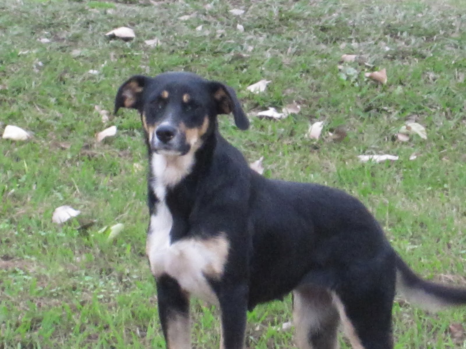
I really intended to walk yesterday, but things worked out differently. It was to be my last day of walking until after Thanksgiving. Early in the morning I drove the route, from Maud (where, by the way, I looked for but didn't find the dog Cotton, pictured above) into the town of Coahoma, a few miles north of Clarksdale. Then I thought I'd better find some gas for the motor home and check out a place to park it for ten days or so. I was planning to leave for Michigan late last night or early this morning. I asked around at a few places and found out there's an RV park at the Coahoma County Fairgrounds in Clarksville. I went there, but it was strictly self-serve and pay on the honor system. I talked to a guy who was camping who told me to go to the Clarksville Tourism Office. There, I chatted with several people and finally got permission to park next to the campground for free, since I won't be using any of their facilities (electricity, water, sewer). By the time all this was done it was late in the morning. I figured I'd start driving right away, go about halfway, then stop for the night. But I made good time, and drove straight through, arriving home at about 2:00 a.m., stoked by the caffeine I've been denying myself while I walk.
It's good to be home with Laurine. Our two-year-old grandson Jacob is here for a few days, too. Laurine and I will be going out to our daughter Katie's in Minnesota for Thanksgiving. I should be back on the road by November 30.
Thanks to everyone who's been following. It means more than you can imagine to know that I'm not doing this alone. Hope you all have a great holiday.
Wednesday, November 18, 2009
Day 48: Cotton
Robinsonville to Maud. 19.6 miles/810.9 total
Wednesday, November 18, 2009
It's another grey cloudy day, in the high 40s, as I leave from the village of Robinsonville. I'm heading to Maud, walking on Old Highway 61 all the way. My walk will take me through the City of Tunica and several places so small that Wikipedia has nothing on them.
Old 61 is the route to take to retrace the steps of the old Delta bluesmen. The Robinsonville area was home to Son House, one of the early influential figures in the history of the blues. Just north of here, in Clack (gone, with all the land owned by Harrah’s now), House was recorded by Alan Lomax in the early 1940s at the Clack Store. Others who played near here include Robert Johnson and Howlin’ Wolf.
Son House’s guitar style was slide guitar, often with the use of a bottle neck. Muddy Waters acknowledged that this man influenced him the most. One of Son House’s songs was called “Preachin’ the Blues,” and goes like this:
I’m gonna get me religion,
I’m gonna join the Baptist church.
Gonna be a Baptist preacher
So I won’t have to do no work.
It seems that Son House hit on one of the reasons there are so many churches in the south.
As for the new Highway 61, I looked carefully and in vain for any signs saying that pedestrians aren’t allowed on the big road. As I think I mentioned, it’s not a limited access highway, just a divided one. So I’m pretty sure that the prohibition against pedestrians on Highway 61 in DeSoto County is one of those crypto-laws, like the one against hitchhiking in Missouri that the cop in Hayti told me about. In other words, it's bullshit. There are a couple of possibilities. The first is that the sheriff may have been ignorant of the law. Cops, as we all know, are notoriously misinformed about the law, as well as about the various procedures for administering the law in a constitutional way. The other possibility is that the sheriff knew full well there was no such law, and was making it up as he went along, in order to have a pretext for stopping and checking out someone who looked like he didn’t quite fit in.
In any event, it illustrates the difference between de jure and de facto laws. A de jure law is one that exists on the books; a de facto law is one that the guy with the gun tells you is the law. Of course one must choose one’s battles, and if that is the greatest injustice I experience on this trip, I will count myself fortunate indeed. Anyway, I really don't want to walk on the new Highway 61.
Before the walk I met and chatted with a farmer in Maud, who gave me permission to park the motor home on his property for the day. He’s a retired Methodist minister, who had a church in Robinsonville. I asked him about the gambling boom in Tunica County. He told me that the casinos had saved the county, although the revenue has fallen off because of the economy. He said Tunica County is about 70% black, and for many years was listed as the poorest county in the country before the gambling came. Like almost all the rest of the folks I've met (civilians, anyway), he was very kind and willing to help.
At a little over five miles I enter Hollywood. I went through a place called Bowdre a mile or so out of Robinsonville, which didn’t amount to anything. Hollywood appears to be a going, if somewhat dingy, concern. Trailers, frame houses, old unused farm buildings. A black dog lies dead in someone’s front yard, up by the road. Ears up, listening for something it’s not going to hear. Sycamore trees hang over the road. Magnolias and swamp oaks grow on lawns. Off to the west across several miles of cotton fields is the Mississippi River. I pass a fairly large house. On the mailbox in front it says “Hollywood Plantation.”
South of town is a graveyard, bumpy and irregular and unkempt. Dotted with stones of people named Joe, Willie, Joe Willie, Earnestine, Viola, Mose. The veterans have government-issued tombstones; everybody else is on their own—some with store-bought markers and others with homemade ones, chiseled on chunks of concrete or made from metal signs that look like they might once have said "For Sale" in someone's front yard. I take a seat on a tree stump. I realize suddenly as I look at the indentations in front of me that the reason these poor folks’ cemeteries are so bumpy and hilly is that they are filled with old, no longer marked graves that have sunk down due to the decay of the wooden boxes in which the people were buried. I am looking at a neat row of several indentations, each about six feet long and two and a half feet wide and eight inches deep. They get filled with water and mud when it rains. Long forgotten people. There are more unmarked graves here than marked ones.
At about nine miles I enter the northern outskirts of Tunica, population about 1,100 in 2000. This area, called Tunica North, is where the casinos were originally located, until they expanded and moved out into the country where there's more room. A hundred yards to the east, on the new Highway 61, there’s a spiffy new middle school and high school, and a large new gymnasium. There’s also a new jail, sheriff’s office, and court building. Gambling money. Of course this infusion into the coffers of the county has not catapulted the majority of the citizens of Tunica into the middle class, by any means. The city and the county have treated themselves well, but individuals are still on their own.
Tunica has a cotton seed oil mill. It reminds me of something I learned at the Cotton Exchange Museum. One of the first products to use cotton seed oil extensively was Crisco, introduced by Procter & Gamble in 1911. They developed a method of hydrogenating cottonseed oil so that it would stay solid at room temperature. It was first intended to be a substitute for animal-based tallow used for candles, but when electricity pretty much did away with the need for candles, P&G figured that since Crisco looked like lard, they could market it as food. As a result, the company took a substantial position in cotton production in the south. Vertical integration. The name Crisco is short for “crystalized cottonseed oil.”
The downtown of Tunica consists of two streets, Edwards and Main, divided by a park-like town green about a block wide. You’re going to love this: In front of a store in downtown there’s a plaque that says it was once R.C. Irwin’s Mercantile Store. It says old Robert was one of the most influential men in the “material and moral development of the Mississippi Delta.” He and his family came west from Mecklenberg, North Carolina, but his parents became ill along the way, and the ten-year-old Robert and his brother made the rest of the trip alone, “along with their faithful slaves.” Robert became one of the largest landowners in Tunica County. When the Civil War broke out he gallantly joined the Confederacy, and afterwards “threw himself with all force of his character into the reclamation of his county from the wreck of war and its redemption from carpetbag rule.”
There’s a nice new fire department and city hall, too, and even a public restroom in the center of town. Over at the edge of the town square is another plaque, this one honoring Harold “Hardface” Clanton, 1916-1982, a gambler who was known as the “Black Sheriff of Tunica County,” and reputedly was the first black millionaire in Tunica County. His promotion of illegal gambling for years helped pave the way for legalized casinos in the county in 1991. He had a place called The Barn where many famous Delta bluesmen entertained.
Three or four miles past the Tunica Gin and lots of cotton fields, I come to the village of Evansville, which consists of a grain elevator and a cotton gin and some shacks. A friendly black-and-tan dog comes up, tail wagging furiously, and licks my hand. I expect her to lose interest after a few hundred feet, when she reaches the end of her territory. But a mile later, the dog is still tagging along, dancing back and forth across the road and down into the ditches and the cotton fields, nosing around for garbage thrown from cars. At one point she starts sniffing at something lying on the other side of the road, and when I go over there I see that it’s a coyote, thoroughly flattened. I tell her to be careful, or that could be her. But she’s afraid of cars and trucks, and runs away from the road when one occasionally zips by. A good survival instinct around here.
As the next few miles go by, the dog continues to tag along, sometimes running ahead, sometimes shooting off into the fields, and occasionally walking alongside me. When I stop to pet her, she sits still in front of me and points her nose at the sky, waiting to get her neck and head scratched. Then she jumps up and puts her feet on my chest. I realize that in the space of an hour I have become rather attached to this creature. I even give her a name, Cotton, because she first darted out toward me from a cotton field, and because of a little white patch on the back of her neck that looks like a piece of the cotton lint that lines the roadside. She’s as quiet as cotton, too. I try to get her to bark, but she won’t do it. Once, when three other dogs rush out after her and start growling, I turn around to face them and they retreat. Cotton stays behind me and whines a little.
Every time I think the dog is finally gone, I look over my right shoulder and there she is. From her teeth and her overall condition I’d say she’s about two or three years old at most.
By the time I pass through Clayton, the next little nothing village down from Evansville, I realize that Cotton will be with me for the rest of today’s walk, six miles altogether. As I near Maud, my destination, I stop to have a talk with her. I tell her I’m leaving now, but that I’ll be back in Maud tomorrow to start my walk, and that if she’s still there, she can walk with me some more. Whatever happens, I’ve enjoyed the company of this dog, and I hope the feeling is mutual.
As I drive off, she's nosing around the yard of that retired preacher. Maybe he needs a dog. Maybe that's why she came here.
Wednesday, November 18, 2009
It's another grey cloudy day, in the high 40s, as I leave from the village of Robinsonville. I'm heading to Maud, walking on Old Highway 61 all the way. My walk will take me through the City of Tunica and several places so small that Wikipedia has nothing on them.
Old 61 is the route to take to retrace the steps of the old Delta bluesmen. The Robinsonville area was home to Son House, one of the early influential figures in the history of the blues. Just north of here, in Clack (gone, with all the land owned by Harrah’s now), House was recorded by Alan Lomax in the early 1940s at the Clack Store. Others who played near here include Robert Johnson and Howlin’ Wolf.
Son House’s guitar style was slide guitar, often with the use of a bottle neck. Muddy Waters acknowledged that this man influenced him the most. One of Son House’s songs was called “Preachin’ the Blues,” and goes like this:
I’m gonna get me religion,
I’m gonna join the Baptist church.
Gonna be a Baptist preacher
So I won’t have to do no work.
It seems that Son House hit on one of the reasons there are so many churches in the south.
As for the new Highway 61, I looked carefully and in vain for any signs saying that pedestrians aren’t allowed on the big road. As I think I mentioned, it’s not a limited access highway, just a divided one. So I’m pretty sure that the prohibition against pedestrians on Highway 61 in DeSoto County is one of those crypto-laws, like the one against hitchhiking in Missouri that the cop in Hayti told me about. In other words, it's bullshit. There are a couple of possibilities. The first is that the sheriff may have been ignorant of the law. Cops, as we all know, are notoriously misinformed about the law, as well as about the various procedures for administering the law in a constitutional way. The other possibility is that the sheriff knew full well there was no such law, and was making it up as he went along, in order to have a pretext for stopping and checking out someone who looked like he didn’t quite fit in.
In any event, it illustrates the difference between de jure and de facto laws. A de jure law is one that exists on the books; a de facto law is one that the guy with the gun tells you is the law. Of course one must choose one’s battles, and if that is the greatest injustice I experience on this trip, I will count myself fortunate indeed. Anyway, I really don't want to walk on the new Highway 61.
Before the walk I met and chatted with a farmer in Maud, who gave me permission to park the motor home on his property for the day. He’s a retired Methodist minister, who had a church in Robinsonville. I asked him about the gambling boom in Tunica County. He told me that the casinos had saved the county, although the revenue has fallen off because of the economy. He said Tunica County is about 70% black, and for many years was listed as the poorest county in the country before the gambling came. Like almost all the rest of the folks I've met (civilians, anyway), he was very kind and willing to help.
At a little over five miles I enter Hollywood. I went through a place called Bowdre a mile or so out of Robinsonville, which didn’t amount to anything. Hollywood appears to be a going, if somewhat dingy, concern. Trailers, frame houses, old unused farm buildings. A black dog lies dead in someone’s front yard, up by the road. Ears up, listening for something it’s not going to hear. Sycamore trees hang over the road. Magnolias and swamp oaks grow on lawns. Off to the west across several miles of cotton fields is the Mississippi River. I pass a fairly large house. On the mailbox in front it says “Hollywood Plantation.”
South of town is a graveyard, bumpy and irregular and unkempt. Dotted with stones of people named Joe, Willie, Joe Willie, Earnestine, Viola, Mose. The veterans have government-issued tombstones; everybody else is on their own—some with store-bought markers and others with homemade ones, chiseled on chunks of concrete or made from metal signs that look like they might once have said "For Sale" in someone's front yard. I take a seat on a tree stump. I realize suddenly as I look at the indentations in front of me that the reason these poor folks’ cemeteries are so bumpy and hilly is that they are filled with old, no longer marked graves that have sunk down due to the decay of the wooden boxes in which the people were buried. I am looking at a neat row of several indentations, each about six feet long and two and a half feet wide and eight inches deep. They get filled with water and mud when it rains. Long forgotten people. There are more unmarked graves here than marked ones.
At about nine miles I enter the northern outskirts of Tunica, population about 1,100 in 2000. This area, called Tunica North, is where the casinos were originally located, until they expanded and moved out into the country where there's more room. A hundred yards to the east, on the new Highway 61, there’s a spiffy new middle school and high school, and a large new gymnasium. There’s also a new jail, sheriff’s office, and court building. Gambling money. Of course this infusion into the coffers of the county has not catapulted the majority of the citizens of Tunica into the middle class, by any means. The city and the county have treated themselves well, but individuals are still on their own.
Tunica has a cotton seed oil mill. It reminds me of something I learned at the Cotton Exchange Museum. One of the first products to use cotton seed oil extensively was Crisco, introduced by Procter & Gamble in 1911. They developed a method of hydrogenating cottonseed oil so that it would stay solid at room temperature. It was first intended to be a substitute for animal-based tallow used for candles, but when electricity pretty much did away with the need for candles, P&G figured that since Crisco looked like lard, they could market it as food. As a result, the company took a substantial position in cotton production in the south. Vertical integration. The name Crisco is short for “crystalized cottonseed oil.”
The downtown of Tunica consists of two streets, Edwards and Main, divided by a park-like town green about a block wide. You’re going to love this: In front of a store in downtown there’s a plaque that says it was once R.C. Irwin’s Mercantile Store. It says old Robert was one of the most influential men in the “material and moral development of the Mississippi Delta.” He and his family came west from Mecklenberg, North Carolina, but his parents became ill along the way, and the ten-year-old Robert and his brother made the rest of the trip alone, “along with their faithful slaves.” Robert became one of the largest landowners in Tunica County. When the Civil War broke out he gallantly joined the Confederacy, and afterwards “threw himself with all force of his character into the reclamation of his county from the wreck of war and its redemption from carpetbag rule.”
There’s a nice new fire department and city hall, too, and even a public restroom in the center of town. Over at the edge of the town square is another plaque, this one honoring Harold “Hardface” Clanton, 1916-1982, a gambler who was known as the “Black Sheriff of Tunica County,” and reputedly was the first black millionaire in Tunica County. His promotion of illegal gambling for years helped pave the way for legalized casinos in the county in 1991. He had a place called The Barn where many famous Delta bluesmen entertained.
Three or four miles past the Tunica Gin and lots of cotton fields, I come to the village of Evansville, which consists of a grain elevator and a cotton gin and some shacks. A friendly black-and-tan dog comes up, tail wagging furiously, and licks my hand. I expect her to lose interest after a few hundred feet, when she reaches the end of her territory. But a mile later, the dog is still tagging along, dancing back and forth across the road and down into the ditches and the cotton fields, nosing around for garbage thrown from cars. At one point she starts sniffing at something lying on the other side of the road, and when I go over there I see that it’s a coyote, thoroughly flattened. I tell her to be careful, or that could be her. But she’s afraid of cars and trucks, and runs away from the road when one occasionally zips by. A good survival instinct around here.
As the next few miles go by, the dog continues to tag along, sometimes running ahead, sometimes shooting off into the fields, and occasionally walking alongside me. When I stop to pet her, she sits still in front of me and points her nose at the sky, waiting to get her neck and head scratched. Then she jumps up and puts her feet on my chest. I realize that in the space of an hour I have become rather attached to this creature. I even give her a name, Cotton, because she first darted out toward me from a cotton field, and because of a little white patch on the back of her neck that looks like a piece of the cotton lint that lines the roadside. She’s as quiet as cotton, too. I try to get her to bark, but she won’t do it. Once, when three other dogs rush out after her and start growling, I turn around to face them and they retreat. Cotton stays behind me and whines a little.
Every time I think the dog is finally gone, I look over my right shoulder and there she is. From her teeth and her overall condition I’d say she’s about two or three years old at most.
By the time I pass through Clayton, the next little nothing village down from Evansville, I realize that Cotton will be with me for the rest of today’s walk, six miles altogether. As I near Maud, my destination, I stop to have a talk with her. I tell her I’m leaving now, but that I’ll be back in Maud tomorrow to start my walk, and that if she’s still there, she can walk with me some more. Whatever happens, I’ve enjoyed the company of this dog, and I hope the feeling is mutual.
As I drive off, she's nosing around the yard of that retired preacher. Maybe he needs a dog. Maybe that's why she came here.
Tuesday, November 17, 2009
Day 47: Why?
Horn Lake to Robinsonville. 20 miles/791.3 total
Tuesday, November 17, 2009
I am leaving from a grocery store parking lot on Route 302 in Horn Lake, headed west to Highway 61 and then south to Robinsonville.
It’s cold and cloudy. I doubt if it will get much over 50 today. So far no rain, but that could come. It rained all day yesterday, but was quite a bit warmer. This weather feels like what I had up in Indiana in October.
I’m headed into Tunica County, which has been given over to casino development. Several of the major Las Vegas organizations have built casinos there, between Highway 61 and the Mississippi River—Harrah’s, Bally’s, the Horseshoe, and others.
I’m starting to accumulate Mississippi stats in my little notebook. I found my first dead raccoon, and my first penny, with duct tape on one side of it.
One of the things that strikes me about Mississippi so far, as well as Memphis and Arkansas, is the large number of churches. I thought West Michigan was full of churches, and it is, but down here they are on practically every corner. Some of them are little squalid flyblown dumps, but many are well-built and expensively turned out. There is a huge amount of money, and land, tied up in religion down here. Most of the churches, probably 70% or more, are of the “Baptist” type, generally. By that I mean that they practice Christianity with certain things in common, namely, baptism by total immersion, and a congregational form of church governance, with the ultimate authority being the individual congregation, rather than an ecclesiastical hierarchy. Down here, they also tend to be fundamentalist, meaning that they interpret the bible literally. This does not apply to the United Methodists, probably another 20% of the churches, who practice infant baptism by sprinkling and have a modified episcopal form of church polity, and generally take a slightly more enlightened view of the bible.
I’m walking through Lynchburg, another suburb of Memphis. Here Route 302 is five lanes wide and just waiting to be developed by someone other than Baptists.
I spent the day in Memphis yesterday, and went to Graceland. Imagine my surprise and delight when I got there and discovered that there are pictures of Billie Bob everywhere! On signs, billboards, t-shirts, and all kinds of souvenirs.
Here are my impressions of Graceland for what they're worth, and in no particular order. The house itself is smaller than I thought it would be. It’s large, but not what you'd call a mansion. The swimming pool is pretty small, too. The furniture and decorating are very tacky, which is partly because it was last decorated in the 70s, and partly because Elvis was a hick.
Graceland sits on about 13 acres, which is a pretty good piece of land for a house in a city. The other thing that impressed me, as I looked at a number of the outfits Elvis wore, was that Elvis himself was a big guy. A big hunk of burning love. And, I must say, very good looking, at least during the period starting from when he got out of the army to about the early 70s.
In addition to Graceland and its outbuildings, I visited exhibits dedicated to Elvis's army stint, his movie career, and a museum dedicated to his vehicles (some of which were repurchased for the exhibit)—limos, Rolls Royces, motorcycles, sports cars, a John Deere tractor, and the pink 1955 Cadillac he gave to his mother. Also, Elvis's two private jets, the full-sized Lisa Marie and the smaller Hound Dog II. They pack a lot of Elvis into the tour.
Next I went to the Cotton Exchange Museum in Memphis, where I learned a lot more about cotton. I had been told by a guy I met on the road in Missouri that a module of cotton was fourteen bales, and that a bale weighs 400 pounds. But the woman at the museum set me straight on that. A bale weighs 500 pounds, and that’s after ginning (removal of the seeds). A module will yield fifteen bales, so that’s 7500 pounds of ginned cotton. But about two-thirds of the weight of the raw cotton in a module is the seeds. That means that a module of cotton weighs more like 22,500 pounds. That makes a little more sense to me, considering the size of a module (about 8 x 8 x 30 feet).
Cotton is judged and graded on its color and how clean it is, and also on the length of the fibers of the plant, called the staple. Short staple cotton has fibers that range from about half an inch to an inch and an eighth. Long staple cotton, traditionally grown in Egypt, can have fibers of two inches or more. The longer the staple, or fiber, the finer and thinner will be thread, because there will need to be fewer splices. Sheets that have up to sixty threads per inch are made from Egyptian cotton, mostly. Short staple cotton makes thicker and bumpier thread, like the kind used for denim.
The woman at the museum also told me that she knows someone who is writing a book about Robert E. Lee Wilson, the guy who founded the town of Wilson, Arkansas. He was once the largest single cotton farmer in the country, with 65,000 acres. I wrote a few things about him in one of these posts. I’m looking forward to reading that book when it comes out.
Kudzu lines the ditches as I approach Highway 61 and turn south. Here Highway 61 is more like an expressway than it was up in Missouri and Arkansas. I’ll take it a few miles and then turn west and pick up Old Highway 61, a more sedate, two-lane road, that runs parallel and goes through the little villages.
Well, I run into a little snag out on Highway 61 about two miles down. A DeSoto County Sheriff deputy stops me and informs me that pedestrians are prohibited on this part of Highway 61. I was not aware of that, and hadn’t seen any signs. It’s not limited access. Anyway, he makes me get in the back seat of his car, after taking my driver’s license to check me out. First he says he's going to drop me down at the county line, about six miles from where we are. I tell him what I'm doing, and ask if he can take me somewhere a little closer. I mention that I was planning to go to Star Landing Road and take that over to Old Highway 61 in Lake Cormorant, so he says he'll drop me off there, which is only about two miles from where we are.
Before he has me get in the car he asks me if I have anything on me he “should be concerned about,” meaning, I think, weapons. I give him my pocket knife, which he holds onto, then he begins feeling the many pockets of my vest.
“What’s this?”
“An apple.”
“An apple?”
“Yes.”
“What’s this?”
“A sandwich.”
“A sandwich?”
“Yep, a sandwich. Wanna see it?”
"What else you got in there?"
"Lots of stuff. I'm really harmless."
And on it goes as he frisks me, top to bottom. Then when I'm in the back seat and he’s finished running my driver’s license, he takes me down to Star Landing Road. I try to engage him in conversation, but he isn’t too chatty. I tell him about the motor home in Robinsonville, and the car up in Horn Lake, and try to explain the whole deal, but he's really having a hard time taking it in. Finally he turns to me and asks, “Why? What’s the point?” As always, a good question. Anyway, he lets me out of the car and gives me my knife back and I thank him for the ride and for his courtesy, and we go our separate ways.
So I have another slight gap in my walk, to go with the one I got up on the bridge from Cairo, Illinois to Missouri. At least I can still say that I haven't voluntarily taken any rides. Now I’m heading down Star Landing Road, which a sign says is the Hernando DeSoto Trail, 1541. It's amazing to think that almost 470 years ago some Spanish dudes walked right along here, with those outrageous helmets of theirs.
Now I’m on Old Highway 61, a two-lane road, and it’s about as lonely as it can be. I see what might be a cormorant taking off from some bushes—a large black water bird—so I know that Lake Cormorant is as good as its name. According to the map I go through the villages of Newport and Penton, but I would be hard pressed to say exactly where these places are. There's nothing to either of them. Lake Cormorant isn’t much, but it does have a post office and what was once a store of some kind.
In the distance I see the water tower of the Harrah’s hotel and casino complex, and at about 16 miles I leave DeSoto County and enter Tunica County. This is where all the casinos are, and as soon as I enter the county I’m on Harrah’s property. Old Highway 61 is called Harrah’s Boulevard here. According to the map, in this area there was once a village called Clack, but it probably wasn’t much of anything to begin with, and now it’s all gone.
Just over the county line a fleet of about thirty stretch limousines, black and white, is parked and waiting. The sheriff’s little ride has afforded me some extra time before dark, so I walk another half a mile down to the casino entrance and take the long driveway in. I’m going to try my luck, doing the same thing I did at the casino up in Michigan City, Indiana, which was to play five dollars in the lowest denomination slot machine they have, and quit when I’ve either lost the five or get ahead. About a half hour later I walk out of Harrah’s, warmed up but five dollars poorer.
After about about a mile I reach Old Highway 61 again. I’m in Robinsonville, except that in 2003 it changed its name to Tunica Resorts. There are nine casinos in this vicinity. Locals still call it Robinsonville. The post office doesn’t have any name on its front, but the guy inside says it's the Robinsonville post office. Robinsonville is a little of the old and a little of the new. It has an old village and some new condos and apartments. Plenty of money here now, and jobs for the locals. And plenty of new ways for them to lose their money.
Tuesday, November 17, 2009
I am leaving from a grocery store parking lot on Route 302 in Horn Lake, headed west to Highway 61 and then south to Robinsonville.
It’s cold and cloudy. I doubt if it will get much over 50 today. So far no rain, but that could come. It rained all day yesterday, but was quite a bit warmer. This weather feels like what I had up in Indiana in October.
I’m headed into Tunica County, which has been given over to casino development. Several of the major Las Vegas organizations have built casinos there, between Highway 61 and the Mississippi River—Harrah’s, Bally’s, the Horseshoe, and others.
I’m starting to accumulate Mississippi stats in my little notebook. I found my first dead raccoon, and my first penny, with duct tape on one side of it.
One of the things that strikes me about Mississippi so far, as well as Memphis and Arkansas, is the large number of churches. I thought West Michigan was full of churches, and it is, but down here they are on practically every corner. Some of them are little squalid flyblown dumps, but many are well-built and expensively turned out. There is a huge amount of money, and land, tied up in religion down here. Most of the churches, probably 70% or more, are of the “Baptist” type, generally. By that I mean that they practice Christianity with certain things in common, namely, baptism by total immersion, and a congregational form of church governance, with the ultimate authority being the individual congregation, rather than an ecclesiastical hierarchy. Down here, they also tend to be fundamentalist, meaning that they interpret the bible literally. This does not apply to the United Methodists, probably another 20% of the churches, who practice infant baptism by sprinkling and have a modified episcopal form of church polity, and generally take a slightly more enlightened view of the bible.
I’m walking through Lynchburg, another suburb of Memphis. Here Route 302 is five lanes wide and just waiting to be developed by someone other than Baptists.
I spent the day in Memphis yesterday, and went to Graceland. Imagine my surprise and delight when I got there and discovered that there are pictures of Billie Bob everywhere! On signs, billboards, t-shirts, and all kinds of souvenirs.
Here are my impressions of Graceland for what they're worth, and in no particular order. The house itself is smaller than I thought it would be. It’s large, but not what you'd call a mansion. The swimming pool is pretty small, too. The furniture and decorating are very tacky, which is partly because it was last decorated in the 70s, and partly because Elvis was a hick.
Graceland sits on about 13 acres, which is a pretty good piece of land for a house in a city. The other thing that impressed me, as I looked at a number of the outfits Elvis wore, was that Elvis himself was a big guy. A big hunk of burning love. And, I must say, very good looking, at least during the period starting from when he got out of the army to about the early 70s.
In addition to Graceland and its outbuildings, I visited exhibits dedicated to Elvis's army stint, his movie career, and a museum dedicated to his vehicles (some of which were repurchased for the exhibit)—limos, Rolls Royces, motorcycles, sports cars, a John Deere tractor, and the pink 1955 Cadillac he gave to his mother. Also, Elvis's two private jets, the full-sized Lisa Marie and the smaller Hound Dog II. They pack a lot of Elvis into the tour.
Next I went to the Cotton Exchange Museum in Memphis, where I learned a lot more about cotton. I had been told by a guy I met on the road in Missouri that a module of cotton was fourteen bales, and that a bale weighs 400 pounds. But the woman at the museum set me straight on that. A bale weighs 500 pounds, and that’s after ginning (removal of the seeds). A module will yield fifteen bales, so that’s 7500 pounds of ginned cotton. But about two-thirds of the weight of the raw cotton in a module is the seeds. That means that a module of cotton weighs more like 22,500 pounds. That makes a little more sense to me, considering the size of a module (about 8 x 8 x 30 feet).
Cotton is judged and graded on its color and how clean it is, and also on the length of the fibers of the plant, called the staple. Short staple cotton has fibers that range from about half an inch to an inch and an eighth. Long staple cotton, traditionally grown in Egypt, can have fibers of two inches or more. The longer the staple, or fiber, the finer and thinner will be thread, because there will need to be fewer splices. Sheets that have up to sixty threads per inch are made from Egyptian cotton, mostly. Short staple cotton makes thicker and bumpier thread, like the kind used for denim.
The woman at the museum also told me that she knows someone who is writing a book about Robert E. Lee Wilson, the guy who founded the town of Wilson, Arkansas. He was once the largest single cotton farmer in the country, with 65,000 acres. I wrote a few things about him in one of these posts. I’m looking forward to reading that book when it comes out.
Kudzu lines the ditches as I approach Highway 61 and turn south. Here Highway 61 is more like an expressway than it was up in Missouri and Arkansas. I’ll take it a few miles and then turn west and pick up Old Highway 61, a more sedate, two-lane road, that runs parallel and goes through the little villages.
Well, I run into a little snag out on Highway 61 about two miles down. A DeSoto County Sheriff deputy stops me and informs me that pedestrians are prohibited on this part of Highway 61. I was not aware of that, and hadn’t seen any signs. It’s not limited access. Anyway, he makes me get in the back seat of his car, after taking my driver’s license to check me out. First he says he's going to drop me down at the county line, about six miles from where we are. I tell him what I'm doing, and ask if he can take me somewhere a little closer. I mention that I was planning to go to Star Landing Road and take that over to Old Highway 61 in Lake Cormorant, so he says he'll drop me off there, which is only about two miles from where we are.
Before he has me get in the car he asks me if I have anything on me he “should be concerned about,” meaning, I think, weapons. I give him my pocket knife, which he holds onto, then he begins feeling the many pockets of my vest.
“What’s this?”
“An apple.”
“An apple?”
“Yes.”
“What’s this?”
“A sandwich.”
“A sandwich?”
“Yep, a sandwich. Wanna see it?”
"What else you got in there?"
"Lots of stuff. I'm really harmless."
And on it goes as he frisks me, top to bottom. Then when I'm in the back seat and he’s finished running my driver’s license, he takes me down to Star Landing Road. I try to engage him in conversation, but he isn’t too chatty. I tell him about the motor home in Robinsonville, and the car up in Horn Lake, and try to explain the whole deal, but he's really having a hard time taking it in. Finally he turns to me and asks, “Why? What’s the point?” As always, a good question. Anyway, he lets me out of the car and gives me my knife back and I thank him for the ride and for his courtesy, and we go our separate ways.
So I have another slight gap in my walk, to go with the one I got up on the bridge from Cairo, Illinois to Missouri. At least I can still say that I haven't voluntarily taken any rides. Now I’m heading down Star Landing Road, which a sign says is the Hernando DeSoto Trail, 1541. It's amazing to think that almost 470 years ago some Spanish dudes walked right along here, with those outrageous helmets of theirs.
Now I’m on Old Highway 61, a two-lane road, and it’s about as lonely as it can be. I see what might be a cormorant taking off from some bushes—a large black water bird—so I know that Lake Cormorant is as good as its name. According to the map I go through the villages of Newport and Penton, but I would be hard pressed to say exactly where these places are. There's nothing to either of them. Lake Cormorant isn’t much, but it does have a post office and what was once a store of some kind.
In the distance I see the water tower of the Harrah’s hotel and casino complex, and at about 16 miles I leave DeSoto County and enter Tunica County. This is where all the casinos are, and as soon as I enter the county I’m on Harrah’s property. Old Highway 61 is called Harrah’s Boulevard here. According to the map, in this area there was once a village called Clack, but it probably wasn’t much of anything to begin with, and now it’s all gone.
Just over the county line a fleet of about thirty stretch limousines, black and white, is parked and waiting. The sheriff’s little ride has afforded me some extra time before dark, so I walk another half a mile down to the casino entrance and take the long driveway in. I’m going to try my luck, doing the same thing I did at the casino up in Michigan City, Indiana, which was to play five dollars in the lowest denomination slot machine they have, and quit when I’ve either lost the five or get ahead. About a half hour later I walk out of Harrah’s, warmed up but five dollars poorer.
After about about a mile I reach Old Highway 61 again. I’m in Robinsonville, except that in 2003 it changed its name to Tunica Resorts. There are nine casinos in this vicinity. Locals still call it Robinsonville. The post office doesn’t have any name on its front, but the guy inside says it's the Robinsonville post office. Robinsonville is a little of the old and a little of the new. It has an old village and some new condos and apartments. Plenty of money here now, and jobs for the locals. And plenty of new ways for them to lose their money.
Sunday, November 15, 2009
Day 46: Dead Confederates
Memphis, Tennessee to Horn Lake, Mississippi. 20.1 miles/771.3 total
Sunday, November 15, 2009
Sunday, November 15, 2009
Today I'm starting from DeSoto Park, in Memphis, high on a bluff overlooking the Mississippi River. My destination is Horn Lake, Mississippi. I’ll be making a sort of arc through the city, first going north, then east, and finally south down U.S. 51.
It’s a sunny day and warm already, with a few high clouds. It’s supposed to get up to 77 this afternoon.
Next to DeSoto Park is an abandoned U.S. Army Reserve Center, consisting of a compound of old buildings, empty and for sale. At one end of the compound is the National Ornamental Metals Museum, which I visited yesterday afternoon after my arrival across the bridge. An interesting collection of sculpture and small ornamental pieces made of iron and bronze, mostly. They have a working blacksmith shop in the back, and the grounds are covered with metal sculptures. The museum collection is a bit too small, however.
On plaques set in a large stone in the park it says that in this area Hernando DeSoto viewed the Mississippi River in 1541. What is now the park was at that time a fortress of Chicsa, chief of the local Indians. But it was also the site of a mound built by earlier inhabitants at some time in the distant past. During the Civil War the Confederates dug a hole in the mound and used it to store artillery ammunition. I climb up on the mound and have a look around. There’s a depression about ten or fifteen feet deep and maybe fifty feet in diameter at the top of the mound.
I won’t get to see everything there is to see in Memphis, but I do plan to see two more tourist sites tomorrow, my next day off--Graceland and the Cotton Exchange Museum. Today I’ll try to get a flavor of the city, from downtown to the outskirts.
This will be my most urban walk. The last time I was in a city of over 100,000 was back in September, on the second or third day, when I walked through Grand Rapids, Michigan. Memphis is much larger, of course. The population is 670,000, in a metropolitan area of about 1.3 million. It’s great to be in a city.
I take McLemore east to Kansas Street. I’m in the warehouse and light industrial district of the city here. It’s all weed-choked sidewalks, strewn with broken glass and garbage. This is the stuff I love. Nature reasserting itself up through the cracked infrastructure, side by side with things cast off by humans. Not that it’s all that way here. There are a few thriving businesses, including the Memphis plant of the Hershey Corporation. If today were a weekday, I’d probably be smelling something delicious right now.
I cut over to Florida Street, which will turn into Georgia and then Front Street, which I can take up into the center of town. At the corner of Florida and Georgia the warehouses give way to some new luxury condos, evidently part of a gentrification project. I pass the site of the Memphis farmer’s market.
I realize I’m only a block away from the Arcade Restaurant, where I ate a few days ago, and also from the Civil Rights Museum at the Lorraine Motel. So I swing over to Main Street and walk up through that neighborhood. A few people are sitting out on the sidewalk in front of cafes that are open for breakfast, sipping coffee and reading newspapers. Nice to see that there’s a place to do that in Memphis.
A few blocks up from that neighborhood I pass the bookstore of the Church of God in Christ. The C.O.G.I.C. was organized in 1907 and is headquartered here in Memphis. I see the acronym all over the place in this part of the south. It’s a predominantly African American group. Serious bible-thumpers.
I walk down Beale Street for a couple of blocks. It’s packed with restaurants and clubs and souvenir shops, including B.B. King’s Restaurant. Blues music plays from loudspeakers in front of buildings. Most of the colorful places are closed this morning, but I get the idea.
From here I head north up past Peabody Place, a sports and entertainment venue. A couple of blocks up from Peabody I turn east on Union Avenue and pass the studios of WDIA, the first radio station to have an all-black music format, back in 1948. Past that is a minor league ballpark, the home of the Memphis Redbirds, the triple-A farm team of the St. Louis Cardinals.
Another half mile down Union is the Sun Records Studio, where Elvis, Jerry Lee Lewis, Roy Orbison, Johnny Cash, and others made their early recordings. I pop in and take a look around, but don’t take the tour. Maybe tomorrow. Gotta keep moving.
At the corner of Union and Manassas there's a park dedicated to the memory of Confederate General Nathan Bedford Forrest, the man after whom Forrest Gump, the smartest white guy in Alabama, was named. The park was set aside by the Sons of Confederate Veterans to honor Forrest and Confederate veterans in general. What the marker out front fails to mention is that Nathan Bedford Forrest was a slave trader before the war, and was particularly virulent in his hatred of blacks. After the war he became the first Grand Wizard of the Ku Klux Klan. Old Nate and the Mrs. are buried right there under the statue of him on his horse. With great pleasure I go up to his gravestone and spit on it.
Across the street is the Cathedral of the Scottish Rite of the Masons. Over on another corner is the University of Tennessee Health Science Center, behind which looms a huge medical complex, combined somehow with the Baptist Hospital medical center. Not long after that I come to the Methodist Hospital medical complex, at the corner of Union and Bellevue Avenues. I turn south onto Bellevue, which is also Highway 51. it would seem that besides competing for the salvation of the sinner, the Baptists and Methodists compete to take care of him when he's sick.
The first few blocks south on Bellevue are shady and filled with large houses. There’s the Annesdale neighborhood, established in 1903 as Memphis’s first exclusive subdivision. For a few more blocks the houses on either side of Bellevue remain handsome and well-kept-up. Gradually I start to see an occasional empty one, and a few in need of paint. The alleyways become choked with weeds.
I go through a filthy underpass decorated with really nice murals of Stax and Atlantic Records recording artists, including Otis Redding, Isaac Hayes, Aretha Franklin, and Sam and Dave. The sign says that I am heading toward Soulville. Not too promising, somehow.
I visit Calvary Cemetery, which is the main Catholic graveyard in Memphis, to see what ethnicity the surnames of the city’s Catholics are, here in this predominantly Protestant city. They’re English, mostly, just like everybody else's, with a few Irish names thrown in. I sit down under a statue of St. Paul to take a rest.
At Parkway, Bellevue Avenue becomes Elvis Presley Boulevard. I walk through a barren stretch of crummy motels, storefront churches, empty gas stations, and fried chicken places. The sidewalk ends. Then after a few miles things start looking a little better. The name Graceland starts to appear here and there, on used car lots and dingy little shopping centers. I must be getting closer to the home of the King. Here’s a sign for Graceland Inn, no longer in business. There’s a Day’s Inn that offers free 24 hour Elvis movies and a guitar-shaped pool.
Finally I walk by Graceland, set way back from the east side of the boulevard. The parking and the ticket office and the souvenirs and Elvis’s two private airplanes are across the street, on the west side. This part of Memphis is called Whitehaven. I guess that figures.
Elvis Presley Boulevard south of Graceland is a great improvement over the area north of the mansion. It looks comparatively prosperous and sort of like a normal suburban commercial strip, with name brand stores and fast food joints.
Weatherwise, it’s warmer than at any time since September. If it weren't for the thin quality of the light and the sun being so low in the southern sky, it would seem like spring or summer.
At about 15.5 miles, I leave Memphis and Tennessee, and enter Mississippi. I'm in DeSoto County and the City of Southaven. Southaven is a city of about 44,000, started only in the 1960s, as a suburb of Memphis.
I close the books on Tennessee, as a walker. I found three pennies on the street and one dead bird. No one offered me a ride, although I would have been amazed if someone had. I walked 16.2 miles in Tennessee altogether.
Almost immediately after entering Mississippi I come to a bronze plaque on a stone, honoring Jefferson Davis, put up by the Mississippi Daughters of the Confederacy. I read it and spit on it. That’s two Confederate icons I’ve spit on today.
I think Mississippi is going to be full of surprises and contradictions. For a state that has consistently remained isolated from the rest of the nation, Mississippi has an odd tendency to view itself with respect to other states. For instance, this place where I am now is probably the northernmost city in Mississippi, but it’s called Southaven. Similarly, there’s a city called West Point (where Howlin’ Wolf came from) that isn't in the western part of the state at all, but over on the east side. It’s west with respect to Alabama, just like Southaven is south with respect to Tennessee. There’s an old saying in the south that the three biggest cities in Mississippi are New Orleans, Memphis, and Birmingham, meaning that there aren’t any really big cities in the state, and that Mississippi looks outside itself for its cultural bearings.
I could take U.S. 51 all the way to Jackson. That would make sense. But I've decided to cut west over to Highway 61, because it goes through places in the Delta where some of my blues heroes lived. So I’ll take 61 to Clarksdale, then Highway 49 down to Jackson.
In a couple of miles I enter the city limits of Horn Lake and head west on Mississippi Route 302. This road looks like 28th Street in Grand Rapids. Horn Lake appears to be middle class, neat, well-maintained, and bi-racial. The city hall is pretty new, and it sits on the corner of Tulane Road and 302, looking prosperous. I don’t know where Horn Lake is getting its money, but it’s doing okay. These are city folks, oriented to Memphis.
At last the motor home comes into view in the parking lot of Schnuck’s grocery store.
Subscribe to:
Posts (Atom)