


Southern California
Tuesday, April 17, 2012
11:00 a.m. I am
setting forth on my bicycle from the Thiennes
Road entrance to the San Gabriel River Bikeway, in
South El Monte at the 23.75 mile point, heading north to the Irwindale/Azusa terminus of the
bike path and then back south again.
It is a warm day, in the 70s right now. This is a very nicely maintained bike path,
asphalt, about the width of a one-lane auto road, with two lanes for
bicycles. Repaving and repairing seem to be going on at frequent intervals, with county maintenance trucks plying the bikeway. At the moment it runs along
the west side of the San Gabriel River bed, which today (and most of the time)
is dry enough that mature trees grow in the basin between the two sides of the
river. Obviously in the event of flood a
great deal of water can be accommodated.
At one time no doubt this was a much wetter and wider river,
created by runoff from the San Gabriel Mountains
several miles to the north. Today, due
to damming and other techniques, much of the water is diverted for
the use of the local residents of the towns nearby. Where I am now those towns are El Monte , Irwindale, Duarte ,
Monrovia , Azusa ,
and a few others.
I think this is the first time I’ve blogged specifically about a bike ride,
although I’ve ridden here a dozen times or more. At this point it runs
along the back ends of modest to poor residential neighborhoods, many of which
have small stables for single horses or ponies, built of plywood and other
scrap materials, as well as some coops for the raising of poultry. The fowl seem in
particular to be colorful and ornately-feathered roosters, used no doubt in this area for friendly and humane cockfighting matches.
There just doesn’t seem to be sufficient reason for so many
roosters to be strutting around with no hens in evidence.
Out in the middle of the mostly-dry river basin there does
run a small rivulet of six or eight feet wide, swelling in some places to a full river
almost filling the bed. Here wild fowl of all
types dive and bob—ducks, geese, herons, and cranes. They swim amid the trash that
floats atop the water—styrofoam, plastic, debris of all kinds—surviving, indeed
thriving, in a way that would be unsettling to a nature purist. But that’s the one of the beauties of this
river: it exists within sight of pristine snow-capped mountains in the north,
while running fitfully through the midst of garbage and graffiti and urban grit.
In small permanent copses on the river's edge I can see
makeshift tents and shelters where indigent people live in their worlds of
stuffed black garbage bags, empty beverage containers, and the shopping carts
they use to collect and transport these things. A disheveled bearded man pedals slowly past me, metal cart
affixed to his rear axle. Out collecting
what others don’t want, either to sell or use or eat or burn.
The
bike path runs along a sort of levee twenty feet or so above the river bed and
there’s another levee on the other side, about 150 feet across the way. Sometimes there are bike paths on both sides
and sometimes the path crosses, via a street or occasionally a pedestrian
bridge, from the west side of the river to the east and back. Down on the outside of the levees, behind the back yard
fences of the houses lining the way, there is frequently a dirt path, along
which people—men mostly—ride their horses.
Most of the equines are sorrel-colored and appear to be well-groomed and
fed. The riders—caballeros—sometimes
decorate their horses with silver-ornamented saddles and bridles and themselves
dress in spangly vaquero-style costumes, occasionally topped with sombreros but
more often with western hats. Most ride
wearing simpler clothing, but all ride with evident pride and care and skill. Where they get the money and time to care for
these horses is anyone’s guess, but they do.
These are no white-fenced Kentucky
horse-country operations.
Up on the bikeway, carefully marked every quarter of a mile
to show the mileage, I encounter a wide variety of fellow travelers: other
casual recreational bikers like me, kids and young men and women strolling and
gathering for a furtive smoke or a kiss, people simply walking or jogging, and
of course the many “serious” bicyclists who zoom past me in either direction,
the ones I call Spandex Warriors. Often these latter are dressed as if they were about to enter
the Tour de France, complete with colorful and endorsement-laden jerseys,
expensive bikes, and all the latest paraphernalia from head to toe, their
gleaming helmets making them look like busy and fast moving wasps, firm in
the belief that all this will make them better and faster and more serious
riders, though I suspect that very few of them are more than clubby
enthusiasts. They ride, indeed, with a gravitas that suggests they might like to ban children from the activity altogether, for not
taking it seriously enough. They ride
with a conformistic fanaticism that reminds me of serious amateur golfers, with their Ping hats and pink shirts and chinos and whatever is the
latest and most trendy and pricey equipment their hobby has to offer.
Meanwhile I plod along as I have since childhood, a tortoise
to these hares, simply pedaling from beginning to end pretty much without
stopping, on legs and a body that are sturdy and time-tested, if not flashy and
sleek. But lest you think I am
gainsaying these bicycle enthusiasts, I hasten to assure you I am not. I look upon them as a man on the freeway in a
Hyundai might look at the guy in the Ferrari who zooms past him, marveling at
the many ways people choose to approach the basic task of getting from one
place to another on wheels.
High up in the underpasses that dip beneath the many cross
streets, in the little cubbies just below the steel of the roadways, are other signs
of human habitation—cans, bottles, tarps, piles of grimy clothes, the smell of
urine. I am aware that I’m traveling not just
alongside, but through, the homes of men.
The rundown casitas of El
Monte give way to the gravel pits, steel cranes, power
line towers, and warehouses of Irwindale as I make my way north to Arrow Highway , the only street where the
bike path users must stop and cross traffic.
Irwindale, so devoid of residents but so filled with the things that make
livable the lives of the millions who live nearby—a huge Miller brewing plant, for
instance. Then gradually as I approach
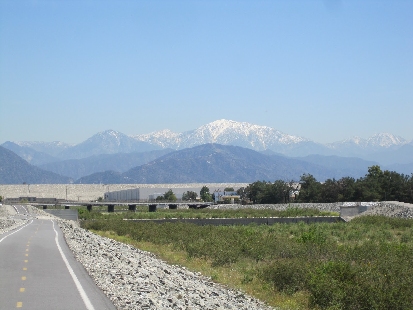
the Santa Fe Dam, the San Gabriel Mountains themselves come to dominate the horizon.
Having crossed the road, I begin what is the only even
moderately strenuous uphill climb on the bikeway, to the top of the Santa Fe
Dam, a half mile or so of incline that make me downshift to the smaller front
sprocket of my premodern Panasonic ten-speed.
For the most part the bikeway is easy to ride on, running gently
downhill from the mountains south to the Pacific Ocean in Seal Beach .
Even when going north and upriver the ascent is so gradual as to barely be
noticeable. In fact, it’s often easier
to go north because of the winds that blow from the sea out of the south and
west.
From atop the dam I can look to the left and see the
majestic mountains and then to the right at the rooftops of the factories and
industrial buildings of Irwindale. I’m
not sure which I like better—perhaps both in equal measure. The brewery, which appears so vast from the
210, looks tiny against the green backdrop of the foothills. All along the road at the bottom of the
fifty or more-foot slope from the dam, a hundred feet of usable space between the trap rock
and the road is used as a series of plant nurseries, growing small trees and
shrubs in buckets, mostly.
Having attained the Irwindale parking lot and entrance to
the bikeway, at the 35.25 mile mark, I turn around and head south and am now
within a mile of where I began today’s journey.
Once again I pass behind Mountain
View High School
South of El Monte ,
at about the 22 mile mark, the river has widened and moves faster. This is the area known as the Whittier Narrows Rose Hills Cemetery in Whittier ,
the largest cemetery in the United
States .
I continue south past the Pico Rivera Golf Course and soon
after, at San Gabriel Parkway , cross the street on a little bike and pedestrian path to the east side of the
river. Over on the east side, just over
the fence and past the ditch and dirt path is another long line of scrap-wood made, impossibly small, horse stables, their usually single inhabitants sticking their
heads out from the open, chest-high barriers. Latinos ride and train the horses in the bit of otherwise unused dirt
between the river and the back yards.
Perhaps some of them are being trained to give rides to children or to
hire out for gentle weekend walks through the precious bits of open space
hereabouts.
In this small space also there are bits of junk and discarded
tires, and graffiti sprawled across little otherwise-silver shacks used by the
railroad, which also runs nearby.
Suddenly I’m cheek-by-jowl with the 605 freeway and down in Bellflower or Norwalk or Lakewood or Cerritos . The river has widened to take up all its
allotted space, though it's still shallow. Then more nurseries,
some covered in domes of plastic, graffiti decorating the sides.
At the 14 mile marker the river loses its natural plant-based bed
and becomes a concrete basin. Running down the center is a ten-foot-wide indentation, a rushing torrent of
water, on either side of which is a flat expanse of concrete about the width of
a two-lane highway. It’s one of those
perfect places for drag racing you always used to see in teenager movies set in
the greater Los Angeles
area during the 50s and 60s, as the smooth pavement runs for miles alongside
the bit of river in the center.
Just past the point where the river becomes concrete comes a
sickly-sweet smell of rotting garbage reminiscent of a big-city Chinatown in summer.
It’s the D.A.R.T.—Downy Area Recycling and Transfer Plant, over on the
west side. On my side of the river are
narrow acres given over to the raising of annual flowers and vegetables—marigolds,
pansies, leaf lettuce and the like—tended by bent-over Mexicans and Asians. If the fetid air can impart any fertilizing
nutrients to this enterprise, then the flowers should do very well. In any event, the workers get to smell this miasma all day long as they hoe and water.
All along the sloping sides down to the concrete riverbed
is evidence of graffiti, but it has been uniformly painted over with rollers by
the authorities. The result is not one
bit of identifiable tagging, but instead a steady, miles-long patchwork of
white, beige and light blue rectangles.
This is the triumphant graffiti of the powers that be, saying unequivocally
that they, not the local kids and gangbangers, own the river bed. Tagging of the most emphatic kind. I find myself wondering at what time of day
this painting gets done, or whether it’s even necessary any more, the spray-painters having perhaps surrendered in this war of attrition.
At the 10 mile marker on the path I decide this is a good
place to turn around and return to the car in South
El Monte . I'm almost out of Los Angeles County and into Orange County. I will have gone 50 miles today when all is said and done, and that’s about
enough. Since I haven’t been biking for
a couple of weeks, my thighs are telling me I shouldn’t push it any
further. I finish up at about 4:00
p.m.
School’s out now and there are more
kids on the path—pairs and trios of laughing boys on the same 16 or 20 inch BMX-style bikes we had a generation or two ago, trick riding on homemade undulating dirt-bike courses or gathering to smoke and talk tough. Cute teenage Mexican couples holding hands, strolling slowly and saying nothing, filled with love. Adults walking impossibly small dogs. Bums sleeping in the warm shade. Life is sweet along the San Gabriel.
2 comments:
Good post, keep going.
Life is sweet on the road here too.
S
50 miles in one day--approaching your bike ride alone and with Zach to Cadillac and on to Central Lake in miles, nt to mention the one you and Danny planned. Not too shabby for such a young guy! Love you always, L
My grandparents are in that cemetary. The only time I was able to visit it, it took quite awhile and the caretaker office to look up and direct me to where they were buried.
Post a Comment